Arizona peaks
Arizona climbs
First Ascent Awards
1201 of 4,318 peaks 27%
Top climbing months
January 12%
December 11%
March 11%
Arizona mountains highlights
- Humphreys Peak (12,633 ft) is the highest mountain in Arizona and is located within the San Francisco Peaks range. It is the only place in Arizona where hikers can experience an alpine environment and has a unique "tundra-like" ecosystem at the summit.
- Camelback Mountain (2,704 ft) in the Phoenix metropolitan area is a popular hike in the Echo Canyon Recreation Area. It is known for its unique rock formations, including a "camel hump" at the summit, which offers stunning views of the city.
- Mount Lemmon (9,157 ft) is the highest peak in the Santa Catalina Mountains near Tucson and offers hikers a unique experience of hiking through five different climate zones, from the desert to the forested mountaintop.
- The Superstition Mountains are known for their rugged beauty and are home to the Flatiron (4,861 ft), a popular and challenging hike known for its unique rock formations, including the iconic "flatiron" rock at the summit.
- Chiricahua Peak (9,763 ft) is located in the Chiricahua Mountains in southeastern Arizona, known for their unique rock formations and abundant wildlife. The peak offers stunning views of the surrounding landscape, including the "Wonderland of Rocks."
- Mount Humphreys (11,670 ft) is the highest peak in the White Mountains and is known for its stunning views of the surrounding landscape, including the deep blue waters of Big Lake and the surrounding forests.
- Cathedral Rock (4,921 ft) is a popular hike in Sedona, known for its stunning red rock formations and spiritual significance to the local community. The trail offers a challenging climb with rewarding views of the surrounding canyons and valleys.
Latest climbs

"My brother and I parked at the 104th St. trailhead and made our way up to Bell Pass. It was a pretty steep ascent from there up to the summit. The views were nice, although a lot of haze was present. We ended up with 8.1 miles, around 2200 ft. of elevation gain, and around 5 hours total time." — ZachTeich • May 23, 2026
"My brother and I parked about 5.3 miles west of Highway 77, on Edwin Rd., at a parking spot right before a cattle guard, and made our way northwest to the peak. The road in is a great dirt road, and then for the hike, we followed a road for awhile, got into a different wash, and then found a use trail which led all the way to the summit. It was about 4.3 miles round trip, with about 1200 ft. of elevation gain. The views from the summit were awesome, with many other prominence peaks visible. We stayed on the summit for about 40 minutes, and the round trip total time was about 2:30." — ZachTeich • May 9, 2026
"My brother and I started around 5:10am and took our time. It was steeper in places than you think it would be. The views from the summit were great - it's a good, low elevation vantage point of many higher peaks in the area, and also a good viewpoint of Tucson." — ZachTeich • Apr 29, 2026
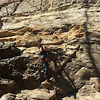
"Nice moderate hike with a bit of scrambling at the peaks: Aspen, Hayden, Hualapai. Wasted some time trying to bushwhack cross country from Hayden to Hualapai following a gpx track. Wasn't worth it (too brushy), so had to backtrack and use the trails. Trails were so much faster and easier! Also spent a fair amount of time taking pictures of lizards. " — tracyt • Apr 5, 2026
"Nice moderate hike with a bit of scrambling at the peaks: Aspen, Hayden, Hualapai. Wasted some time trying to bushwhack cross country from Hayden to Hualapai following a gpx track. Wasn't worth it (too brushy), so had to backtrack and use the trails. Trails were so much faster and easier! Also spent a fair amount of time taking pictures of lizards. " — tracyt • Apr 5, 2026