Region
Highlights
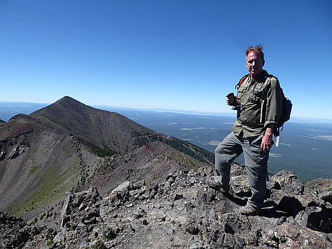
- This secondary peak on the way to Humprey's peak is the 3rd highest point in Arizona.
Routes
/-111.682812107712,35.3408675906122,11,0.00,0.00/320x240@2x?access_token=pk.eyJ1IjoicGVha2VyeSIsImEiOiJjampra3Z0bnAxeTVnM3FteHlybHY3b2p1In0.7a5dEa5-995VUv8ceHHNmw)
11 summits • 10.0 mi • 3,238 ft gain • 7 hr 15 min • Class 1
3 summits • 11.5 mi • 3,199 ft gain • 8 hr 54 min
2 summits • 10.6 mi • 3,621 ft gain • 7 hr 6 min
2 summits • 10.1 mi • 3,267 ft gain • 7 hr 46 min
2 summits • 11.0 mi • 3,512 ft gain • 8 hr 5 min
1 summit • 23.3 mi • 4,890 ft gain • 13 hr 31 min
Latest summits

"Got a late start coming in from Nevada all night driving from Boundary Peak, NV. Got to bed at 2am and up around 7am to get started on Humphreys. Luckily it’s a pretty easy 12,000’ mountain. Not much exposure or slope angle. Great trail and the weather was great.
Was able to locate the wreckage of a B24 Bomber that crashed on the side of the mountain in 1944 during a night training run killing all 8 crew members.
" — wiweasel • Nov 11, 2023

"It felt so good to finally get Humphrey's Peak this year, that I wanted to go back and do it again - this time via the Weatherford Trail! I knew this was a beast and going to be long, but DANG it was a long day. About 5250' gain (a vertical mile), and some of that was retracing elevation loss, and about 24 miles total from Schultz Pass trailhead to the summit and back again. It was a long but gorgeous day - hiking in the inner basin, up on the ridge of the bowl, was just incredibly beautiful. The first two miles have not quite 1000' of gain, and then once you hit the actual Weatherford trail that used to be a highway for Model T's to take people near the summit of the current snowbowl area - well, then it becomes a gentle and very even grade. I'd say about 400' gain/mile? You spend a good long time at around 10,800' along the inner rim of the bowl between Doyle/Fremont and then the Fremont/Agassiz saddle. Then you climb back up again and eventually leave the treeline and stay above that while you pass tantalizingly close to Agassiz (which you cannot hike to; it HAS to be a snow ascent, it cannot be done on bare rock) then drop down to the saddle and join the masses (literal masses)..." — psychikingjes • Jun 11, 2022

"Third try was indeed the charm - so good to finally get a win! My first successful summit of Humphreys in 2022, hopefully not my last. We're back firmly into three-season hike territory (aka basically no snow at all), rather than a winter snowshoe/crampon/snow hike. We started a little later in the morning than originally intended, but these things happen and work has been crazy. With no snow, though, I was less worried about starting alpine-early. We brought our microspikes but never needed them. The day was beautiful, a little breezy and with some low-hanging clouds to start. We just missed a cloud strike the summit and saddle and cover everything in hoarfrost; it was melting and flaking off by the time we arrived. The weather was overall good until the saddle with the Weatherford trail, at which point the wind picked up. All along the exposed ridgeline from the saddle to the summit, the wind got progressively worse. Strangely (but thankfully), it was relatively calm at the summit itself, just a light breeze. The second we stepped back down, though, the wind was howling even stronger and it was icy cold. I had my soft windbreaker on and then my puffy down jacket over that, along ..." — psychikingjes • May 21, 2022

"Passed this "Point" on the way to the summit (Humphreys Peak) of the original San Francisco Peak. Interesting history from summit post.org:
Humphreys Peak is the highest point of San Francisco Mountain. San Francisco Mountain is a fragment of what was a much larger mountain. It is estimated that San Francisco Mtn. was once about 16,000-20,000 feet. It is also Arizona's only strato-volcano.
San Francisco Mountain has said to be Mt. Saint Helens twin. Before the eruption of Mt. Saint Helens there was many questions about San Francisco Mtn. Scientist did not know why it had its bowl shape. Volcanoes usually blow up and not to the side. And if it did erupt, what happened to all the matter that was blown away. It was once assumed that maybe the mountain caved in and created its bowl appearance. That theory was never fully accepted. After Mount Saint Helens erupted a lot of questions were answered. Mount Saint Helens did not blow up, it blew out; and then a lava dome stared to grow inside of it. San Francisco Mtn. has a lava dome just on the outside of it, named Sugarloaf, which formed after it blew. The appearance of both San Francisco Mtn. and Mount Saint Helens is remarkably simi..." — BryHong8 • Oct 30, 2016
"(See Humphreys Peak for a Google Earth perspective of the hike)
My 19 year daughter recently moved to California to share in an adventure in living, with her other 2 sisters. I have 4 daughters and she is the only one that is interested in peakbagging. Last year my son Garret & I hiked Mt. Whitney, the highest peak in California and the lower 49 states. We had been talking about hiking Arizona’s highest Peak, Humphreys Peak, elevation 12,633 since last year. I have an interest in hiking a few western state high points. He had a new son, was moving into a new house, didn’t have much time to take off and didn’t really care to do Arizona’s highest peak, so I asked my daughter Christina. I told her I would fly her out. She was excited to go.
We left the house in the Albuquerque area at 2:30 AM, July 8, 2016. There wasn’t much traffic on the freeway, and with a 75 mph speed limit we were starting to hike at 7:30 AM (6:30 AM Arizona time) We took highway 18O northwest out of Flagstaff, then between mileage marker 222 and 223 we turned north on NF Road 516 towards the ski area. It was a very cool, clear morning. The temperature was 50 degrees. Christina immediately put on a light ..." — Phil-Robinson • Jul 8, 2016

"Drove up from Vegas. Took the Humphreys Peak trail to Humphreys Peak, where we braved 50-60 mph winds, then visited San Francisco Mountain & the plane crash site on our way down." — Kevin • Jun 9, 2012
Photos
Awards
About peakery awards
Log successful summits on peakery to earn awards:
Peak Badges: Earn a special badge for each unique peak you summit. See all of your badges on your Badges page.

First Ascent Award: Only 1 available per peak. Goes to the first peakery member to log a successful summit of a peak. Snag this award and the peak will forever bear your name.

King of the Mountain Award: Only 1 available per peak. Summit a peak more times than any other member. Beware: this award can be lost!

Summit Steward: Summit a peak at least 5 times to become one of its Summit Stewards. As Steward of a peak, you’re encouraged to keep that peak’s info up-to-date on peakery and spread goodwill on your future climbs up the peak.