
Region
Highlights
Routes
3 climbs • 15.9 km • 4,887 m gain • 7 hr 31 min
1 climb • 15.9 km • 4,887 m gain • 8 hr 27 min
1 climb • 17.5 km • 5,258 m gain • 10 hr 57 min
1 climb • 14.6 km • 3,701 m gain • 6 hr 2 min
Latest climbs
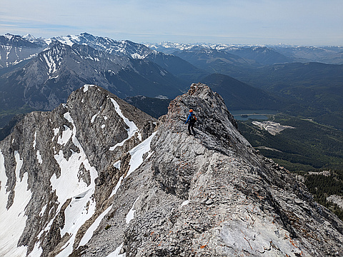
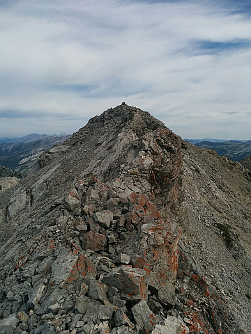
"A very enjoyable ascent of Phillips Peak, "difficult" scramble near the top, a few "difficult" moves which felt awkward on the way down following by the knife edge ridge. Mt. Tecumseh is easier moderate (Class 2 terrain). We could not traverse the steep ledge between the two summits since it was filled with snow and didn't look safe. Instead, we went down additional 100 vertical meters where the slope was dry. Tecumseh is complete opposite of Phillips - it's a boring slog on tedious rubble. The views are better than from Phillips though. Snow made the descent into the bowl easier. It should suck later in the season when the snow is gone. The rest of the route follows creek and is tedious (except for a short slot canyon). As much I enjoyed Phillips I didn't like Tecumseh." — Taras • Jun 9, 2024

"Not quite technically a summit - stayed about 30 meters back because of a dangerous looking cornice. On my route down, I saw an avalanche from one of the cornices letting go.
I approached from the BC side, and went up the ridge straight north of Phillipps Lake, along the BC/Alberta border.
Then descended along the route into the bowl and used the common route to exit.
I found mountain goat tracks way up on the highest ridge - genuinely impressed " — AaronKauffman48 • Jun 3, 2022

"we went up to Phillipps peak's false summit to measure the position of a border marker placed in 1922, with a high-precision GPS unit/ While in the neighbourhood, we climbed Phillipps Peak, came down the ridge to find a narrow ramp traverse in to the bowl below Mt Tecumseh, which we then climbed. We finished by coming out via the canyon normal route to Tecumseh. A long day, with 3 spot that I would consider difficult scrambling." — apfelstrudel • Sep 19, 2020

"Bike and Hike. Climbed South ridge of phillips peak which had some moderate scrambling along it till the summit ridge which was exposed but solid enough. Descended to the scree ramp on the SE ridge and gained the normal ascent route for Tecumseh. " — ken_hercules • Jul 8, 2020
"It was hot. +32C at the valley. I biked the approach road (along gas right of way) to where one starts up from Tecumseh. Locked up the bike there and went up as for Tecumseh. Upon reaching the bowl botttom, I turned left and gained the ridge. Gaining the ridge and the ridge was moderate scrambling and the small notch was on the easier side of difficult scrambling. Took a scree gully for the way down, which had tedious scree. At the end of the gully there was avi debris (trees) and lots of vegetation, sop some bushwhacking was required, but no significant obstacles. Biked back out (mostly downhill)." — BertB • Jul 8, 2017
Photos
Awards
About peakery awards
Log climbs on peakery to earn awards:
Peak Badges: Earn a special badge for each unique peak you summit. See all of your badges on your Badges page.

First Ascent Award: Only 1 available per peak. Goes to the first peakery member to log a successful summit of a peak. Snag this award and the peak will forever bear your name.

King of the Mountain Award: Only 1 available per peak. Summit a peak more times than any other member. Beware: this award can be lost!

Summit Steward: Summit a peak at least 5 times to become one of its Summit Stewards. As Steward of a peak, you’re encouraged to keep that peak’s info up-to-date on peakery and spread goodwill on your future climbs up the peak.