
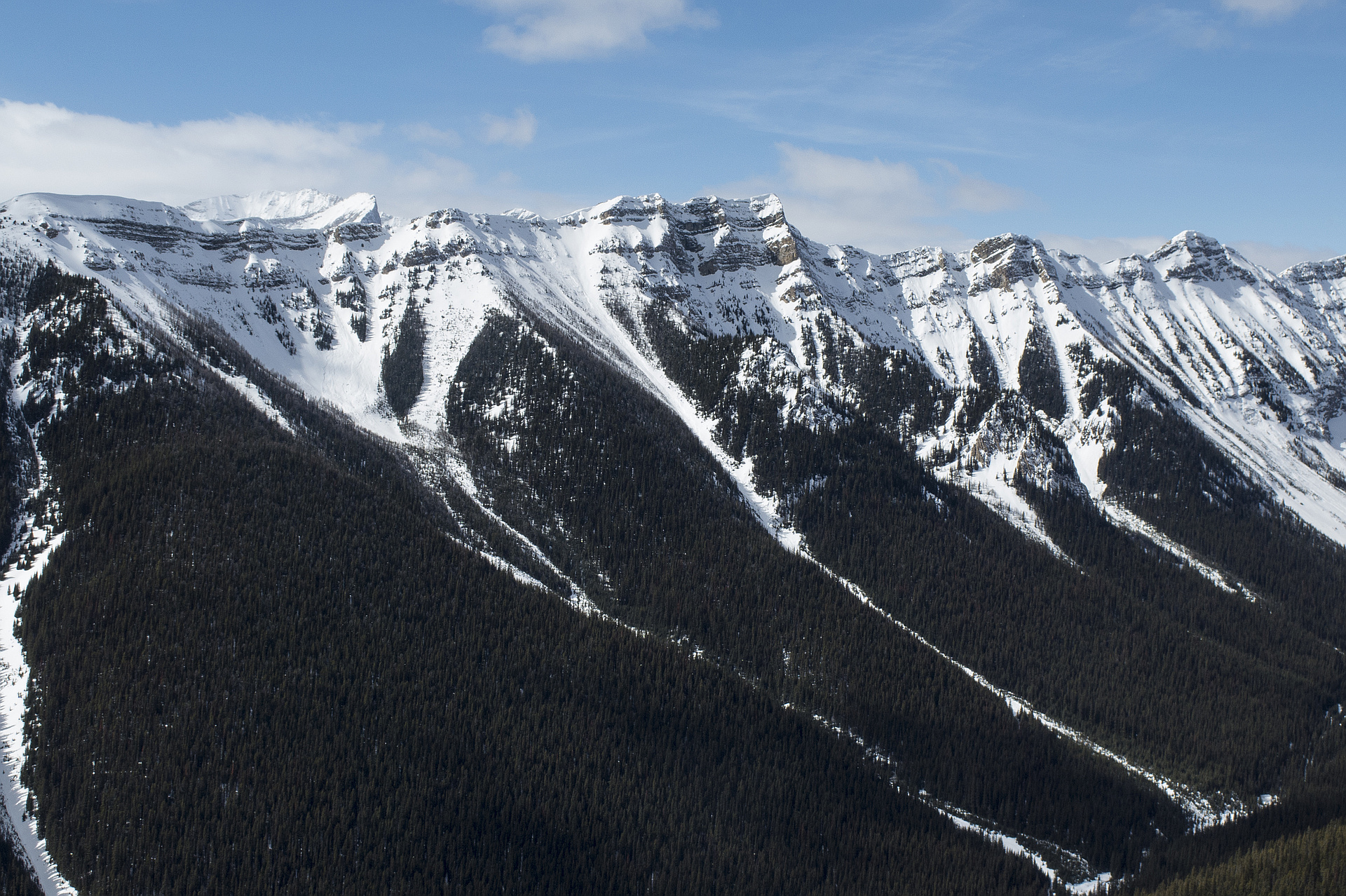
Region
Highlights
Routes
2 climbs • 10.8 km • 2,917 m gain • 6 hr 56 min
2 climbs • 8.6 km • 2,913 m gain • 7 hr 33 min
1 climb • 9.4 km • 3,004 m gain • 8 hr 0 min • Class 3
1 climb • 5.1 km • 2,443 m gain • 4 hr 33 min
1 climb • 7.9 km • 3,198 m gain • 6 hr 41 min
1 climb • 9.4 km • 3,613 m gain • 5 hr 40 min
Latest climbs
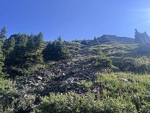
"Route via SW drainage. About half way up drainage splits and I took left one up to the small col ( Vern’s suggestion). From the col steep but easy mostly grassy slopes up to the ridge. This route avoids most of the slabs and is technically an easy scramble. Great views, short day." — PawelG • Aug 11, 2024

"The rain started as I reached the beginning of the scramble section. I opted to go up the descent slope instead, rejoining the upper final scrambling section. The rain stopped but the rock was wet, to bad some of the slabs looked fun to climb if dry. I returned the same way stopping at the small grassy outlier first." — Randy • Jun 24, 2020

"Since there was little snow last week at Hummingbird Plume Lookout and not much new snow had fallen, I decided to try Kent again by means of south ridge. We started further back due to concern about parking along the roadside. This probably added 2km and roughly 100m of elevation gain. We found the High Rockies trail for some part, and then broke from it based on the previous GPS track I had made. The bushwhacking was fair. We got up higher to South Kent and the snow was deeper there. Unfortunately the snow had a crust with icing sugar under that. Up to about 2 ft deep. We continued on, and I was getting rather tired. We got up on the ridge, got to a highpoint. At this time we had been going up for four hrs. The next section was going to get more technical. I decided it be best if we turned around and not get caught in the dark. We found a bushy way down and walked along the road. Good views though." — BertB • Dec 8, 2018
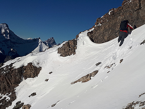
"We parked at Black Prince Day Use and went up Mt. Kent via South Ridge. There was so little snow in the trees that we ditched snowshoes 150m higher. Snow increased only marginally higher up so we didn't need the snowshoes the whole day!
The 2km ridgewalk to the summit of Mt. Kent was the highlight of the day. We were treated to the blue sky, gorgeous scenery and no wind. The ridgewalk was mostly a hike. There was a short stretch of a "moderate" scramble 400m before the summit. Then we went up a steep snow ramp to gain the summit block.
Nugara describes the last few hundred meters as "dangerous and difficult" but we didn't find it bad.
There was so little snow we agreed to descent via the summer route, which is not recommended in the winter due to the avi concerns. Initially, the descent is very steep. It was a bit tricky to descend the snow covered slabs but the terrain get less steep lower down and we even treated ourselves to a glissade.
It was a great day out. Snow-wise, it felt more like October than December.
PS. I uploaded Mihail's track as I had forgotten my GPS." — Taras • Dec 8, 2018

"Wanted to do a short trip to be back in the city by 3 pm ish. So again we left the city at 5 am. This time to get up Mt. Kent. According to Nugara we had to park by a drainage on Spray lakes road a couple km north of the Black Prince pullout. Started hiking a little past 7 am." — dkmountainman • Oct 3, 2011
Photos
Awards
Challenges
About peakery awards
Log climbs on peakery to earn awards:
Peak Badges: Earn a special badge for each unique peak you summit. See all of your badges on your Badges page.

First Ascent Award: Only 1 available per peak. Goes to the first peakery member to log a successful summit of a peak. Snag this award and the peak will forever bear your name.

King of the Mountain Award: Only 1 available per peak. Summit a peak more times than any other member. Beware: this award can be lost!

Summit Steward: Summit a peak at least 5 times to become one of its Summit Stewards. As Steward of a peak, you’re encouraged to keep that peak’s info up-to-date on peakery and spread goodwill on your future climbs up the peak.