
Region
Highlights
Routes
20 climbs • 23.1 km • 5,112 m gain • 10 hr 6 min
5 climbs • 11.3 km • 4,757 m gain • 5 hr 11 min
2 climbs • 24.3 km • 5,154 m gain • 8 hr 54 min
Latest climbs

"Billy said 5am meet at PetroCan and I for some reason agreed. We drove into trailhead in the pitch black but hey the stars were out for a first time in a long time....and there was snow at the trailhead. Our goal was 8 hrs and that is what we did. Raining and cloudy within 30 min. Snow on trail and when we got above the tarn it was whiteout to the point we ascended the sub-peak and got completely turned around and thought the peak was 180 degrees the other way. GPS on the phone wasn't working and it wasn't clear where the peak was nor where the route was we were staring at a cliff where the route should be in calf deep snow. A phone reset and route correction got us re-oriented and after a slippery traverse we were back on track and heading up to the peak in snow and soon knee deep post holing with average 60cm depth snow. Navigation basically was a barely visible outline of the ridge to one side which was corniced. Then the radio tower building began to appear out of the ether...we were there. Sheltering from the wind we saw blue sky above us but it never materialized at our elevation. So 15 min and a chill setting in we began descending. Deep post holes and biting wind adding ici..." — alexjoseph • Sep 23, 2018

"I was working at Sunshine village at the time and my friends Ben and Bob decided to climb Mount Bourgeau. It was my first mountain climbing experience and Bob was the most experienced of us. I think it was Ben’s first experience as well as he was from Saskatchewan.
We had a fantastic climb as we ascended the scree slopes and had a couple sections where Bob would lead climb and belay us as we climbed some of the more challenging sections.
It was a memorable time that I have never forgotten as it my entry into climbing.
We started from the Sunshine Village parking lot.
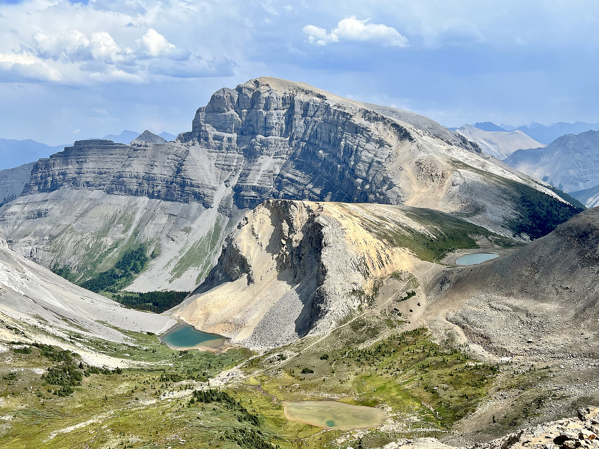
Approach
Start from the Sunshine Village parking lot: Head through the trees towards the trail, which should be visible from the parking lot.
Follow the Bourgeau Lake trail: For the first 6 km, follow the well-defined Bourgeau Lake trail, which is a steady climb through forest and across streams.
Locate the third avalanche path: Continue on the trail until you reach the third avalanche path that crosses it. This is a key landmark.
Bushwhack up to the bowl: From the clearing of the avalanche path, bushwhack up and to the left through the steep trees to reach the bowl above. This section has a significant e..." — rodneufeld • Aug 11, 1990
Photos
Awards
Challenges
About peakery awards
Log climbs on peakery to earn awards:
Peak Badges: Earn a special badge for each unique peak you summit. See all of your badges on your Badges page.

First Ascent Award: Only 1 available per peak. Goes to the first peakery member to log a successful summit of a peak. Snag this award and the peak will forever bear your name.

King of the Mountain Award: Only 1 available per peak. Summit a peak more times than any other member. Beware: this award can be lost!

Summit Steward: Summit a peak at least 5 times to become one of its Summit Stewards. As Steward of a peak, you’re encouraged to keep that peak’s info up-to-date on peakery and spread goodwill on your future climbs up the peak.