
Region
Highlights
Routes
4 climbs • 6.3 km • 1,713 m gain • 3 hr 5 min • Class 2
3 climbs • 5.1 km • 1,560 m gain • 2 hr 25 min
2 climbs • 4.7 km • 752 m gain • 3 hr 27 min
1 climb • 11.6 km • 1,623 m gain • 5 hr 17 min
1 climb • 12.5 km • 2,373 m gain • 5 hr 35 min
1 climb • 16.7 km • 2,815 m gain • 7 hr 57 min
1 climb • 5.5 km • 1,452 m gain • 2 hr 28 min
1 climb • 8.7 km • 2,789 m gain • 2 hr 43 min
Latest climbs

"Thought I'd try and get in a winter one since it was such a nice day. I did the loop clockwise so I wouldn't have to come down the steep side. A bit harder than anticipated since the trail down the ridge was buried in snow and resulted in some bushwacking." — danradu • Feb 5, 2023

"Did this one with the kids. Decent outing and not difficult. It was fun meandering through the forest along the top of the slope leading to the ridge. Kids climbed on lots of little boulders along the way. It was a great day to be out." — Slogenstein • Jun 13, 2021
"North scramble route up Yates Mountain. The short bit of scrambling near the top was a welcome change from steep hiking through the forest. My route up McConnell point was a rocky ridge above the highway. It was a nice option to scramble up small cliff bands rather then using the other hiking trails." — Randy • Jun 23, 2020

"went backpacking in Quaite Valey campground friday night, parking at Barrier Lake. Given rain, we postponed our plan of hiking Engagement Mtn Friday night. Instead, got up Saturday and had breakfast on the summit of EM. We returned to camp, packed up, and took the backpacks for a walk. we first headed to the Fire lookout via Prairie View. we dropped our packs where prairie view hits McConnel ridge, to lighten the load to the lookout. After returning to our packs, we had lunch, and headed down via McConnell Ridge. Wasnèt sure which of the three Bumps was considered the summit, so we did all three of them. Then there wasn't really a trail. We headed downn the gully, avoiding a few cliff. bands. Instead of heading for the ridge, we staid at the base of the ridge, and found some descent scree to descend quickly. Had we known the first bump was the summit, we would have likely turned around, as the rest is not really worth it IMO (certainly not with an overnight backpack). On the return, we followed the lakeshore given there were three grizzlies on the trail." — apfelstrudel • Jun 6, 2020

"Wanted a short hike to wrap up the holidays. Given the avalanche hazard was rapidly ramping up, and high winds (100+ kph forecast) thus seemed like a good compromise. Went up the "direct" route on the west side, came back down via the Razor's edge. A fun easy and quick outing, will likely return to do more of it running." — apfelstrudel • Jan 3, 2019

"7.1km loop with 540m gain in 3:30hrs.
A quick family outing. They forecasted just no winds (barely 5km/h)... I guess they did quite a mistake.. it was so windy and cold.
Almost no snow, just a bit of ice on road on the way back." — alexp • Dec 22, 2018

"Parked as for Quaite Valley, walked along the highway and headed up Razor's Edge. That was a nice walk along the ridge for a bit. But I was looking over to the right and needed to get up there. Soooo... chose my own adventure and I bushwhacked up the steep mossy treed slopes, dodging some rock outcrops here and there.
The way down consisted of following the east ridge a bit, but that was a thin trail and I decided to continue my own adventure. Somewhat steep scree, and a bit of bush. I ended up coming straight south onto the campground. From there an easy walk out.
Found a snow basket, and lost it. A shrub took it out of my hands, and I could not find it after two minutes of looking." — BertB • Apr 26, 2016

"Headwall trail is mainly a steep hike. Park after the guard rail along highway, trail starts past the small hump and boulders. Mainly well defined trail that sees little use. Another quick evening trip." — Randy • Apr 19, 2016
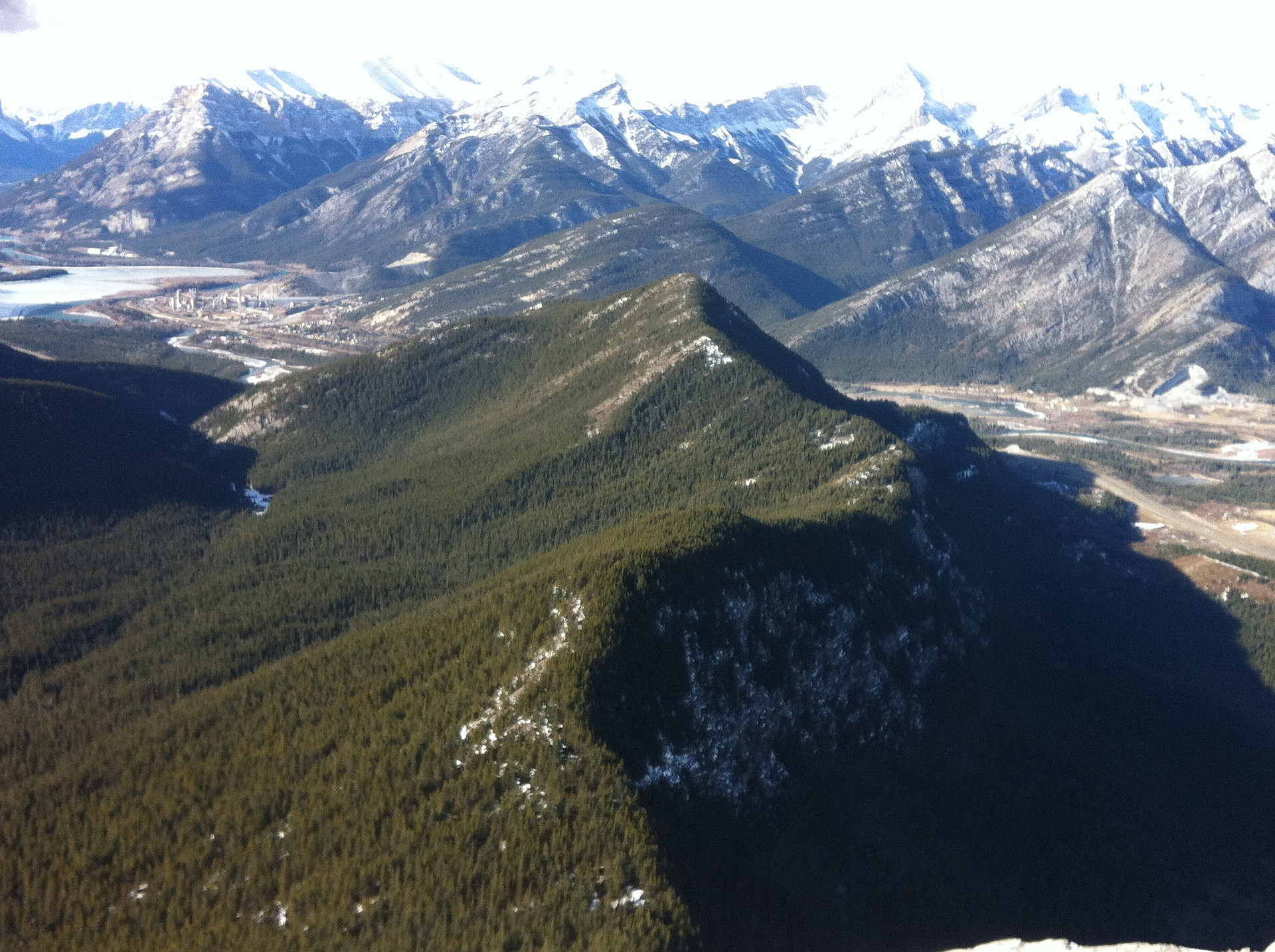
Photos
Awards
About peakery awards
Log climbs on peakery to earn awards:
Peak Badges: Earn a special badge for each unique peak you summit. See all of your badges on your Badges page.

First Ascent Award: Only 1 available per peak. Goes to the first peakery member to log a successful summit of a peak. Snag this award and the peak will forever bear your name.

King of the Mountain Award: Only 1 available per peak. Summit a peak more times than any other member. Beware: this award can be lost!

Summit Steward: Summit a peak at least 5 times to become one of its Summit Stewards. As Steward of a peak, you’re encouraged to keep that peak’s info up-to-date on peakery and spread goodwill on your future climbs up the peak.