Region
Highlights
Routes
/-116.52828827508,51.792191982821,11,0.00,0.00/320x240@2x?access_token=pk.eyJ1IjoicGVha2VyeSIsImEiOiJjampra3Z0bnAxeTVnM3FteHlybHY3b2p1In0.7a5dEa5-995VUv8ceHHNmw)
6 summits • 7.2 km • 1,284 m gain • 7 hr 29 min
2 summits • 9.0 km • 1,302 m gain • 8 hr 47 min
1 summit • 10.2 km • 1,274 m gain • 6 hr 53 min
1 summit • 12.3 km • 1,560 m gain • 5 hr 58 min
1 summit • 17.9 km • 1,743 m gain • 11 hr 27 min • Class 3
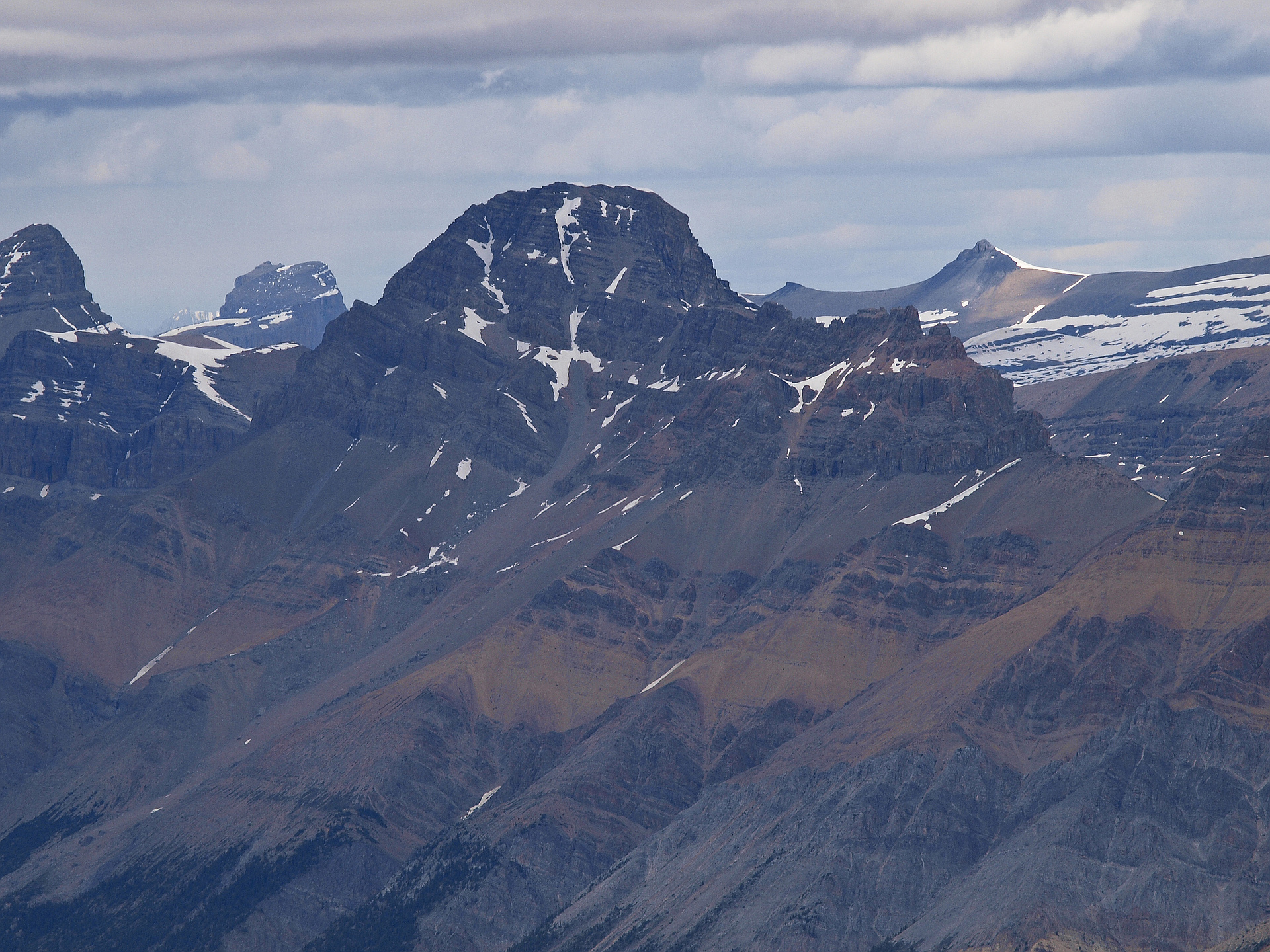
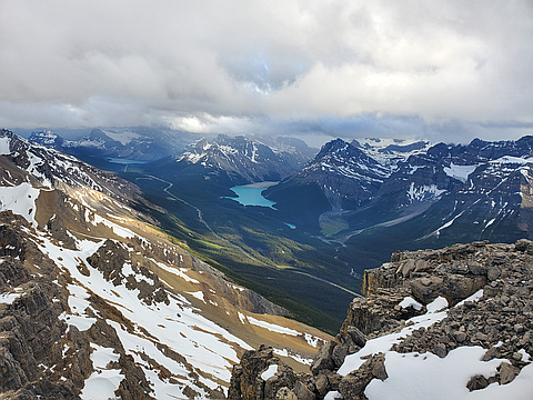
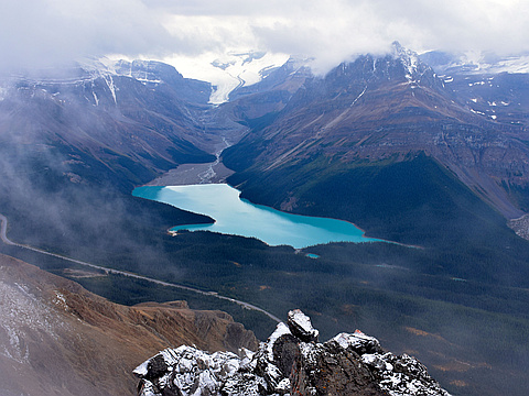
Latest summits
"4 Kanes left for half day work ascents. Bosworth looked good last weekend from Lake O'Hara and that was the target with marginal weather (again). On highway approach it looked snowy. So we turned back to go home. Then decided nope we should do Observation Peak because we were close by. So we grabbed 1 bar of cell service to download route info. Drove north on Icefields Hwy and parked at Bow Summit at a construction stop and got out to put on our shoes at the base of Observation Peak which looked great. The flag lady asked what we were doing and when we said climb Observation Peak she said, "No you're not. You can't park anywhere 8km either side of that location." So we decided to go thru construction to see where the north end was and if Weed was an option. Turns out Weed is north of the construction (~500m) but couldn't see a trailhead and didn't have any info so turned south again to go home. Then while waiting for construction noticed I could turn off one map layer to see OpenTopo trail. So turn around again and back north to the trailhead. Still couldn't get a visual but followed GPS on north side of creek and bushwacked for half an hour before getting above trees and bits of t..." — alexjoseph • Jul 15, 2020
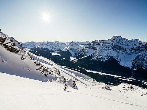
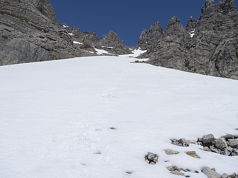
"Mount Weed - Nov 30 2019. We skied off the summit of Mt Weed yesterday. An awesome line that we've been looking at for quite a while now. The approach was the crux. There was poor coverage until treeline. We bootpacked about 250m of elevation gain because of that. Crampons needed! Once we hit treeline it was smooth sailing. Snow was variable in the couloir, bit of everything from isolated wind slabs, sun crust, facets, powder, and all in between. The bootpack up went mostly well, with a reasonable amount of wallowing. I measured 48 degrees at the steepest part. Majority of the couloir was low 40s. The summit view was absolutely amazing combined with the best weather day in forever, so stoked on that, infinite vis. The ski down was pretty tricky until about half way down the couloir where the snow improved, followed by fantastic powder skiing right to treeline. Lots of sharks! We hiked back down to the car from there to save our skis." — jakefinnan • Nov 30, 2019
"Silverhorn - Weed traverse: 16.8km return in 2,000m gain in 11:30hrs car-to-car.
Got a snow storm on Silverhorn's NW ridge, whiteout at the summit but decent weather after. Even 10-15 mins of sunshine in the afternoon.
On descent followed a normal trail for about a half, then traversed to skier's left till another "drainage". It was a creek in cliffs with few waterfalls. Stayed in the forest on its right till more or less flat surface. Then direct line to parking with a bit of bushwacking." — alexp • Sep 9, 2018
"Mount Weed is a great early season destination. I started very late and made a few navigation errors. Snow was soft by the time I reached the upper ascent gully. I could use the snow to my advantage only on the descent.
If I ever do Weed again, I'll do it in early June and start very early for a terrific 800m glissade. Summit views are fantastic, one of the best of all Kane scrambles, so I might come back for this one." — Taras • Jun 18, 2018
Photos
Awards
Challenges
About peakery awards
Log successful summits on peakery to earn awards:
Peak Badges: Earn a special badge for each unique peak you summit. See all of your badges on your Badges page.

First Ascent Award: Only 1 available per peak. Goes to the first peakery member to log a successful summit of a peak. Snag this award and the peak will forever bear your name.

King of the Mountain Award: Only 1 available per peak. Summit a peak more times than any other member. Beware: this award can be lost!

Summit Steward: Summit a peak at least 5 times to become one of its Summit Stewards. As Steward of a peak, you’re encouraged to keep that peak’s info up-to-date on peakery and spread goodwill on your future climbs up the peak.