
Region
Highlights
Routes
2 climbs • 27.5 km • 4,877 m gain • 10 hr 13 min
1 climb • 18.0 km • 2,734 m gain • 12 hr 28 min
1 climb • 32.3 km • 7,758 m gain • 10 hr 6 min
1 climb • 29.4 km • 5,812 m gain • 29 hr 0 min
Latest climbs
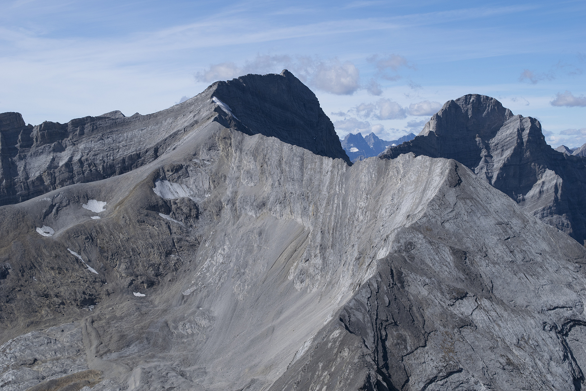
"Yesterday the weather was perfect for a stroll up Mt Foch. Although the approach from the Upper Kananaskis Lakes parking lot is long, it's always so scenic. Once we branched off the main Aster lake trail, we were continually distracted by the incredible number of fossils in Foch Creek, more than I had seen anywhere.
We took the more direct route up to the ridge, rather than the longer Kane route. This involves slogging about 500m up some tiresome treadmill scree and loose dirt to reach the ridge. This route was dry and we didn't encounter and random rockfall that other parties have reported.
Once on the ridge, the scrambling was more interesting and challenging with a few downclimbs and an exposed ridge traverse to reach the summit.
Fortunately the ascent misery is inversely proportional to the descent joy level and it was a pretty quick descent from the ridge to the valley. We took a detour for a much needed cool off in the pond between Sarrail and Foch." — geoffhardy • Aug 27, 2023

"We climbed Mt. Foch via Petain Basin, which is possibly the safest route with the least amount of objective hazards. Fit parties can probably do it in under 12 hours from Kananaskis Lakes with the bike approach. We started from the end of Elk River Forestry Road and camped in the Basin.
Since this is unpublished route, I'll provide a few details:
-From Petain Basin take an obvious ramp and travel generally in NW direction to the other end of the Basin. Don't get unnecessarily high and don't get too close an unnamed peak between Fox and Foch. At the end of the Basin, you will find an obvious ramp to the ridge (1st photo), which joins the Kane route a few hundred meters before the summit and avoid all hazardous downclimbs. The access ramp is on generally stable rubble and some slabs (Class II terrain), easy despite the appearance. Higher up we donned crampons for 50m. During the hot summer, the snow will likely be gone by early-to mid August. Not this year.
-The Kane ridge is initially easy. Two short downclimbs probably deserve Class IV ratings but the rock is excellent so they are fairly easy. The third downclimb can be bypassed easily on climbers right. A steep slabby slope ..." — Taras • Aug 15, 2020

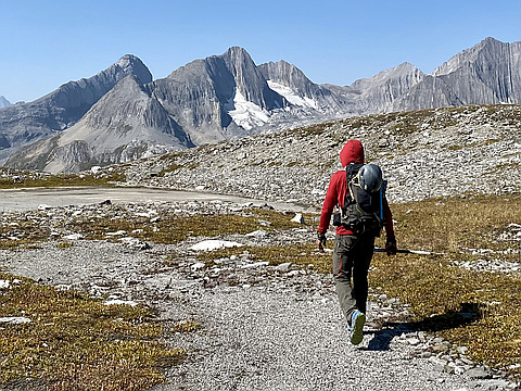
"Day trip
I really like the Aster Lake area. It was quiet on Saturday. We didn't see anybody outside of the parking lot...and, from a distance a party descending Joffre, and a party on the summit of Sarrail.
The hike to marlborough pond is easy. Stay climbers left of the creek to find a sometimes faint trail. There's a cascade about 500 meters up, the trail seems to end here. Just step left a few meters to find it again.
We ascended directly from the lake, generally trending right to avoid cliffs. Found stable rubble for the first 350 of 500 vertical meters. The top was less good, but tolerable.
We hit the ridge 200 vert from the false summit. Easy plod with great views.
Helmets on at the false summit for sustained difficult scrambling. You start by descending a somewhat narrow ridge, but when you run into an obvious 8 meter overhang, peel off left or right. I went left, it was steeper and ended with a big step onto 30 degree slab (not really exposed though). Liz went right. Easier, but had to traverse snow with an exposed run out. We both took my way on the way out.
Regain ridge, continuing a down climb trend, until you hit a narrow downward trending ridge with lots ..." — mike_rogers81 • Jul 14, 2018

"via Foch Creek to S ridge of Unnamed 3125 m GR293033, and then via WSW ridge, rope and protection used, to Foch with J. Skvaril and I. Watson. Left register on Unnamed on way back, calling it Mt. Stefanik (WW1 General in French Army and Minister of War in Czechoslovakia) and had beers here." — KrisT • Aug 30, 1997
Photos
Awards
Challenges
About peakery awards
Log climbs on peakery to earn awards:
Peak Badges: Earn a special badge for each unique peak you summit. See all of your badges on your Badges page.

First Ascent Award: Only 1 available per peak. Goes to the first peakery member to log a successful summit of a peak. Snag this award and the peak will forever bear your name.

King of the Mountain Award: Only 1 available per peak. Summit a peak more times than any other member. Beware: this award can be lost!

Summit Steward: Summit a peak at least 5 times to become one of its Summit Stewards. As Steward of a peak, you’re encouraged to keep that peak’s info up-to-date on peakery and spread goodwill on your future climbs up the peak.