
Region
Highlights
Routes
3 climbs • 12.8 km • 4,068 m gain • 7 hr 26 min
2 climbs • 22.0 km • 5,511 m gain • 8 hr 5 min
1 climb • 18.0 km • 5,329 m gain • 5 hr 35 min
1 climb • 13.5 km • 4,271 m gain • 6 hr 7 min
1 climb • 13.8 km • 4,187 m gain • 9 hr 58 min
1 climb • 17.6 km • 5,608 m gain • 9 hr 17 min
1 climb • 19.0 km • 6,364 m gain • 5 hr 44 min
1 climb • 21.5 km • 5,299 m gain • 6 hr 19 min
1 climb • 23.4 km • 5,662 m gain • 9 hr 5 min
Latest climbs
"Unfinished business after February attempt. Our snowshoe tracks from last time completely filled in so it was still a slog to reach the ridge but it was easy from there. A fantastic spring day out, basically perfect conditions and weather for this time of year." — yuri • Apr 9, 2022

"Another unsuccessful attempt in the mountains this week. The Nakiska access road was quick and easy but getting to the ridge from there was very slow trail breaking in snowshoes and took 3 hours to go only 2km and ascend 400m. We were already behind schedule and the crazy high winds and spindrift was the nail in the coffin." — yuri • Feb 26, 2022
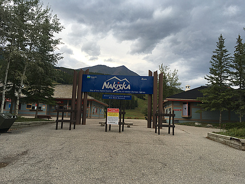
"They were working at Nakiska excavating and laying pipes for their snow making. So I went around and up Marmot Creek. It was nice at first but then became more of a bushwhack and some washouts most likely from the big flood. Then arrived at a nice old trail that was slightly overgrown. Which later I found out would of led to another nice overgrown trail that I could of used. But no I followed GPS track up through the forest. It was steep with lots of trees blown down, not very fun. But once on to the open slope it was actually quite pleasant. It was late in the day so I returned back along the ridge. I used the other route. The scree was soft most of the time. Reached the creek which I followed for a short bit. A cairn marked where to leave the creek up the other bank. It led to an old overgrown trail. Which led to the trail I was previously on. If I would of went left it would of lead to where I was earlier. I went right it was up hill for a bit but went to Nakiska where I Followed the easy ski out." — Randy • Aug 26, 2021

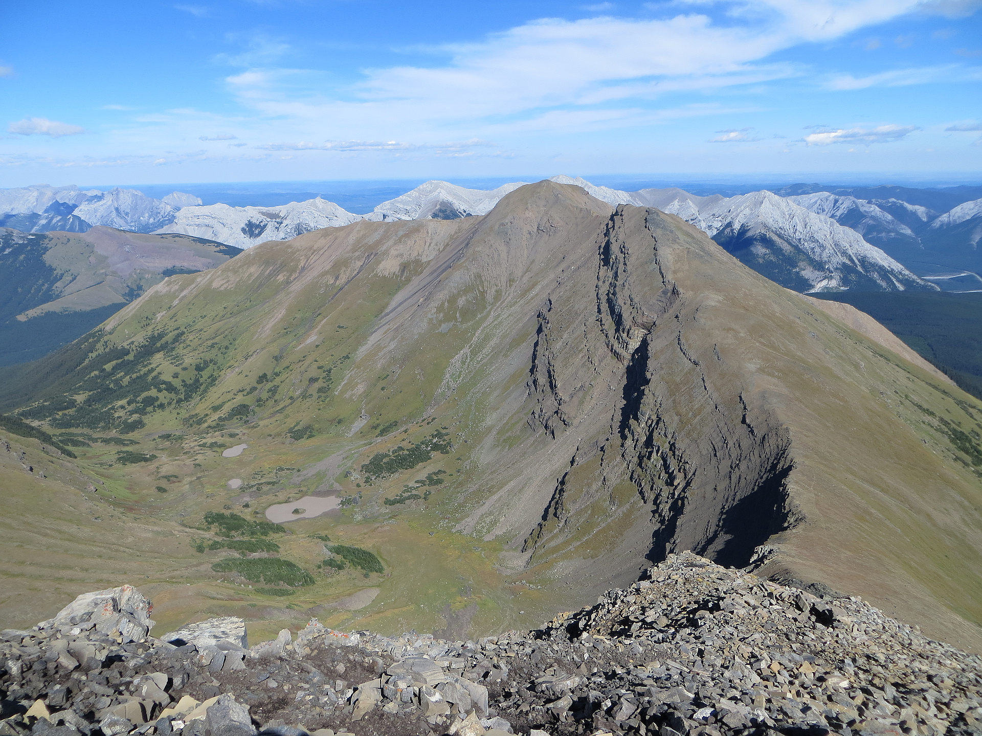
"Started at Ribbon Creek and hiked up to Mount Allan. Then dropped down to the east and ascended Mount Collembola. There was quite a bit of moderate downclimbing from this route. We descended from Collembola's north ridge to Dead Man's Flats where we parked a second vehicle.
I would recommend doing this route in the opposite direction so that you are climbing up the scramble sections on Collembola instead of downclimbing. " — nathanwatt • Jul 20, 2020

"Started at Nakiska. Used a GPS to find our way up the somewhat overgrown trails to Fisera Ridge. Followed that ridge crest west to the base of Mt. Allan summit block but traversed right north through a cirque then up northwest to the summit ridge of Mt. Collembola. Plenty of minor route-finding around cliffs and boulders led us up to the summit. Near the top we found a broken piece of horn leftover from a bighorn sheep fight. We had some fun with our yellow rubber chicken club mascot along the way. We took a different way down, southeast ridge steeply dropping through boulders, scree then grass, down into the bush, then used our GPS to find our way back to the ski area." — geoffc • Aug 24, 2016

"Well today was a big day... Corbin Ruthven and I decided to summit 3 mountains. Olympic Summit, Mount Allan and Mount Collembola. It took as 9 hours almost on the dot, to cover 24KM and almost 2000Meters of total elevation. My Fitbit stats are all wanked due to having to stop tracking with the Fitbit GPS due to fear of running out of battery, so I switched to the phone. Oh and we camped over night in a campground. Not as fun as the backcountry....." — TBird • Aug 2, 2016

"Did a solo up Mount Collembola. It was a cool start but after a bit I was in the sun wearing a t-shirt (and gloves). Used the north ridge which involved a difficult section that looked intimidating and it did involve some climbing moves. Great day!" — BertB • Oct 25, 2015
Photos
Awards
Challenges
About peakery awards
Log climbs on peakery to earn awards:
Peak Badges: Earn a special badge for each unique peak you summit. See all of your badges on your Badges page.

First Ascent Award: Only 1 available per peak. Goes to the first peakery member to log a successful summit of a peak. Snag this award and the peak will forever bear your name.

King of the Mountain Award: Only 1 available per peak. Summit a peak more times than any other member. Beware: this award can be lost!

Summit Steward: Summit a peak at least 5 times to become one of its Summit Stewards. As Steward of a peak, you’re encouraged to keep that peak’s info up-to-date on peakery and spread goodwill on your future climbs up the peak.