
Region
Highlights
Routes
2 climbs • 4.3 mi • 1,804 ft gain • 3 hr 52 min
1 climb • 2.3 mi • 1,179 ft gain • 2 hr 13 min
1 climb • 4.3 mi • 1,689 ft gain • 4 hr 34 min
1 climb • 2.1 mi • 939 ft gain • 1 hr 41 min
Latest climbs

"I found the register bottle broken and the old notes a bit chewed, last time I was here. I brought a new register container today, but sadly the notebook and pencil have been totally destroyed by critters in the last few weeks. Please bring a new book and pencil. I tried to take the old glass shards down, but cut myself in the proccess... so maybe bring a heavy-duty bag that will hold sharps.
This not the best route, requires HC." — hwstock • Oct 26, 2024
"Another eye-knee-pack test after strabismus surgery. I sort-of followed Kevin Hume's trip from years back, but I wanted to follow the ridge down. There has been a fire since he went, and the ridge back has become a cactus minefield. While I am glad I took this route, I wouldn't recommend it. Note that some of the easier Misty Routes (from the north) trespass on private property; the non-trespass north route requires 4wd. The Potosi Pass road is currently (Oct 2024) suitable for 2wd cars with at least 5" clearance. Note register on Misty needs to be replaced (broken)" — hwstock • Oct 11, 2024

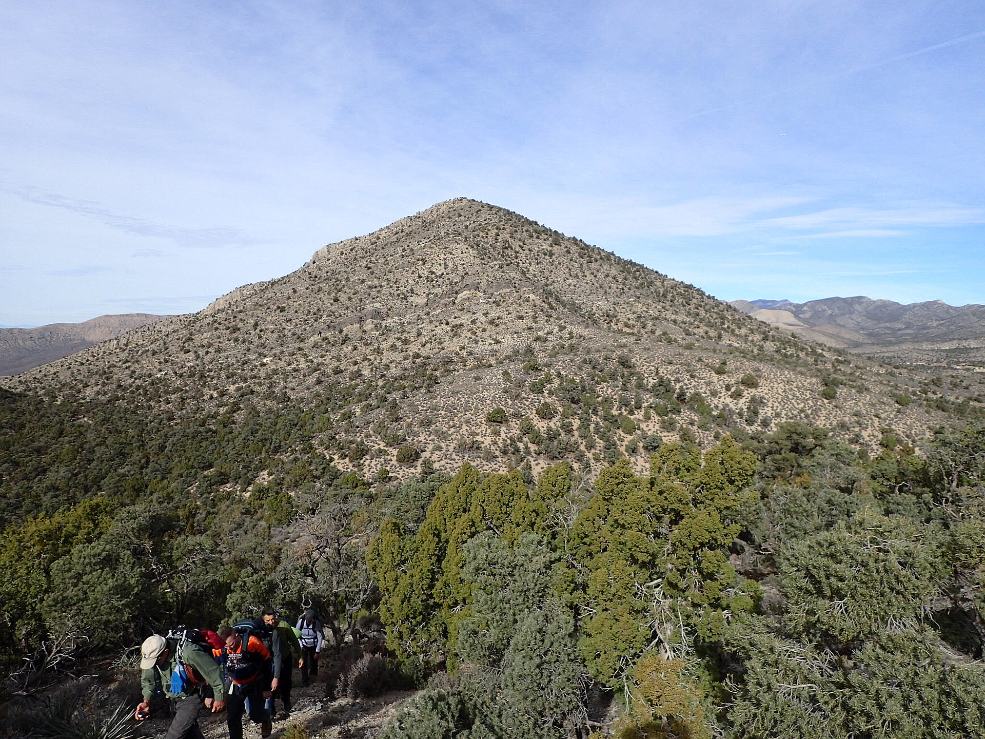
"LVMC Hike. We started on Potosi Mountain Road, just short of Potosi Pass. We quickly gained the ridgeline above us and followed it as it turned north, towards Claret Peak. It got a bit loose near the top, but nothing over class 2. From there, we descended into the small valley south of Misty Mountain, gained the low saddle, then followed Misty Mountain's south ridge to the top. To get back to the cars, we descended to the low saddle, then went back up the other side. We loosely followed the ridge for a ways before dropping down to the road, which we hiked back to the cars. It was a pleasant hike with good company." — Kevin • Dec 23, 2017
Photos
Awards
About peakery awards
Log climbs on peakery to earn awards:
Peak Badges: Earn a special badge for each unique peak you summit. See all of your badges on your Badges page.

First Ascent Award: Only 1 available per peak. Goes to the first peakery member to log a successful summit of a peak. Snag this award and the peak will forever bear your name.

King of the Mountain Award: Only 1 available per peak. Summit a peak more times than any other member. Beware: this award can be lost!

Summit Steward: Summit a peak at least 5 times to become one of its Summit Stewards. As Steward of a peak, you’re encouraged to keep that peak’s info up-to-date on peakery and spread goodwill on your future climbs up the peak.