
Region
Highlights
Routes
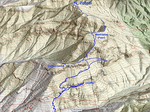
4 climbs • 4.7 mi • 2,914 ft gain • 5 hr 55 min
1 climb • 5.0 mi • 2,858 ft gain • 4 hr 58 min
1 climb • 6.9 mi • 2,583 ft gain • 5 hr 28 min
1 climb • 3.6 mi • 2,467 ft gain • 7 hr 5 min
1 climb • 5.1 mi • 2,137 ft gain • 4 hr 24 min
Latest climbs
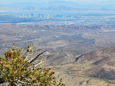
"To Cottonwood Overlook (nice trail!) then on to Meditation Point, Namaste Hill and Buddha's Rest. Pleasant - not too brushy, not too much loose rock, routefinding fairly easy and intuitive. The moldy peanut butter jar is still at Buddha's Rest summit. From there, tried to see how close to Potosi I could get. Got pretty close - made it to the first cliff line that the higher antennas are above - then the route got treacherous, very loose rock, and I turned back. Perhaps the Potosi summit is attainable with a different approach? Maybe a gully farther east? Has anyone done it this way from the north? (I read about a few explorations from the north, but no successes.)" — tracyt • Mar 8, 2026
"I really much prefer the eastern routes... but It's getting warm. A friend asked to set aside this day a month back, so I chose this as a "safe" shoulder season trip, as it starts in the shade and gets to 7400'. The trail is scenic... but so VERY easy to lose near the climbing areas. There is no trail after the cottonwood saddle (with Meditation Point). There is rocky rib on the way to Meditation Point, and on the return trip, you have to be very careful to navigate back to the top of that rib." — hwstock • Apr 21, 2025
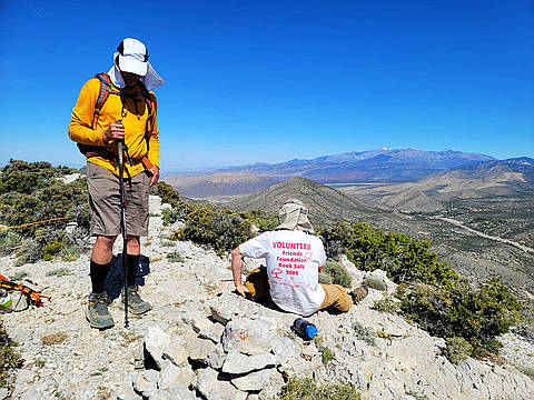
"Very windy, which cut down on water use. I broke 5 ribs, punctured a lung, and had a serious concussion a bit over 2 months ago, and this was one of my graduated "tests." Ribs were a bit sore at end. The "OOPS" was interesting, but unintended." — hwstock • Apr 12, 2025
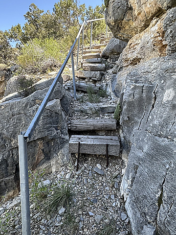
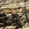
"4.23.24~Buddah’s Rest (North Potosi) 6.5 miles, 2,400’ gain, 4:28hrs. After parking I heard sounds of an animal bellowing and moaning in the hills across the highway. I saw some sheep up there and wonder if one fell. I’ve never heard them make sounds before. I started out at 11:30am on a warm day but there were breezes and I never felt uncomfortably warm. My main goal was to check out the Old Boy Scout trails but I did the summit because I was curious about this gully that leads to the satellite saddle. It’s as terrible as I imagined but did the job. I used the Highline Trail, Boot Hollow & the Ponderosa Canyon trails. These trails are enchanting, rugged, lonesome and charmingly unkept. They follow below and above gigantic cliff walls. Really beautiful. " — paula.raimondi • Apr 23, 2024
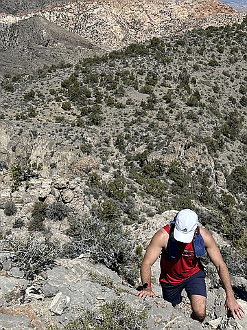
"4.19.2024~Cottonwood Overlook, Meditation Point & Buddah’s Rest (No. Potosi) w/Jimmy. 6.5 miles, 2,800’ gain in 4:43hrs. We started around noon. It was warm without much of a breeze. I thought it would cool off near the last peak but it didn’t. 2 of the peaks were new to Jimmy. We were the only 2024 sign in on No. Potosi. I forgot how difficult these peaks are with the rough terrain, branches coming at your face, every cactus and sharp yucca on earth ready to impale for feet and ankles and sharp rock. Nonetheless it was a fun workout with views of grandeur." — paula.raimondi • Apr 19, 2024
"We decided to check an alternate trail on the way down. The trail was easy to follow, went by caves and great scenery, but is little-used; we cut down from that WNW-trending trail to the road. The Clark County records show this is still BSA land, and I don't recommend this way because of the potential trespassing (even though there are no signs, and the BSA have erected signs and built trails on USFS and BLM land). The only totally non-trespass way to reach North Potosi, is on the ridge to the ENE of the summit; and that route requires a legal (but gymnastic) drop through a near-highway fence (see my other TRs)." — hwstock • Nov 5, 2023
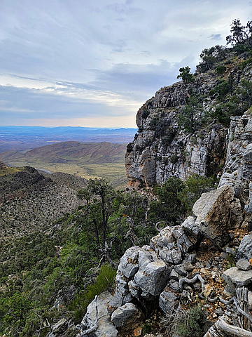
"This a good shoulder-season trip, as one starts in the shade before 8AM. I dont post here much, except to say what not to do! The way I took up "The Fortress" (named by BSA long ago, here called "Cottonwood Overlook"), Meditation Point, North Potosi (here called "Buddha's Rest") started with some totally unnecessary breaking through a cliff band. I explored some shelters (shallow caves) that I had seen for years. It rained about half the day, just light sprinkles, but the weather put a slight damper on my explorations." — hwstock • Sep 10, 2023
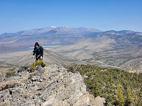
"I went with Michelle as a shoulder-season climb. Though I had been coming to the peak since 2018, and had partly come around the trails, I never had a complete trail approach till this time, l when I saw Paula R's report. Before I had hit the trails almost as a mistake, and had dropped down gullies from above. I tried 10x to enter this page years back, and Peakery kept bombing on me. I still prefer the eastern routes, but they involve more elevation gain and some gymnastics since 2020." — hwstock • Apr 6, 2022
"The southern route shown here is the only LEGAL access I know to North Potosi ("Buddha's Rest"). Meditation Point is on private land. Much has changed since I went in 2018; there a fence along rte 160, designed to keep people from dumping. There are legal points to drop through that fence; the catch is that you have to drop and climb out over a 6' concrete wall." — hwstock • Sep 28, 2021

"3.31.2021~4 Peaks, 6.5 miles, 3,000’ gain in 4:13hrs. Cottonwood Overlook, Meditation Point, Namaste Hill & North Potosi Mtn (aka Buddha’s Rest). I started from Potosi Canyon Rd/Old Spanish trail off SteRt 160. I took the Highline Trail to Cottonwood OvLk & the main ridge. From there it was rough going with agave, cactus landlines and sharp thick brush and pines. The wind was frigid cold. Views were grand. I loved this trek. I’ve driven by this area countless times and never knew these enchanting trails, on the North end of Potosi Mtn., existed. Great day." — paula.raimondi • Mar 31, 2021
Photos
Awards
About peakery awards
Log climbs on peakery to earn awards:
Peak Badges: Earn a special badge for each unique peak you summit. See all of your badges on your Badges page.

First Ascent Award: Only 1 available per peak. Goes to the first peakery member to log a successful summit of a peak. Snag this award and the peak will forever bear your name.

King of the Mountain Award: Only 1 available per peak. Summit a peak more times than any other member. Beware: this award can be lost!

Summit Steward: Summit a peak at least 5 times to become one of its Summit Stewards. As Steward of a peak, you’re encouraged to keep that peak’s info up-to-date on peakery and spread goodwill on your future climbs up the peak.