
Region
Highlights
Routes
2 climbs • 2.5 mi • 1,248 ft gain • 2 hr 47 min
1 climb • 4.0 mi • 3,081 ft gain • 7 hr 59 min
1 climb • 2.0 mi • 1,731 ft gain • 3 hr 41 min
Latest climbs
"It was time to see if the NE ridge was going to be easier than going up the scree bowl on the north side of the mountain. From the distance it looked like a solid rock, continuous ridge. It was a fun route, but up and down on crumbly rock and very steep, loose scree chutes looking for a way to continue on the ridge. The ridge was not a continuous ridge and the last part was a very narrow, sloped, very exposed knife edge that we elected to not try...which meant, again, another climb down to find a better climb up. All in all, not the route that I would recommend. As far as time...all the routes that I have tried have taken about the same time...approximately 2.5 hours. " — Heartattackbruce • Aug 13, 2024

"This is an advanced scramblers route that a lot of people may not enjoy. The route finding, terrain and conditions only allowed us to "average" half a mile an hour. There is a lot of very steep scree that needs to be climbed and traversed throughout the route to the Forehead. From the Forehead and down is pretty straight forward and, if I had to pick a word, "normal" for the Charleston area. The magnificent Bristlecone trees that you get to see on this route make worth the effort. " — Heartattackbruce • Jul 11, 2024

"After sitting around lazy all day watching the Dodgers game & eating spaghetti, I decided that I needed a little exercise. I called up a friend to see if he was up for a last minute hike. Luckily, he was! We parked at the big gravel pull-out at about 6:25pm & headed up the standard route (the gully). We branched off & headed up a steep slope & finally gained the ridge about 500 feet from the cache. From there, we climbed a class 4 wall & made our way along the ridge to the peak. We got there as the sun was setting, so we didn't stay long. We came down a bit faster, taking the gully the whole way. We got back to the car in the dark, but there was enough ambient light that we didn't have to use our headlamps. " — Kevin • May 26, 2013
"Went directly up from the Lee Canyon Road, past a pinnacle with a little arch & on up the west slope. This was brutally steep, but had really different views of Mummy's Head area. There was a large cave with dripping water too." — StudioHoodoo • Aug 8, 2009
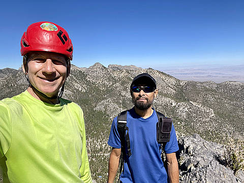
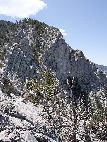
Photos
Awards
About peakery awards
Log climbs on peakery to earn awards:
Peak Badges: Earn a special badge for each unique peak you summit. See all of your badges on your Badges page.

First Ascent Award: Only 1 available per peak. Goes to the first peakery member to log a successful summit of a peak. Snag this award and the peak will forever bear your name.

King of the Mountain Award: Only 1 available per peak. Summit a peak more times than any other member. Beware: this award can be lost!

Summit Steward: Summit a peak at least 5 times to become one of its Summit Stewards. As Steward of a peak, you’re encouraged to keep that peak’s info up-to-date on peakery and spread goodwill on your future climbs up the peak.