
Region
Highlights
Routes
3 climbs • 3.0 mi • 576 ft gain • 1 hr 38 min
1 climb • 6.7 mi • 511 ft gain • 3 hr 46 min
1 climb • 7.9 mi • 1,725 ft gain • 3 hr 33 min
1 climb • 8.0 mi • 1,223 ft gain • 3 hr 55 min
1 climb • 4.9 mi • 1,263 ft gain • 2 hr 44 min
Latest climbs
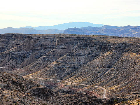
"This area has changed A LOT since 2020. This gpx is without trespass, requires no fence-hopping. The Initial parking is at OakLeaf Park, the routes in roads for a bit, then goes up a well-cairned route to 3516 (Mesa HighPoint), then heads N and NW till is descends an easy but slippery and rocky slop to a slot canyon, then climbs up a steep but easy slope to 3405 (Mesa Mesa). I came down sans trail, but you can get a few more miles by keeping WNW on the ridge." — hwstock • Dec 8, 2024
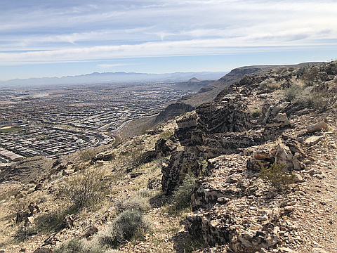
"This is my new favorite local hike with stunning views of urban sprawl contrasted with open desert. I wasn’t familiar with his area so I parked in a dirt parking lot off Town Center next the flood channel and hiked up to the flood basin. From there I found the ATV tracks that start up the steep first hill. Once you finish the first steep hill it’s smooth sailing. On the return I followed the Permagrin bike trail.
Next time I’ll take the more gradual trail up the canyon and on the return use the wash next to Permagrin (and avoid the steep bike bumps). I wouldn’t recommend this in the summer unless you are prepared for extreme heat." — hughroper • Feb 15, 2020
Photos
Awards
About peakery awards
Log climbs on peakery to earn awards:
Peak Badges: Earn a special badge for each unique peak you summit. See all of your badges on your Badges page.

First Ascent Award: Only 1 available per peak. Goes to the first peakery member to log a successful summit of a peak. Snag this award and the peak will forever bear your name.

King of the Mountain Award: Only 1 available per peak. Summit a peak more times than any other member. Beware: this award can be lost!

Summit Steward: Summit a peak at least 5 times to become one of its Summit Stewards. As Steward of a peak, you’re encouraged to keep that peak’s info up-to-date on peakery and spread goodwill on your future climbs up the peak.