
Region
Highlights
Routes
1 climb • 4.9 mi • 1,495 ft gain • 4 hr 0 min
1 climb • 4.9 mi • 1,467 ft gain • 4 hr 0 min
Latest climbs
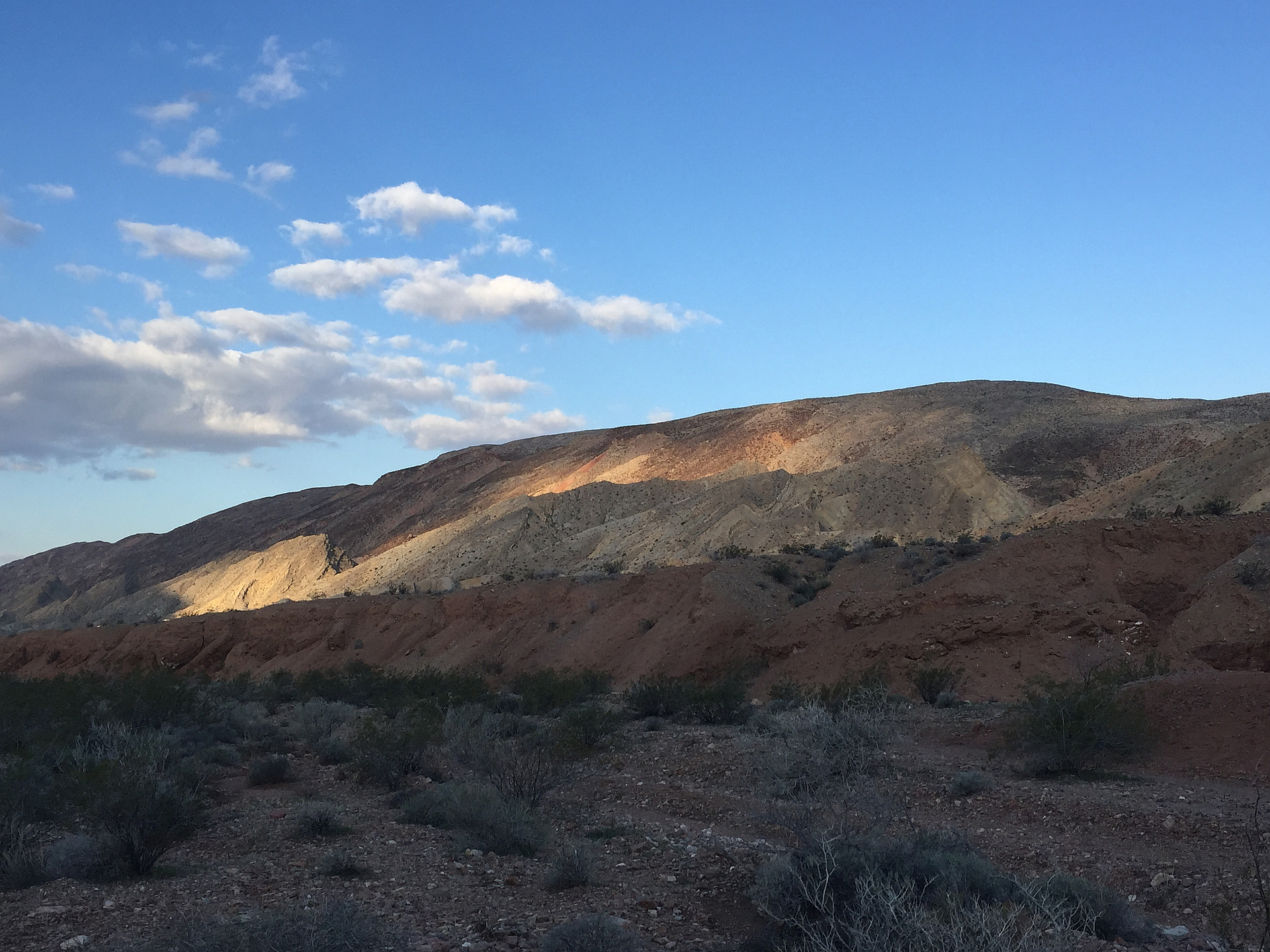
"Parked at the area where there was once an emergency phone. Hiked up the pretty canyon across the road & on up the ridge to Jean's Peak & then to Mount Greybeard. Descended Greybeard & hiked all the way over to Pinto Ridge highpoint. Descended back to the lower part of ridge, then down into the pretty canyon that runs between Pinto Ridge & a lower ridge.I looped back through that canyon all the way back to my Jeep. That canyon is rough, but so pretty. There is nothing beyond class 2, but it is rough & tiring. I had to climb out several times to get around dead ends/obstacles. I love this loop & have been back there several times. I'll add my gps info soon. " — StudioHoodoo • Dec 30, 2023

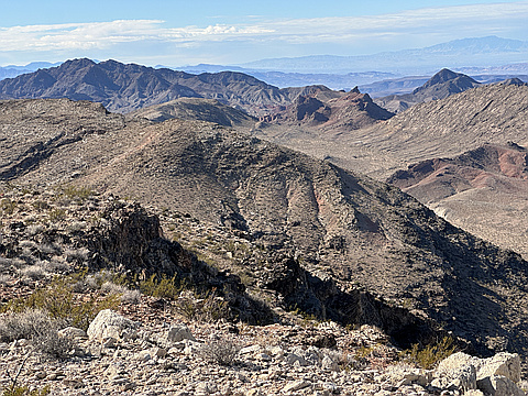
"What a beautiful day! We hiked up to Pinto Ridge via the North Slope, descended the NW Gully back to the valley, then ascended the NE slope of Razorback Ridge. We traversed the spine of the ridge to the highpoint, before descending down the north side and taking the wash back to the road. The ridgeline for Razorback is much more rugged than it looks." — Kevin • Dec 31, 2016
Photos
Awards
About peakery awards
Log climbs on peakery to earn awards:
Peak Badges: Earn a special badge for each unique peak you summit. See all of your badges on your Badges page.

First Ascent Award: Only 1 available per peak. Goes to the first peakery member to log a successful summit of a peak. Snag this award and the peak will forever bear your name.

King of the Mountain Award: Only 1 available per peak. Summit a peak more times than any other member. Beware: this award can be lost!

Summit Steward: Summit a peak at least 5 times to become one of its Summit Stewards. As Steward of a peak, you’re encouraged to keep that peak’s info up-to-date on peakery and spread goodwill on your future climbs up the peak.