
Region
Most climbed route
Highlights
Latest climbs
"Hiked under the Iron Horse Trail up a steep path to Zig Zag landing, then took a slight left onto a logging road. The next 3/4 mi was the worst bout of downed trees we've ever seen - very slow going. Lots of snow still at the top that we weren't quite prepared for either - feet got soaked! Pretty cool view but the trail was terrible!" — North-Bend-Erica • Apr 16, 2016
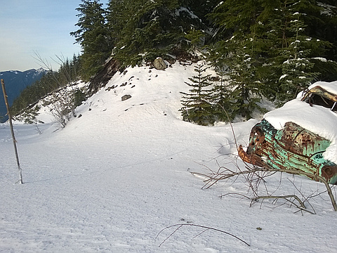
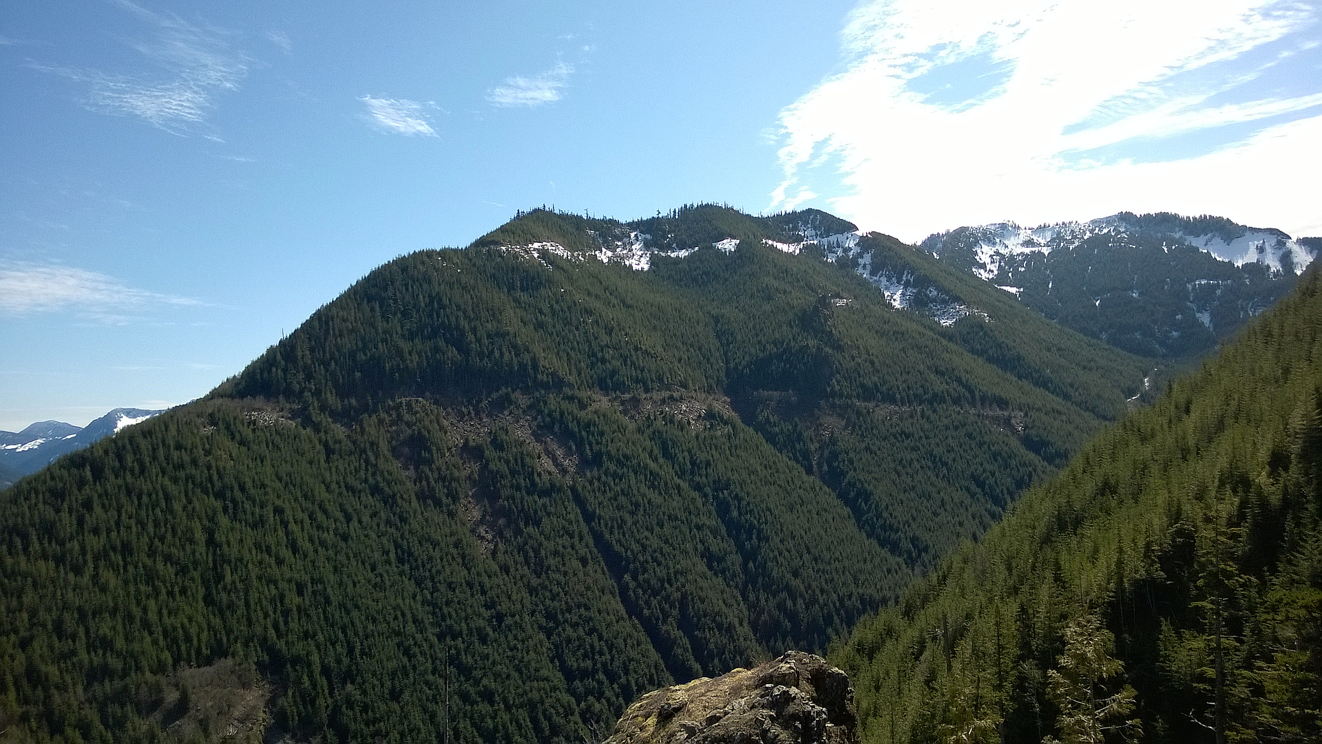
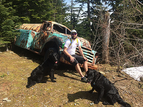
"Hiked up zig-zag trail from Olallie State Park near I-90 exit 38. All the blown down trees have been cleaned up around 2500 ft, making the path easy to follow now. At 2700 ft there is a distinctive little landing and 5 minutes further up is the intersection of three FS roads marking the end of the zig-zag trail. Take the middle road bearing SE. There are a lot of downed trees to walk around for 0.4 miles. After two hairpin turns, you are heading south with a steep drop to the west and views of Change Peak and Mt Washington. The road curves around to the west of the peak, and on the south side you find the old truck! To attain the peak, head due north along the ridge through the trees for a few hundred yards. I thought I could continue N along the ridge, but after a while it ends at another minor peak with 50 foot drops in all directions, except the way you came. Backtracking south a ways, I then dropped down a steep slope in deep snow with an excellent texture back to the road. From the truck going further south
along the ridge, it may be possible to get to Chester Peak (4701 ft elevation), but the road effectively ends, and in snow it looks very difficult.
2900 ft ga..." — markgarrett • Feb 23, 2016
Photos
Awards
About peakery awards
Log climbs on peakery to earn awards:
Peak Badges: Earn a special badge for each unique peak you summit. See all of your badges on your Badges page.

First Ascent Award: Only 1 available per peak. Goes to the first peakery member to log a successful summit of a peak. Snag this award and the peak will forever bear your name.

King of the Mountain Award: Only 1 available per peak. Summit a peak more times than any other member. Beware: this award can be lost!

Summit Steward: Summit a peak at least 5 times to become one of its Summit Stewards. As Steward of a peak, you’re encouraged to keep that peak’s info up-to-date on peakery and spread goodwill on your future climbs up the peak.