

Region
Most climbed route
Highlights
Latest climbs
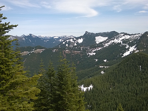
"Continuing solo from my conquest of Change Peak with Joel & Derek, it was a very easy 2-3 mile stroll down a wide FS road to Greenway Mountain. I diverted left onto a ridge just because the Green Trails map shows a 4304 ft spot elevation there. I moved onto the ridge approaching Greenway in a similar way, but it was not necessary, since the road ends up pretty close to the peak anyway. I descended this way, east from the peak down to the road. From here I went back west 2.5 miles and descended by the Mt Washington trail. About a half mile west of Greenway, there is a FS road spur going north. This looks like a good point to ascend the peak on your immediate left as you face the spectacular view north. I've seen a hike report calling this peak, "Mid Mother Mountain".
Total stats for the day, including getting to Change Peak were:
4100 ft total gain, 17 miles, 11 hrs. Long day!" — markgarrett • Apr 16, 2016
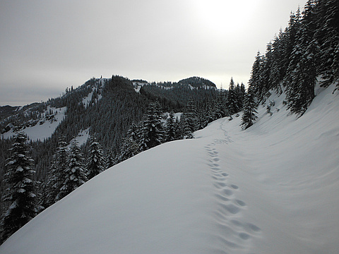
"Today was another late start due to work getting canceled at the last minute. I have been thinking about visiting Greenway Mountain near Mt Washington and Change Peak for months, waiting for snow to make the off-trail sections less painful for the dogs and humans involved. Several other factors made this an ideal day for the trip, including a relatively low avalanche danger forecast and a short drive to the trailhead (45 minutes from Seattle) to compensate for the late start.
With and roads covering most of the routes and a complete lack of necessary travel on South facing slopes, this would even make a good destination during moderate avy danger, though I would not recommend approaching from the Hall Point trail during such conditions. I also would not take a dog above Hall Point under any conditions as it would require significant added road-walking mileage, elevation loss, and/or bushwhacking in order to avoid loose, rough 30-degree-plus terrain with some exposure. The Great Wall Trail is a much more dog friendly route and adds less than 2 miles to the trip.
From exit 38 I parked at the gated road east of Hall Creek, crossed under an old railroad bridge and followed the ..." — Jeb • Jan 24, 2013
Awards
About peakery awards
Log climbs on peakery to earn awards:
Peak Badges: Earn a special badge for each unique peak you summit. See all of your badges on your Badges page.

First Ascent Award: Only 1 available per peak. Goes to the first peakery member to log a successful summit of a peak. Snag this award and the peak will forever bear your name.

King of the Mountain Award: Only 1 available per peak. Summit a peak more times than any other member. Beware: this award can be lost!

Summit Steward: Summit a peak at least 5 times to become one of its Summit Stewards. As Steward of a peak, you’re encouraged to keep that peak’s info up-to-date on peakery and spread goodwill on your future climbs up the peak.