Region
Most climbed route
Highlights
Routes
/-121.68350846443172,47.427615345845766,11,0.00,0.00/320x240@2x?access_token=pk.eyJ1IjoicGVha2VyeSIsImEiOiJjampra3Z0bnAxeTVnM3FteHlybHY3b2p1In0.7a5dEa5-995VUv8ceHHNmw)
1 summit • 10.4 mi • 2,920 ft gain • 4 hr 27 min
1 summit • 11.5 mi • 3,474 ft gain • 3 hr 25 min
Latest summits

"Climbed Change Peak after summiting Mount Washington - really nice snowshoe, and nice way to make a short 8 mile round-tripper (Mount Washington) into a pretty big 13 mile day with another 1,000 feet of elevation gain." — BryHong8 • Mar 19, 2017

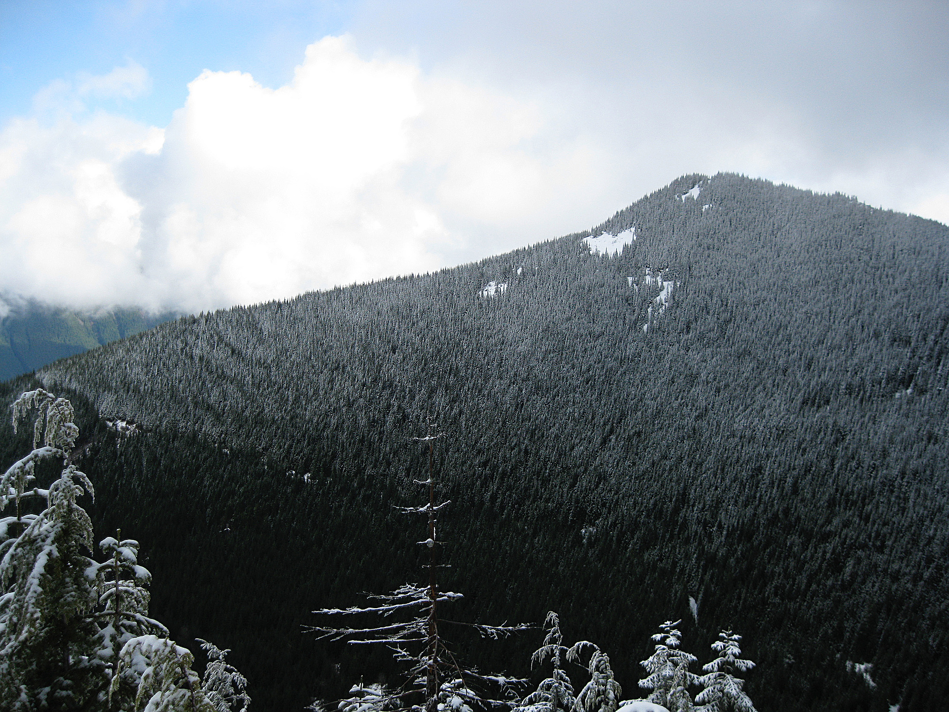
"I hiked up to Change Peak with Joel Grant and his son-in-law Derek. Starting at the Olallie Park trailhead, we climbed up the zig-zag trail briefly to the Iron Horse trail, then west a bit to the Change Creek trail. Going up steeply for a mile, we quickly reached Hall Point at 2440 ft. Continuing south, we switched back and forth up the old FS roads to meet the Great Wall trail, and then the final spur up to the peak of Change Peak. My partners headed back down the Great Wall and Mt Washington trails, while I continued up to Greenway Mtn to the southeast.
The one-way trip to Change was 3150 ft gain, 5 miles, 4 hrs." — markgarrett • Apr 16, 2016

"I've been itching to get into the mountains, so I headed east after work. Inspired by Jeb's TR, I headed for Change Peak. I was The day started out with a number of unfortunate circumstances, the most annoying being that I forgot my camera at home. I also lost my Green Trails map during last weeks hike, and as luck would have it, REI was out of them.
I finally got to the Trailhead at 4:40 missing a few essentials, but still determined. Getting started this late meant that this would be a hurried affair, but a hurried hike is better than no hike at all. The trail was in good condition. Someone had cleared some small blowdowns recently. Snow patches started at about 2500 ft. Full snow cover began a bit after the Owl spot at 2800 ft. The trail was well packed down.
The main trail goes to Mt. Washington, so I turned off onto the Great Wall Trail. This was not packed down, but someone there had been enough traffic that it was easy to follow. The afternoon snow was soft so I switched to snow shoes. I had no problem following the road until about 3800 ft. Here I followed some boot tracks which abandoned the road for a direct route to the top. This was not the best choice. The going ..." — MangyMarmot • Apr 13, 2012

"The snowline started just above the first junction, with the sign for "Mt Wa". From where the Great Wall Trail started there was one set of snowshoe tracks over 6 inches to a foot of fresh powder from Thursday flurries. Just before the road/trail made it's final swoop around to the west side of the north ridge I left the tracks and headed up towards the summit, weaving through alder and hemlock, sinking to my knees with most steps. The surface layer of snow was well settled and nice and crunchy, with a solid layer 1-2 feet below the powder.
Upon reaching the summit I was battered with heavy southeastern winds sending powder up and over the ridge where it accumulated in large cornices. Looking south I spotted the snowshoer I had followed up as he/she made their way along the Great Wall road/trail. After retreating a few feet down the northwest face and into a small thicket I ate and contemplated continuing along the ridge to Mt Washington, but hesitantly decided to head down, having responsibilities to tend to back home.
The sun was exposed all day, and by 1:30 on my way down, the crunchy snow had already softened substantially and I was glad I wouldn't be slogging through it..." — Jeb • Apr 7, 2012

"9.5 mile hike. Hit snow at about 3000 ft - mostly crusted over but postholed half the time. Foggy and gloomy for most of the hike until we almost reached the summit, then the sun came out off and on and pushed all the fog down into the valleys. The last .3 mile is a bushwhack through very dense hemlock saplings. Didn't get back to the car until after dark." — mtnhiker • Dec 19, 2011
Photos
Awards
About peakery awards
Log successful summits on peakery to earn awards:
Peak Badges: Earn a special badge for each unique peak you summit. See all of your badges on your Badges page.

First Ascent Award: Only 1 available per peak. Goes to the first peakery member to log a successful summit of a peak. Snag this award and the peak will forever bear your name.

King of the Mountain Award: Only 1 available per peak. Summit a peak more times than any other member. Beware: this award can be lost!

Summit Steward: Summit a peak at least 5 times to become one of its Summit Stewards. As Steward of a peak, you’re encouraged to keep that peak’s info up-to-date on peakery and spread goodwill on your future climbs up the peak.