Region
Most climbed route
Highlights
- Can be closed until March 2022
Routes
/-116.922315254211,34.1222382402753,11,0.00,0.00/320x240@2x?access_token=pk.eyJ1IjoicGVha2VyeSIsImEiOiJjampra3Z0bnAxeTVnM3FteHlybHY3b2p1In0.7a5dEa5-995VUv8ceHHNmw)
2 summits • 16.5 mi • 4,652 ft gain • 7 hr 27 min
1 summit • 16.2 mi • 3,687 ft gain • 9 hr 41 min
1 summit • 10.4 mi • 523 ft gain • 6 hr 24 min
1 summit • 24.1 mi • 6,721 ft gain • 12 hr 18 min
1 summit • 18.4 mi • 4,946 ft gain • 7 hr 56 min
Latest summits

"Cool beautiful weather above the marine layer for this 6-peak loop - lots of flowers, and some remaining snow up top. Alger Creek on the descent was particularly beautiful with running water in multiple spots - made the last 10 miles go by with ease. Note: self-issued permits are now required and can be obtained on SGWA.org" — danishclimber • May 28, 2022

"Early start from camp at Trail Fork Springs. I avoided the snow on the way up by traversing across below Anderson. The ridge between San Bernardino East Peak and the main peak still has some pretty big snow drifts - easy to avoid by dropping slightly south if needed. Super clear day - could see Catalina Island, the Tehachapi mountains, northern SD county." — edg • May 15, 2022

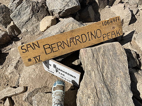
"This hike started at 5 AM. Crossing Mill Creek was great and made my feet cold. Up the trail we saw forests, trees, and the wilderness sign. Then we turned onto the Momyer Creek Trail. Then the trail comes through lush forest and manzanita meadows. Then we hit a cliffside section and met up with the San Bernardino Peak Divide Trail. Then at that section, it was snowy and the snow was 3 feet deep. We summited San Bernardino East Peak. The summit had great views! Then we got on top of a snowbank. Then we summited San Bernardino Peak. It had good views, a register, and a sign." — lc444 • May 8, 2022

"Hot and smoke plumes from the Apple fire dominating the southward views! Water still running in Limber Pines Springs to filter from. Also logged the Virtual geocache GCMO8Y along the way." — Sierrawildflower • Aug 1, 2020
"June 28, 2020. Backpacking 9 peaks day 2. From High Spring Meadow to the 5 eastern peaks and down Momyer. Going down Momyer Trail was horrible: calling it overgrown is an extreme understatement. The trail nearly disappears in some places and you have to hold your arms above your head to squeeze through the shoulder height bushes. Wear long sleeves or you will be scratched to pieces. I will never hike Momyer again. Miserable. " — runningvegan • Jun 28, 2020
"As if doing the 2020 SoCal Six (18) Pack of Peaks twice isn't enough, lets add 7 more peaks to the challenge. The San Bernardino to San Gorgonio (peaks 4 and 5 of round two) Nine Peak Challenge which also incudes San Bernardino East Peak, Anderson Peak, Shields Peak, Alto Diablo Peak, Charlton Peak, Little Charlton Peak, and Jepson Peak.
My friend Tara and I met up late the night before. Staged a vehicle at Vivian Creek and then drove up to Angelus Oaks to begin our journey. We stepped off right around 11pm on the 12th and headed up to our first peak of the day, San Bernardino Peak" — Philip-Yoho • Jun 13, 2020

"May 16, 2020. Angeles Oaks Trail. The snow started at Limber Pine Campground and made the north-facing switchbacks impassable. I brought my snowshoes and they did not help as the snow was too wet and loose and the slopes were too steep for them. I ended up following some hikers who were jumping from snow-free tree spot to tree spot. I joined their group and we hiked cross county (off-trail) to the summit. Micro-spikes and gaiters are a must. Shout-out to that awesome group who let me join them! What a day! My second San Bernardino summit and four of six peaks are now completed this year in the 6-Pack Challenge. " — runningvegan • May 16, 2020
"Great hike today up one of my favorite trails. Took the Momyer Creek Trail up to the San Bernardino Divide Trail. I had read a trail report from the week previous that another group did this route and found themselves post holing for a few hours while they made their way to San Bernardino Peak. Having read this, I of course brought all my gear and snowshoed across the ridge to East San Bernardino and San Bernardino.
Back to the challenge though. Today was my 16th Peak of the 2020 SoCal Six (18) Pack of Peaks Challenge and my 5th peak of the Original Six Peaks." — Philip-Yoho • May 9, 2020
"What a great hike this was. We took the Forsee Creek Trail up to Anderson Peak. Then we followed the San Bernardino Divide Trail a short distance to San Bernardino East Peak and then on to San Bernardino Peak. From San B we took a quick visit of the Washington Monument on our way to Columbine Springs turn off. Once there we head north east down to Johns Meadow and back out to Forsee Creek. A great day of hiking with Tara, her husband Chris and Heather. All totalled we ended with 18.66 miles and 5115 feet in elevation gain." — Philip-Yoho • Oct 12, 2019
"Peak two of six of the SoCal Six Pack Challenge. 17 miles and 4,629 feet of elevation gain. A word of the wise, the dirt road leading to the end of the trailhead needs to be graded. I drive a Ford Focus and was not expecting to need a high clearance vehicle. I parked down the road a ways and hiked up the road to the trailhead. Bring lots of water (I brought four liters and needed it all) and sunscreen. Very exposed and rocky. Some pretty wildflowers still on the trail at lower elevations. There were a few patches of snow, but nothing that required snow gear. " — runningvegan • Jun 23, 2019
Awards
Challenges
About peakery awards
Log successful summits on peakery to earn awards:
Peak Badges: Earn a special badge for each unique peak you summit. See all of your badges on your Badges page.

First Ascent Award: Only 1 available per peak. Goes to the first peakery member to log a successful summit of a peak. Snag this award and the peak will forever bear your name.

King of the Mountain Award: Only 1 available per peak. Summit a peak more times than any other member. Beware: this award can be lost!

Summit Steward: Summit a peak at least 5 times to become one of its Summit Stewards. As Steward of a peak, you’re encouraged to keep that peak’s info up-to-date on peakery and spread goodwill on your future climbs up the peak.