Region
Most climbed route
Highlights
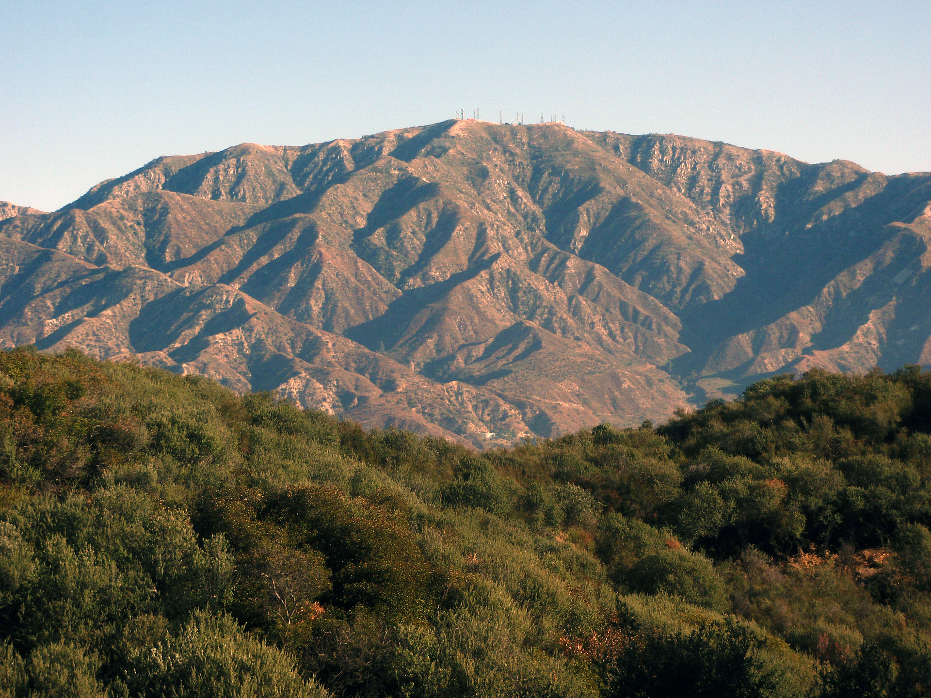
- Mount Lukens is the highest point within the Los Angeles city limits.
Routes
/-118.238039048804,34.2688548240072,11,0.00,0.00/320x240@2x?access_token=pk.eyJ1IjoicGVha2VyeSIsImEiOiJjampra3Z0bnAxeTVnM3FteHlybHY3b2p1In0.7a5dEa5-995VUv8ceHHNmw)
9 summits • 9.9 mi • 3,142 ft gain • 4 hr 53 min • Class 1
6 summits • 11.0 mi • 3,042 ft gain • 5 hr 21 min
1 summit • 12.6 mi • 2,708 ft gain • 5 hr 24 min
1 summit • 9.6 mi • 3,317 ft gain • 4 hr 41 min
1 summit • 7.0 mi • 3,093 ft gain • 2 hr 39 min
Latest summits

"This one started out at 8 AM, as we had to drive far from home to get here. Once at the Stone Canyon Trailhead, we started up. We crossed Big Tujunga Creek and then went further up to the sign for the official start of the Stone Canyon Trail. After the hike up Stone Canyon, we got views of Condor Peak/Point, Big Tujunga canyon, and Josephine/Lawlor Peaks. Then after that the trail climbed up a few switchbacks, into some shade, over a long, hot section, and then turned to a grade of around 60% near the firebreak. The firebreak was bald and had cool views of the summit. Then we visited the "Pigpen" fire water storage area. We turned left on Haines Canyon TKTR and went up to the summit. After that we could seee the summit antenna site and the cistern. The top had a benchmark. We could see Downtown LA, Twin Peaks, Mt Waterman, Pacifico Mtn, and other things" — lc444 • Oct 11, 2022

"This is my fourth summit of Mount Lukens, even though the last visit was 19 years ago. As far as I know, this was my first visit to The Redoubt, though. Each of the four times I did it in a different way. The first way was via Stone Canyon from the north. The second way was via Haines Canyon from the west. The third way was via Angeles Crest Highway and Mt Lukens Truck Trail from the east. The fourth way involved Deukmeijian Wilderness Park from the south. However, instead of descending via Dunsmore Canyon, I took the wide loop into Haines Canyon and concluded the hike with 2.5 miles of tranquil hillside community street walking. My phone died with 1.5 miles to go, so the GPX is incomplete, but it isn't difficult to piece the rest of it together. It was good to reconnect with portions of an old trail from the past. Hiking stats are: 14.1 miles and 3,297 feet of elevation gain." — MikeTeeples • Mar 20, 2021

"Easy morning hike. I average 3.1 mph… Pretty good with the elevation gain and the distance. Overall, nice views. However, they are canceled out a little bit because the valley is so smoggy all the time." — kirbyhays • Feb 25, 2018

"Took the Stone Canyon Trail to Mt. Lukens on Tuesday, April 4, 2017 on what turned out to be a sunny, warm morning. Didn't see another person on the entire trail. I'm not going to add anything new that hasn't been written about this peak on Modern Hiker, Summitpost or hundredpeaks but I will reinforce the same things. Wear pants and a long sleeve shirt! Not only is a lot of the trail overgrown and you are risking scratched up arms and legs, there is also a large tick presence. I chose this hike to get a mid-distance (8 miles) with decent elevation gain (3,200ft) as I am doing Mt. Whitney in September; however with the amount of exposure on this hike, I'm glad I didn't wait until summer to do it." — laphil • Apr 4, 2017

"A fun day hiking with my friend David. This was supose to be a group hike with Hike Beyond the Hills; however, while in route to the trailhead (which for me was about a 1.5 hour drive) our hike leader called and cancelled the hike due to rain. Right after that David calls and asks if I still plan to go. I'm half way there, so yes that a no brainer for me. Of course, David was more than happy to join me. It rain some during the first mile of the hike, but after that we had partly cloudy skies and great weather. So glad we decided not cancel. We followed the Haines Canyon route up and looped around and down the Sister Elsie Trail and back across on the Old Mount Lukens Trail." — Philip-Yoho • Jan 7, 2017

"It's not Half Dome but it's nice single track within easy reach. Started from Wildwood Picnic Area. The trailhead is easy to miss. Head down towards the riverbed.
The trail is a bit overgrown so definitely wear pants." — JustinB • Dec 13, 2015

"Not my first time in the San Gabriels, but my first time during summer. This was a HOT climb up to a very hazy/smoggy view. My car said 93 when I got back to the trailhead at 1:45 pm. The Sierra this is not." — edg • Jun 20, 2015

"In the beginning was fine, at the half way it got very windy and cold, I realized that I was the only one left alone, however after I got to the top another couple made it also. It was not easy but it is not impossible." — VictorYeterian • Jan 12, 2014

"I didn't see a soul until I passed a hiking couple near the summit. (And then didn't see them again!) There's lots of brush, so definitely wear long pants, and I'd recommend long sleeves too. (I couldn't find the summit marker. Where is it?)" — HikerMark • Sep 22, 2013

"Hiked up Haines canyon the way up. After a brief stay on top and talking some pictures we headed back down starting on Haines but cutting down the single trail connecting back to Sister Elsie trail. All in all a great hike minus the cloudy skys blocking our views." — Ryan_Wallace • Feb 26, 2012
Photos
Awards
Challenges
About peakery awards
Log successful summits on peakery to earn awards:
Peak Badges: Earn a special badge for each unique peak you summit. See all of your badges on your Badges page.

First Ascent Award: Only 1 available per peak. Goes to the first peakery member to log a successful summit of a peak. Snag this award and the peak will forever bear your name.

King of the Mountain Award: Only 1 available per peak. Summit a peak more times than any other member. Beware: this award can be lost!

Summit Steward: Summit a peak at least 5 times to become one of its Summit Stewards. As Steward of a peak, you’re encouraged to keep that peak’s info up-to-date on peakery and spread goodwill on your future climbs up the peak.