Region
Highlights
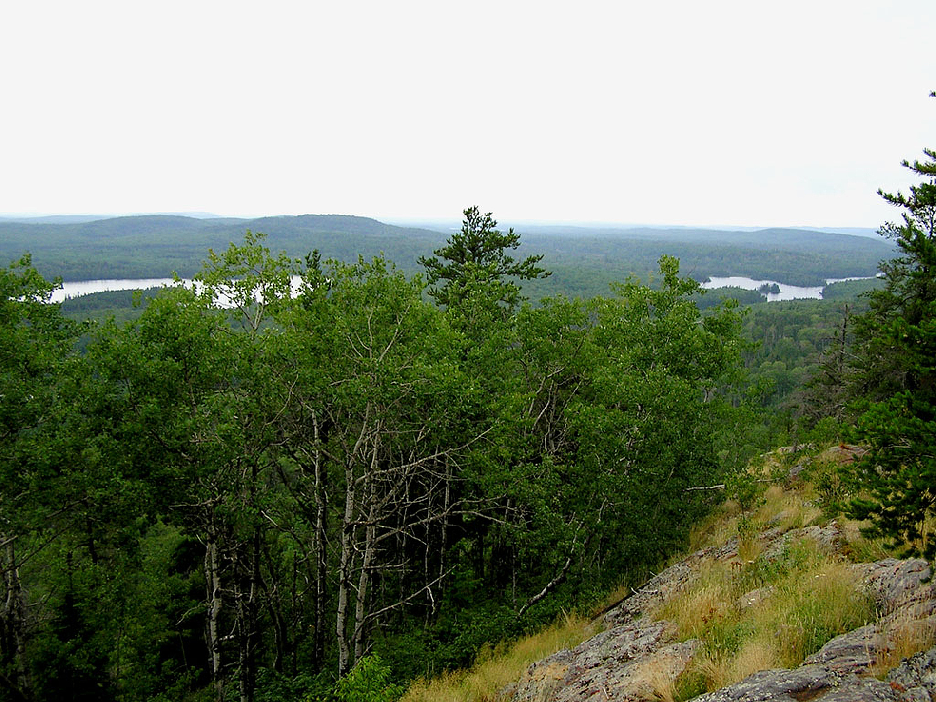
- Eagle Mountain is the highest peak in Minnesota.
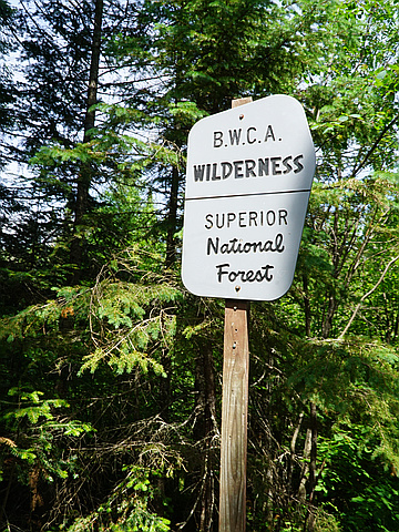
- Located in the Boundary Waters Canoe Area Wilderness and Superior National Forest in the Misquah Hills.
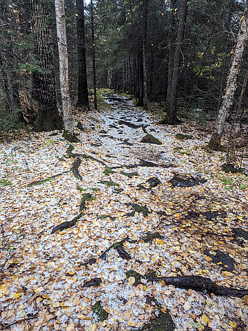
- The hike to the summit is about 3.5 miles with an elevation gain of 550 feet. The trail is rocky and moderately strenuous.
- Whale Lake is located about halfway along the trail and offers two campsites to hikers.
- The peak of the mountain is marked with a plaque.
Routes
/-90.5603422,47.8974238,11,0.00,0.00/320x240@2x?access_token=pk.eyJ1IjoicGVha2VyeSIsImEiOiJjampra3Z0bnAxeTVnM3FteHlybHY3b2p1In0.7a5dEa5-995VUv8ceHHNmw)
8 summits • 6.7 mi • 429 ft gain • 2 hr 31 min
1 summit • 7.1 mi • 451 ft gain • 3 hr 23 min
Latest summits
"Hands down one of the most beautiful areas I've ever been to. However, I had to turn around shortly after starting to climb the mountain as it started to hail very heavily, causing the rocks and dirt to become dangerously slippery.
Be warned, if it rains, the trail turns into a small creek, and you will have very wet feet!" — Sidpatchy • Oct 5, 2023

"I planned an extra day to get to this one on my way to visit scattered family members. Wish I had more time to explore this area along the northern shore of Lake Superior. I didn't find the uphill section too difficult. It took me a while to figure out that the real summit was into the woods, after searching in vain for a marker near the viewpoint at the top. It was a long tedious hike back, but another state HP done!" — SteveM_StickMan • Jul 11, 2023
"This would happen to be the buggiest hike I've been on to date. I'm glad I sprayed bug spray on before the hike; even so, I ended up with several nasty mosquito bites. Other than the literal cloud of mosquitoes following us around, the only issue was humidity. A gorgeous hike and an easy trail to follow. State high point #20 for me! :) " — psychikingjes • Jul 4, 2019

"State highpoint #43 for Amber and I. Flew into Chicago at 11pm, drove to Timms Hill, then drove to Eagle Mountain. The hike was so beautiful, but the humidity and mosquitos made it unbearable. I HATE MOSQUITOS!!! After this hike, we tried to make it to Mount Arvon the same day, but I was exhausted - no sleep, over 1200 miles of driving and 7 miles of hiking = tired Kevin." — Kevin • Jul 4, 2019

"Never been so harassed by mosquitoes on a hike. Sort of a high plateau (never also been so unclear which part was highest). I know it's the midwest - but the high point of the midwest was sort of a letdown. " — fish • Aug 8, 2015
"Fairly easy walk, about 7 miles round trip with some nice views at the top. Got caught in an intermittent rainstorm that left us drenched by the time we made it back to the car, but the hike was still worth it." — nairon • Jun 23, 2015

"I've driven by the Minnesota northshore for years (living in Thunder Bay) and now that I know it was a high point it was time to bag it while picking up some goods from the border. My 11 yr old daughter joined and boy she's in shape!" — alexjoseph • Aug 25, 2013

"At midnight on July 1, 1991, 5 climbers, Pete Allard, Jim Grace, Shaun Lacher, David Sandway and myself, Dennis Stewart, took their first step off the summit of Mount Rainier and began a climbing marathon to reach the highest point in each of the 48 contiguous states in one calendar month. During the month of July in 1991, the team hiked over 250 miles, climbed over 14 vertical miles and drove over 14,000 miles. Their total time (summit to summit) was 30 days, 10 hours and 52 minutes. All 5 members of the climbing team reached every summit during the month long expedition. Eagle Mountain was the 37th peak climbed on this record breaking trip, which got the team recognition in Guinness Book of Records." — Stewy • Jul 18, 1991
Photos
Awards
Challenges
About peakery awards
Log successful summits on peakery to earn awards:
Peak Badges: Earn a special badge for each unique peak you summit. See all of your badges on your Badges page.

First Ascent Award: Only 1 available per peak. Goes to the first peakery member to log a successful summit of a peak. Snag this award and the peak will forever bear your name.

King of the Mountain Award: Only 1 available per peak. Summit a peak more times than any other member. Beware: this award can be lost!

Summit Steward: Summit a peak at least 5 times to become one of its Summit Stewards. As Steward of a peak, you’re encouraged to keep that peak’s info up-to-date on peakery and spread goodwill on your future climbs up the peak.