Highest peak
Lyon Mountain
3,820 ft / 1,164 m
Most prominent peak
Lyon Mountain
2,212 ft / 674 m prom
Most climbed peak
Poke-O-Moonshine Mountain
396 climbs
Most difficult peak
Poke-O-Moonshine Mountain
Class 1
Difficulty breakdown
Class 1/2 1 peak
Highlights
Latest climbs
"Flat section fallowed by a climb.
The trail is on private posted property, only hiking is permitted, hunting, fishing, camping and all other use are prohibited.
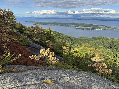
The view is on Lake Champlain. You can see Camel Hump and Burlington (guess it) on the other side of the lake" — pierredenommee • Aug 27, 2025

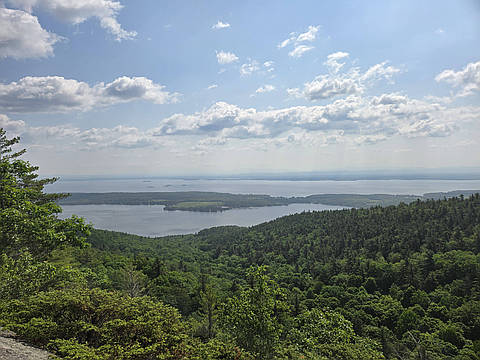
"Hike was about 2.81 miles and started out pretty flat and easy. Then...it started climbing...and climbing...and climbing. Pretty steep, but a good workout and the view of Lake Champlain is excellent." — TJandMS • Aug 26, 2025
"After spending a second night at Meacham Lake, I headed home today, stopping to hike Silver Lake Mountain on the way back. I'm glad I stopped. It was a stunning short hike, with beautiful red pines and open rocks on the way up. Not too steep, but the majority of the trail was interesting. The summit showcased a cool view of Taylor Pond, with Catamount Mt. rising beyond. There were also less deer flies on this trail, something I have newfound appreciation for after Loon Lake and Debar." — elimihuta • Jul 10, 2025
"Hiked this peak with brother Dean today. 1.6 miles to the rocky summit. Nice views of Willsboro Bay and Lake Champlain were to the east and the high peaks to the west. There were quite a number of hikers today for a weekday hike." — garyogden • Jun 11, 2025
"This was our last (of 10) hike required for the ADK Blue Challenge. We had heard that the “new” trail was really well done and even though it was a three-hour drive to get to the trailhead, we decided it was time. And we were not disappointed! The day was perfect with temperature at the start around 55 degrees at the base and about 68 degrees when we finished. The “old” trail is still certainly visible, but the DEC does not want it used. We travelled up the initial section of this trail (which is same as the new trail) and came to a left turn that brings you to the trail register and the first of two wooden bridges. The trail contained numerous switchbacks which resulted in an easy to moderate hike for the majority of the trail. A few mud spots, but the trail was in great condition and was a very nice walk through a beautiful forest. At about 0.3 miles from the summit, the new trail rejoins the old trail for a somewhat steep, rocky ascent for about 0.2 miles. After that, the last 0.1 miles was essentially flat and an easy walk to the summit. The tower is not a tall one (35 footer) and is in need of some repair as one wood step was broken and several landings had the protective wire..." — TJandMS • Jun 28, 2024