Region
Most climbed route
Highlights
Routes
/-112.181094341278,33.7468955398028,11,0.00,0.00/320x240@2x?access_token=pk.eyJ1IjoicGVha2VyeSIsImEiOiJjampra3Z0bnAxeTVnM3FteHlybHY3b2p1In0.7a5dEa5-995VUv8ceHHNmw)
1 summit • 2.8 mi • 662 ft gain • 1 hr 25 min
Latest summits

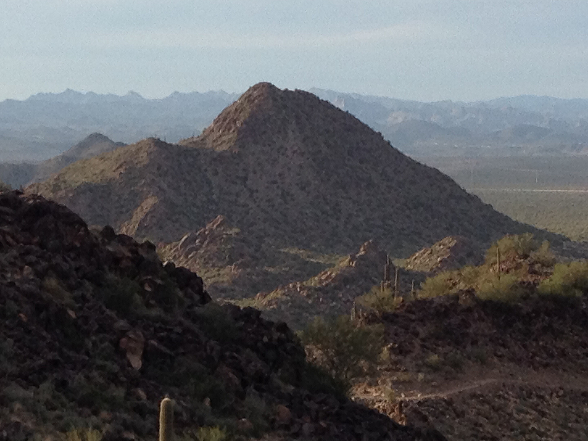
"I'm not gonna lie, I was pretty nervous about doing this peak. Every trip report I read mentioned this as a difficult peak to summit, and with terminology that is still rather new to me as "Class 2" and "Class 3" I was definitely feeling anxious. My last few trips haven't been that enjoyable to say the least and I was starting to feel that I was doing scrambles that have the potential to cost me my life (Mummy Mountain, I'm looking at you). So as I made my drive up to North Phoenix through I-17, I was feeling pretty discouraged and just about to call it quits to hiking off trails overall. Boy am I super thankful I didn't turn back.
Starting off with the parking: if you drive to the I-17, get off on Happy Valley Rd and go West until you hit 51st ave. Take a right and you can go straight ahead to the end of the road next to the canal where you will see signs of "Road Closure". You can park at the end of this road. Do note that you need a State Trust Land Permit to continue from here, which you can easily purchase online.
The walk to the mountain isn't anything too exciting. There's a lot of trails that branch out across the dessert. I bumped into multiple hikers walking aroun..." — easotelo1 • Nov 27, 2020

"This was a nice hike and climb at the end. I approached the peak from the southeast and made it to the saddle south of the summit, then climbed up to the top. On the way back I took the use trail from the saddle to the east, then back to the trails I approached on. It was about 2.4 miles round trip and 1:10." — ZachTeich • Mar 7, 2020
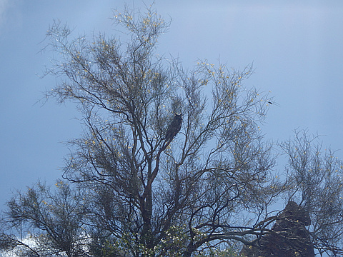
"Probably the toughest summit in Phoenix city limits- trail-less, permitted, plenty of loose class III and route finding challenges, capped off by a Great Horned Owl guarding the summit. Highly recommended.
Complete TR: http://themtsarecalling.com/pyramid/" — Christopher • May 1, 2016
Photos
Awards
Challenges
About peakery awards
Log successful summits on peakery to earn awards:
Peak Badges: Earn a special badge for each unique peak you summit. See all of your badges on your Badges page.

First Ascent Award: Only 1 available per peak. Goes to the first peakery member to log a successful summit of a peak. Snag this award and the peak will forever bear your name.

King of the Mountain Award: Only 1 available per peak. Summit a peak more times than any other member. Beware: this award can be lost!

Summit Steward: Summit a peak at least 5 times to become one of its Summit Stewards. As Steward of a peak, you’re encouraged to keep that peak’s info up-to-date on peakery and spread goodwill on your future climbs up the peak.