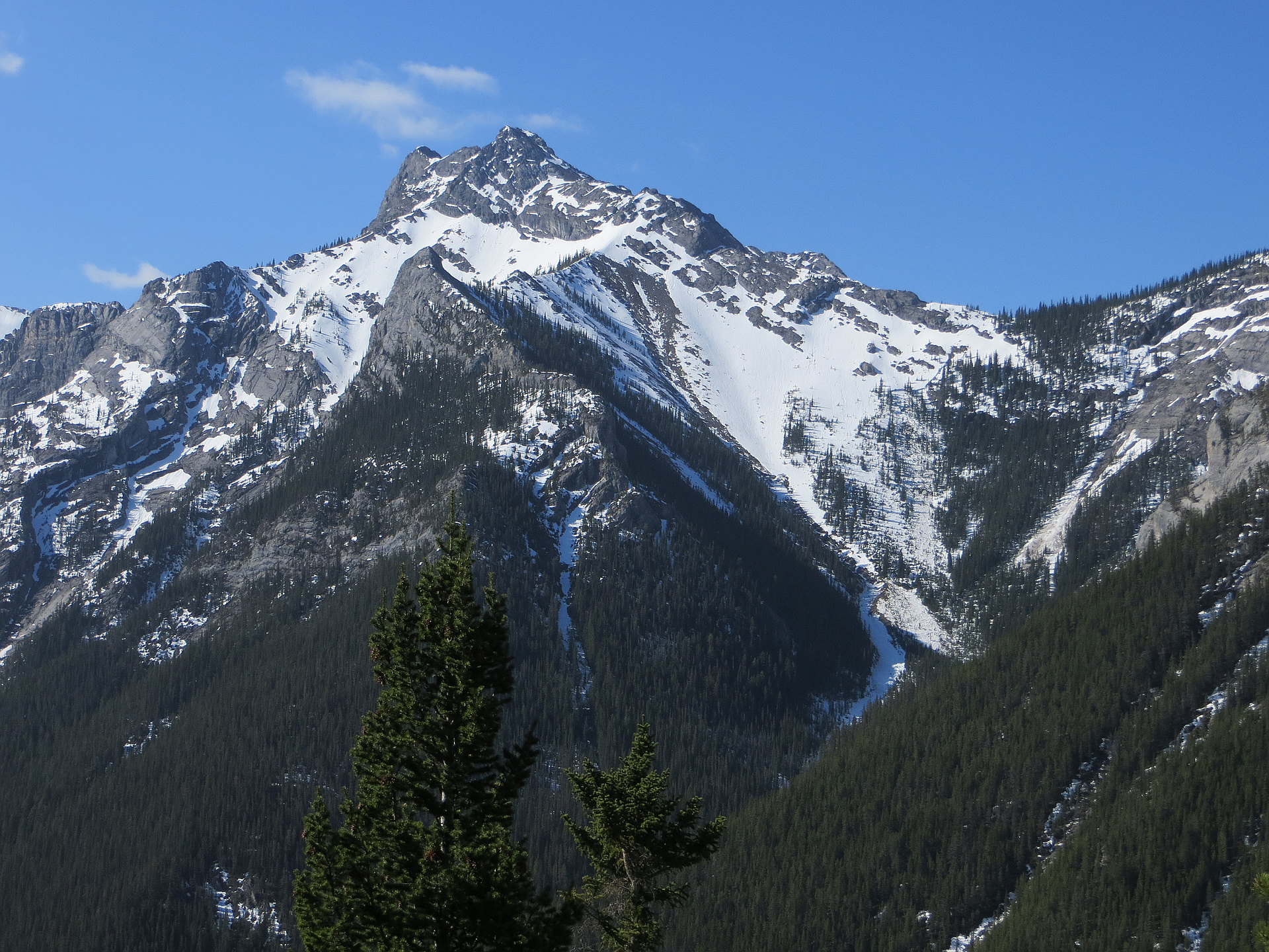
Region
Most climbed route
Highlights
Routes
/-115.087130069733,50.9336617989927,11,0.00,0.00/320x240@2x?access_token=pk.eyJ1IjoicGVha2VyeSIsImEiOiJjampra3Z0bnAxeTVnM3FteHlybHY3b2p1In0.7a5dEa5-995VUv8ceHHNmw)
1 summit • 10.9 km • 997 m gain • 6 hr 14 min
1 summit • 7.7 km • 933 m gain • 5 hr 46 min
1 summit • 8.8 km • 1,160 m gain • 5 hr 30 min
1 summit • 19.4 km • 1,671 m gain • 9 hr 44 min
Latest summits

"We modified the route by going up the SW Ridge of Wasootch. We also added an additional peak (Peakery) by doing an out-and-back from Kananaskis Peak to one of her outliers. To start, we parked at Evan-Thomas Creek Day Use area because this is where we would finish. We then biked mostly down hill for about 5km to the unmarked Trailhead for the SW ridge to Wasootch Peaks.
On decent from Wasootch North, we dipped into the bowl on the east side. Chelsea and I each ended up on separate routes (one high, one low), both worked. This helped avoid additional elevation gain if we were to back track all the way to Wasootch South.
Scrambling along the ridge was a lot of fun. As mentioned in many other trip reports, you have the option to take scree bypasses around many sections. We didn’t take any of the bypasses and found the scrambling to be quite enjoyable (class 2/3 in my opinion). The rock was solid anytime we felt real exposure. So my recommendation would be to favour the ridge when presented with an option. If you don’t like exposure, or your trying to minimize trip duration, take the bypasses.
It felt like 75% of the traverse was straightforward ridge walking with eas..." — ivo • Jul 29, 2023

"Solo go up the big traverse, mostly easy to moderate scrambling depending on the line you take on the ridge, very similar in difficulty and length to the opal traverse. Coming down from volcano peak to the road is an absolute pain, it took me 4 hours to get to that point and a further 2 hours to do 1 km of the most brutal bushwhacking ever, just a spiderweb of burnt fallen trees at about waist height on quite steep terrain. Follow the gps line and you should be able to get to the logging road to get out of there… Good Luck " — corbinruthven • Sep 17, 2022
"Hiked up the descent route. When we reached the scree slope we took a hard right and made our way up a slope till it crested. Then up a nice ridge to do some scrambling to gain the main summit ridge. From here we had a nice view of the route to the West Peak before we headed up to the summit.. We followed the ridge past the summit for a little extra it was nice. A hot day with some light winds that were picking up when we started down." — Randy • Jun 22, 2021
"Started out super early in the am at the Wasootch-Kananaskis col. Truly an amazing sunrise from there. Have to say Kananaskis peak is one of the more entertaining scrambles I've done. Lots of difficult spots that I really enjoyed. Also found a cave along the way. We were actually planning to do the grand traverse from here all the way to Volcano peak but decided to bail shortly after leaving Kananaskis peak. Bushwhacked back to the road then walked back to our vehicle. " — Slogenstein • Aug 22, 2020
"Conditions were suitable. We did the west approach route. Enjoyable mix of light bushwhacking, hiking, rock scrambling and a scree-run. Loose suitcase-size boulders in places. Few snow patches except for a massive compact avalanche deposit in a valley northwest of the peak. Narrow "knife edged" ridge to cross near the summit. Crossed it to reach the summit and again back down. Ran down scree and then onto the avalanche snowfield. Deer tracks on the avalanche snowfield. Five in our group." — geoffc • Jun 12, 2020

"CSMC trip: 6-peak traverse, from Wasootch to Old Baldy to McDougall.
See comments in McDougall for the full report.
Kananaskis peak: Somewhere before the peak got a cloud with zero visibility for some time but it cleared up pretty quickly. I guess we bypassed the crux as it was described in all reports. Scrambling at the moderate level, not more.
" — alexp • Jun 14, 2015
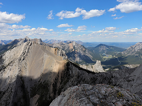
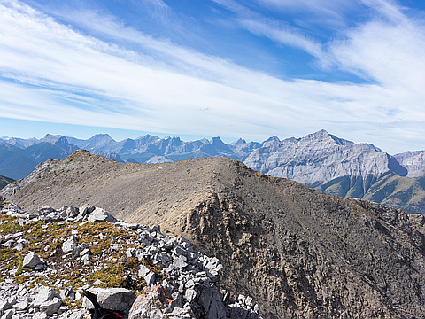
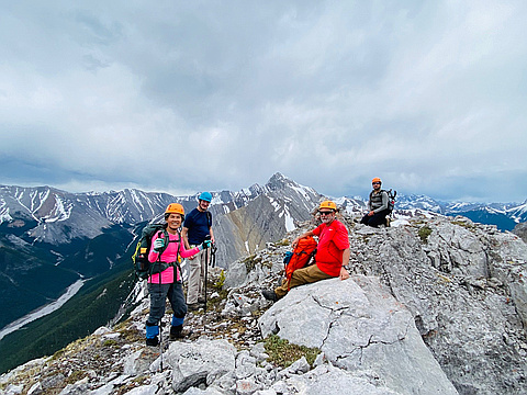
Photos
Awards
Challenges
About peakery awards
Log successful summits on peakery to earn awards:
Peak Badges: Earn a special badge for each unique peak you summit. See all of your badges on your Badges page.

First Ascent Award: Only 1 available per peak. Goes to the first peakery member to log a successful summit of a peak. Snag this award and the peak will forever bear your name.

King of the Mountain Award: Only 1 available per peak. Summit a peak more times than any other member. Beware: this award can be lost!

Summit Steward: Summit a peak at least 5 times to become one of its Summit Stewards. As Steward of a peak, you’re encouraged to keep that peak’s info up-to-date on peakery and spread goodwill on your future climbs up the peak.