
Region
Highlights
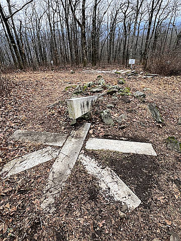
- Southern terminus of the Appalachian Trail 1930-1958
Routes
3 climbs • 0.7 mi • 32 ft gain • 18 min
Latest climbs
"Before Terry and I summited Mount Oglethorpe, we hiked the Appalachian Trail (AT) Approach Trail from the southern terminus to the pond at mile 0.3, then he climbed to the bridge across the face of Amicalola Falls at mile 0.8 while I went back to the car to pick him up at the West Ridge Falls Access Trail. At Mount Oglethorpe we parked by the AT original southern terminus and walked around to the viewing platforms and up to the peak. At the end we posed for fun photos at the “Greatest Little Privy in the North Georgia Mountains.”" — davidensley • Jan 3, 2026

"My first time I turned back at the RF hazard sign and decided to return with someone in case the RF messed with my heart stents. Today Gina and I parked at the privy, used it, then hiked to the top of Mount Oglethorpe. Having no trouble with RF, I hiked around the outside of the fence and found the high point where the evergreens grow close to the fence. I went back around looking for where Peakery had the high point and found it below the stone building. I have corrected that since." — davidensley • Jan 9, 2023

"Drove to Eagles Rest Park but did not approach peak due to radio frequency hazard sign. Sign in park says Mount Oglethorpe used to be the southern terminus of the Appalachian Trail. " — davidensley • Sep 25, 2021
Photos
Awards
About peakery awards
Log climbs on peakery to earn awards:
Peak Badges: Earn a special badge for each unique peak you summit. See all of your badges on your Badges page.

First Ascent Award: Only 1 available per peak. Goes to the first peakery member to log a successful summit of a peak. Snag this award and the peak will forever bear your name.

King of the Mountain Award: Only 1 available per peak. Summit a peak more times than any other member. Beware: this award can be lost!

Summit Steward: Summit a peak at least 5 times to become one of its Summit Stewards. As Steward of a peak, you’re encouraged to keep that peak’s info up-to-date on peakery and spread goodwill on your future climbs up the peak.