Region
Highlights
Routes
/145.818329403876,-17.3993064353564,11,0.00,0.00/320x240@2x?access_token=pk.eyJ1IjoicGVha2VyeSIsImEiOiJjampra3Z0bnAxeTVnM3FteHlybHY3b2p1In0.7a5dEa5-995VUv8ceHHNmw)
3 summits • 15.5 km • 1,483 m gain • 10 hr 27 min
Latest summits

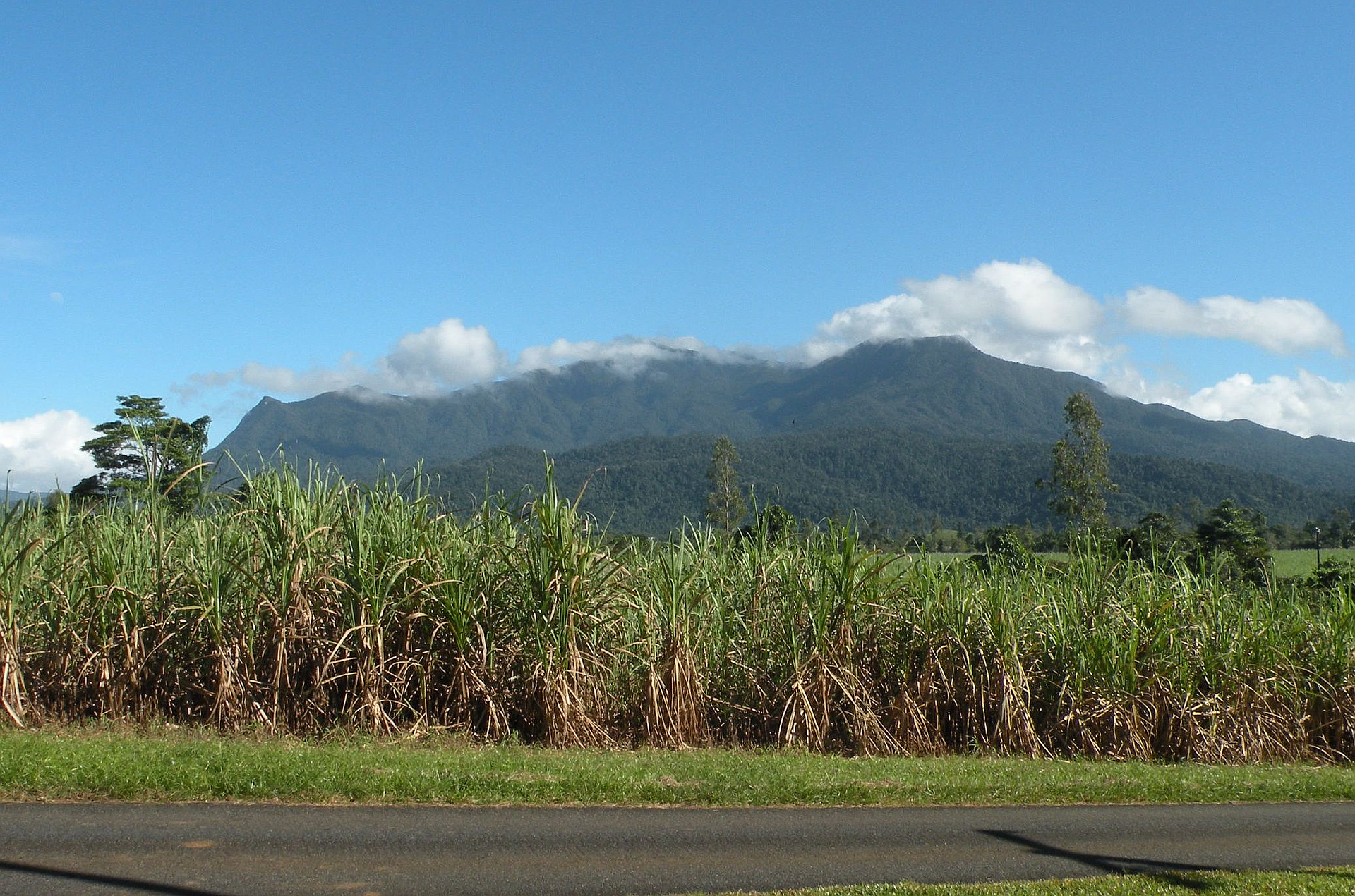
"15km return hike, took all of 11 hours with lunch and a brief stop at the summit. Climb was pretty intense at some points and summit was, as usual, covered in clouds with only occasional visibility breaks. Best view was from the helipad 500 from the summit. Creek with seemingly drinkable water reaches up to 3.5km from the parking lot, only drank 3L comfortably the whole day. Epic summit scramble, awesome experience, would be stunning on a clear day. " — MacRogers2087 • Sep 25, 2021

"This was our 3rd State8 peak. It was the hardest climb I'd done to date!
Leeches were everywhere – we lathered ourselves in 80% DEET, and 1 team member wore stockings on her arms and legs which was an effective barrier against leeches. Luckily we didn't encounter any ticks, but they are out there too. It is possible to do this hike in 1 long day, but it is recommended by QLD Parks and Wildlife you camp overnight, which is what we did. We camped at the eastern Summit, which is 500m from the summit. It took 2 hours from carpark to the First Camp Site with relatively easy terrain. There are several creek crossings. From the First Camp Site, the track just goes up and up and is unrelenting! Some sections are so steep we had to grab tree roots to pull ourselves up. Every km there is an indicator along the trail, which is very well marked. The Second Camp Site, at the Eastern Summit, has a small emergency hut, helicopter landing pad and small grassy section to erect tents (our 2x 2person tents just fit!) The Emergency hut was occupied when we arrived with 3 people. From here, it is only 500m to the summit, but it is a very difficult route. It took us 1 hour to the summit, as we were bou..." — tarawood • Apr 12, 2019
"Dry 7 hours walking on Western track to reach the campsite near the peak. Good views from the big rock outcrop on the way. Rain and strong gusty winds overnight. Plenty of water in the creek beside the campsite. Went to main peak soon after dawn and did not get a view due to cloud. Had entered cloud when ascending the open tussocky slopes below the main peak. On the way back to the Western trail head found that the rain had only been on the top of the mountain. Dry and dusty below about 600 metres. No sightings of golden bowerbirds or their bowers. Fresh Cassowary scats seen at the western trail head. Had not seen cassowary scats there before. Suspect the cassowaries have been forced to move inland/upland to this area for food following extensive vegetation loss along the coast caused by cyclones" — davidlahey • Oct 3, 2014
Awards
Challenges
About peakery awards
Log successful summits on peakery to earn awards:
Peak Badges: Earn a special badge for each unique peak you summit. See all of your badges on your Badges page.

First Ascent Award: Only 1 available per peak. Goes to the first peakery member to log a successful summit of a peak. Snag this award and the peak will forever bear your name.

King of the Mountain Award: Only 1 available per peak. Summit a peak more times than any other member. Beware: this award can be lost!

Summit Steward: Summit a peak at least 5 times to become one of its Summit Stewards. As Steward of a peak, you’re encouraged to keep that peak’s info up-to-date on peakery and spread goodwill on your future climbs up the peak.