
Region
Most climbed route
Highlights
Latest climbs
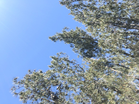
"Third time is a charm. Brush in Upper Lopez Canyon has grown back substantially since my last trip thanks to a big winter. We started at 6:30am, promptly got lost due to a huge fallen tree covering the trail, then arrived at the second switchback along the burrito creek trail at 11:45. From here we left the road and began our bushwhacking straight up to the ridgeline. The brush wasn’t too bad but poison oak was sprinkled everywhere. We reached the ridge quicker than expected and followed the overgrown fire break to a “wall of death”. We patiently trimmed, zigzagged and pushed our way through a dense thicket. We emerged on the other side and found our way to the summit at 2:08pm. There were no views and the high point wasn’t obvious. We had a hunch that the high point was actually a bit further to the south of the spot point on the topo. We left a makeshift register and followed our path back. It only took us 4hr45min to return to the car. If you have interest, I recommend doing it as soon as possible before the brush grows back. I also recommend following my GPS and signs of recent clippings." — seancasserly • May 11, 2019
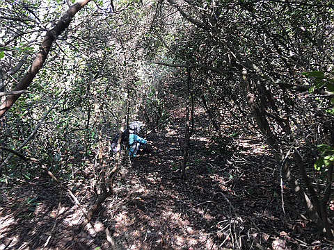
"This was my second attempt.
Attempt 1- The trail begins at the same location as the Big Falls Trailhead at the end of Upper Lopez Canyon Road. 4WD is recommended to reach this trailhead. The first two miles follows a dirt road, which acts as an easement through private ranches. While the road is closed to vehicles, it is open to the general public. The road is in good condition and is maintained by a CAT for the first two miles. Afterwards, the road becomes a trail, which slowly deteriorates over time. Fortunately, I was armed with my machete and recovered most, if not all of the trail. In some places, the trail seems to completely vanish; additional brush clearing and paying close attention at creek crossings is necessary. 4.5 miles in, we arrived at the Sulfur Pots Campground, where there is a flat spot for a tent, a fire pit, pit toilet and a picnic table. It seems this site hasn't been used in years. After one more mile, we reached an intersection with the Burrito Creek Trail running perpendicular to the Lopez Canyon Trail, where there is a rusty old sign simply reading "Trail". What once seemed to be a well establish road has since been lost to mankind. I followed the road ..." — seancasserly • Mar 31, 2018
Photos
Awards
About peakery awards
Log climbs on peakery to earn awards:
Peak Badges: Earn a special badge for each unique peak you summit. See all of your badges on your Badges page.

First Ascent Award: Only 1 available per peak. Goes to the first peakery member to log a successful summit of a peak. Snag this award and the peak will forever bear your name.

King of the Mountain Award: Only 1 available per peak. Summit a peak more times than any other member. Beware: this award can be lost!

Summit Steward: Summit a peak at least 5 times to become one of its Summit Stewards. As Steward of a peak, you’re encouraged to keep that peak’s info up-to-date on peakery and spread goodwill on your future climbs up the peak.