
Region
Most climbed route
Highlights
Routes
1 climb • 7.1 mi • 2,174 ft gain • 2 hr 54 min
1 climb • 7.2 mi • 2,765 ft gain • 4 hr 39 min
Latest climbs

"Really rough road for my Taurus, but flattened out near the end. Some sketchy parts that looked prone to washouts in the future. Trail was great, newer trail (2011 I think), well maintained, even grade. Well done by WTA volunteers. Lots of clouds but got a few glimpses of beautiful views in between. Not too much room on the summit, but not hard to share. Great trip!" — minischankie • Jun 30, 2016

"There was one car at the Jennifer Dunn Trailhead when I arrived at 7:45 and we were on the trail by 8. The trail is in good shape, only a few blowdowns along the way. It follows an old road for the first half with several overgrown spurs along the way.
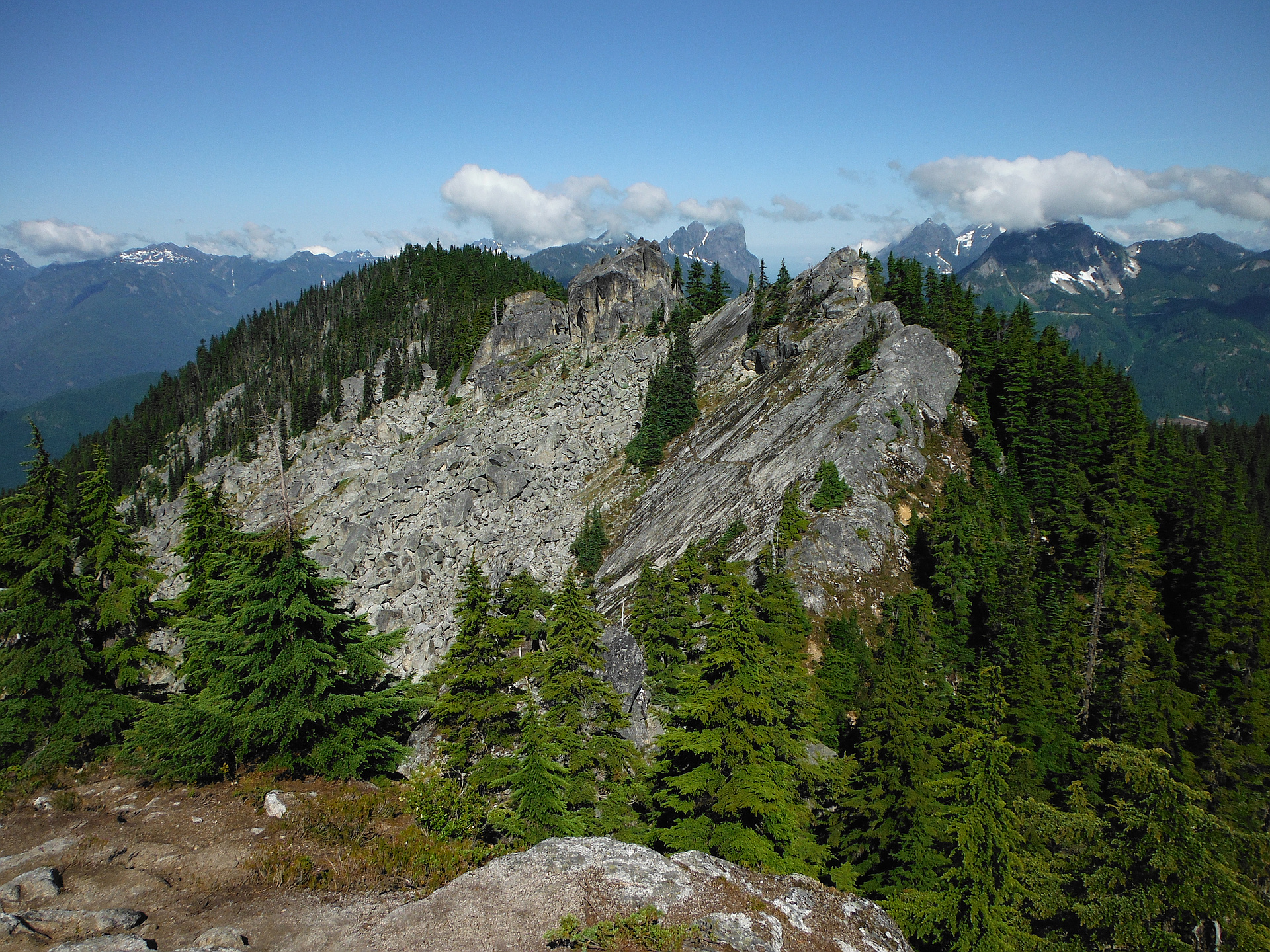
The trail stops at the farthest East of 4 peaks. The rest looked slightly higher from where I stood and a 30 foot class 4 drop separated us. I followed the edge of the wall a ways before realizing I would need to lose about 600 feet of elevation to get down and around it with my dog.
We left the trail at about 4500' and rounded the cliff band at 4400', staying close to the base to avoid travelling over large talus. I found a definite trail cut into the rock below the middle peaks. The one farther to the east is about 15 feet lower, and I was able to walk right up. The higher of the two is a monolith requiring some technical climbing and probably some rope to achieve, so we continued past and followed the fading trail to the West peak which still looked to be the mountains high point.
At the rounded summit I found a summit register in a very old mason jar half buried on it's side in dirt and pine needles. The lid had corro..." — Jeb • Jul 13, 2013
Photos
Awards
About peakery awards
Log climbs on peakery to earn awards:
Peak Badges: Earn a special badge for each unique peak you summit. See all of your badges on your Badges page.

First Ascent Award: Only 1 available per peak. Goes to the first peakery member to log a successful summit of a peak. Snag this award and the peak will forever bear your name.

King of the Mountain Award: Only 1 available per peak. Summit a peak more times than any other member. Beware: this award can be lost!

Summit Steward: Summit a peak at least 5 times to become one of its Summit Stewards. As Steward of a peak, you’re encouraged to keep that peak’s info up-to-date on peakery and spread goodwill on your future climbs up the peak.