
Region
Highlights
Routes
10 climbs • 5.0 mi • 4,051 ft gain • 9 hr 23 min • Class 3
Latest climbs

"From Terrence's WTA Report:
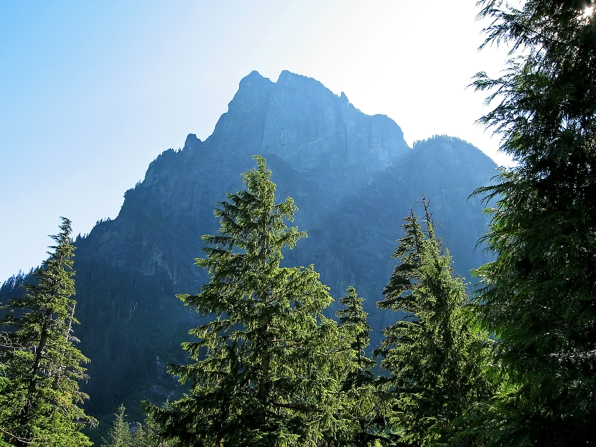
We are the Mountain Goats, Terrence (13) and Nathan (16), and today one of us (Terrence) climbed Baring Mountain.
The climber's trail behind the bathrooms was easy enough to find and follow. The cutoff to the right came much sooner expected, and we ended up going by it about 1,000 feet before we realized our mistake and turned around. Look for the pink where the creek is coming down the slope. The first mile is everything that you have read - very, very, steep. In fact, according to SummitPost, Baring Mountain is the third steepest mountain/hike in Washington State. It is straight up, and the dirt, mud and vegetation (with a few large rocks to go up) make it slippery and a challenging. Heading straight up the the ridge (first mile) you gain nearly 2,000 feet. The trail is relatively easy to follow, with the pink tape helping out.
Once at the ridge, the next mile is the easiest part of the route. Relatively flat, with some elevation loss and regain. After another 3/4s of a mile, it's back up, up and up, through the woods towards the boulder field. We took a wrong right turn and ended on the south side of the boulder filed, so we had to..." — BryHong8 • Nov 2, 2019

"Still some snow in the gully, but most of the crew did not take out their axes. Poles are recommended, especially for the descent of the muddy and incredibly slick track down from the ridge. One hand line was somewhat useful, while the other mostly served as a trip line. Most views were obscured by clouds. Still a very fun trek with a great group." — TynanRammGranberg • Jun 25, 2016

"Had my sights set on this iconic peak for a long time. Finally got the chance to hit it on a perfect day.
Unbelievably our feet never touched snow... it's like August conditions. Ice axe and crampons never left my pack. Incredible views from the summit, revealing the sheer scale of the Cascades. There are an infinite number of peaks to explore here. Probably the best vantage point for Merchant and Gunn peaks... really want to head up there. Mt Daniel really stood out from here, luring me to tackle it soon. And Mt Stuart is so prolific even from this distance, like a huge really vertical pyramid.
The way down was trying. Thanks to my skateboard skills from a few days of practice in 7th grade, I managed to ride and then jump off a massive, flat loose boulder that started to slide down the gully.
The last 2000 ft back down from the ridge was the hardest part of the day. Mud and some wet roots etc. on the really steep trail made for laughably slow going, even slower than the tough climb up. A fall here often could be... bad. It was like 2000 vert of veggie belays (the fixed ropes in a few sections were also useful). When we got to the end of the gully we high-fived in relief...." — scott • May 28, 2015

"Two new hand lines encountered at a heavily eroded and short class 3 section on approach to ridge line. Snow in gully was soft and fairly shallow. Some exposed rock and opportunities to punch through. Snow wall at notch was imposing but not difficult given the soft snow conditions. " — Trystan • Mar 8, 2015

"I hiked in with Automahn to barclay lake at 830 am Sunday to meet colin for an attempt at Mount Barings summit. We hoped to find a scramble route/bootpath up to the West ridge from the lake, but had no luck. After a few unsuccessful attempts we decided to head back to trailhead. Here we followed the old road where it continues past the outhouse and then up the creekside trail on the right less than half mile in. Colin's dog Cooper was pretty tired from their trip up Mount townsend Saturday, but Automahn was fresh from two and a half weeks of rest.
The trail is at it's steepest right away. The first relief came 2000 feet up where is it trail crests the ridge. After about a mile of gentle up and downs, the steep climb continues for a few hundred more feet to a saddle with a clear view of both summits and the gully between them. Dense canopy allowed only the occasional peek at the surrounding peaks. We were running low on time due to our late start and so we agreed upon a 5 o'clock turnaround time regardless of whether we had reached the summit.
Several isolated snow fields remained in the talus-filled gully, the lowest provided a small melt pool w..." — Jeb • Aug 4, 2013

"We set out early, starting from Barclay Lake Trailhead at 4:15am. We followed the abandoned road a short while and found the trail heading up on the right side of a flowing creek. Route finding by headlamp in the darkness was mildly challenging (we only lost the path and had to backtrack once). The trail up is steep as expected. The lower section has a lot of ground cover that goes away under larger trees after climbing about 600 feet. A little route finding was necessary as there seem to be a few tracks leading up/down from the ridge. Once on the ridge, the path is more obvious. The last 100-200 vertical feet that you climb back up the ridge is covered in snow. It was firm, but boots were fine on it. At the bottom of the snow gulley, the path to the summit is all snow. We put on crampons to help us move faster on the firm snow. We reached the gap between the North and South summits quickly. This is where we found the snow wall that is climbed to reach the North summit. The wall was in the shade for our ascent and the snow was nice and firm. It was not that difficult, but be careful as the exposure and consequences of a fall here could be unfavorable. If we had brought a small rope..." — swab35 • Jul 4, 2011
Photos
Awards
Challenges
About peakery awards
Log climbs on peakery to earn awards:
Peak Badges: Earn a special badge for each unique peak you summit. See all of your badges on your Badges page.

First Ascent Award: Only 1 available per peak. Goes to the first peakery member to log a successful summit of a peak. Snag this award and the peak will forever bear your name.

King of the Mountain Award: Only 1 available per peak. Summit a peak more times than any other member. Beware: this award can be lost!

Summit Steward: Summit a peak at least 5 times to become one of its Summit Stewards. As Steward of a peak, you’re encouraged to keep that peak’s info up-to-date on peakery and spread goodwill on your future climbs up the peak.