Region
Highlights
Routes
/-115.320965133045,50.7267776941361,11,0.00,0.00/320x240@2x?access_token=pk.eyJ1IjoicGVha2VyeSIsImEiOiJjampra3Z0bnAxeTVnM3FteHlybHY3b2p1In0.7a5dEa5-995VUv8ceHHNmw)
3 summits • 23.4 km • 1,234 m gain • 10 hr 44 min
1 summit • 21.9 km • 1,314 m gain • 11 hr 54 min
Latest summits

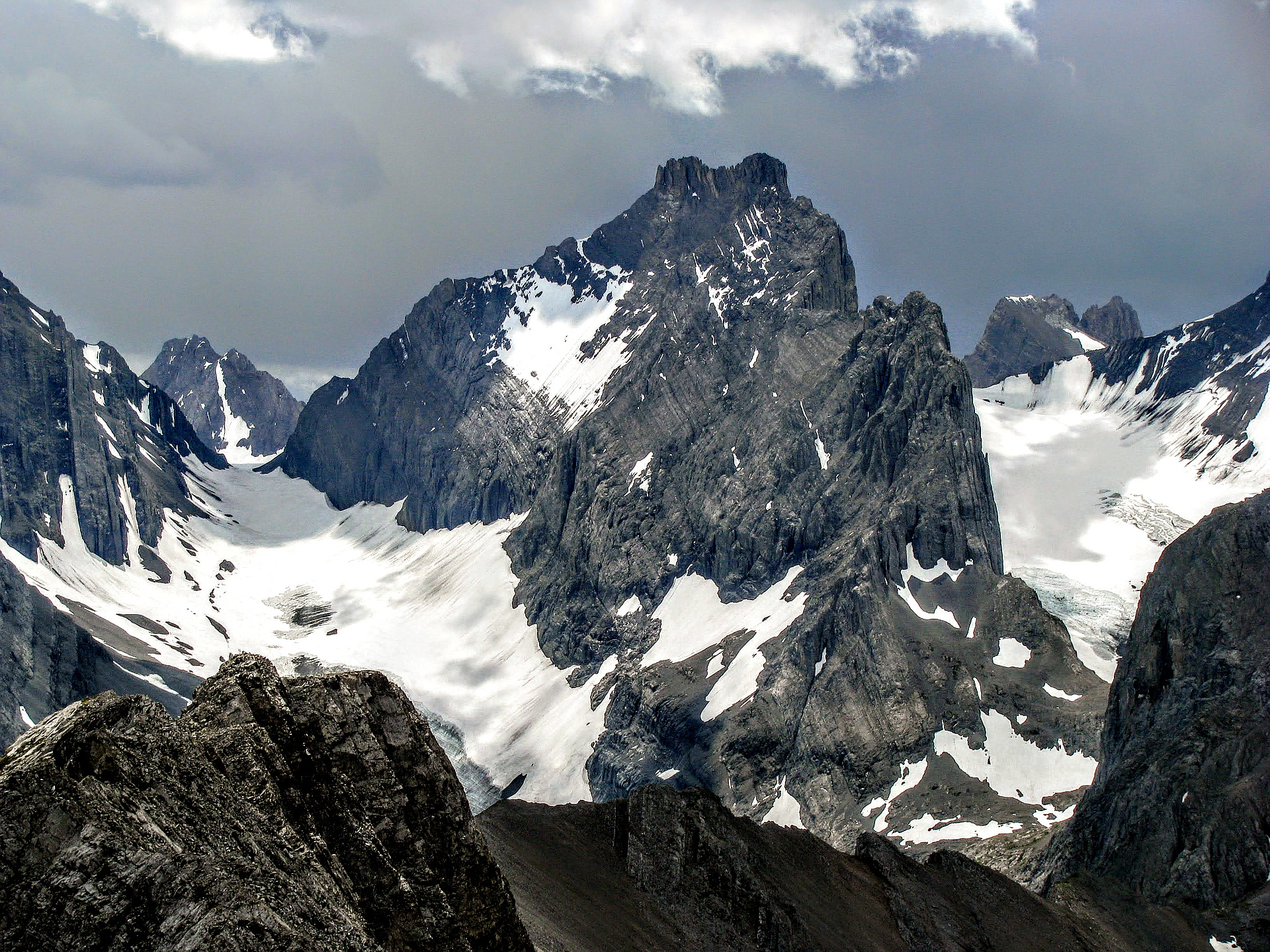
"We crossed sustained Class 4 terrain with the deadly exposure and at least one low Class 5 section, followed by a severely exposed knife-edge ridge. Then we traversed on a steep deadly exposed slabs to the advertised ledge that is supposed to bring climbers to the final summit ridge. We were not on the scrambling terrain by any definition, but it was still within our comfort level.
The scree covered ledge is extremely exposed with several hundred meters free fall to the base of the mountain. The beginning of the ledge is very narrow - looked to me like 7-10 inches wide. We would have to commit ourselves to step plunging on the down-slopping scree and hope it will hold. If it moves - you will fly several hundred meters to death. This began to look insane for unprotected climbing. We decided to turn back.
I can't believe Alan Kane decided to include this mountain in his "Scrambles in the Canadian Rockies". I would recommend to anyone to ignore Alan Kane, he is out of his mind, and bring some sort of protection, at least short rope, and treat Mt. Robertson as a standard mountaineering objective, which it is. We saw many rappel stations on the most challenging sections. David Jones..." — Taras • Aug 28, 2020

"Very exposed with some tricky moves and loose rock. I found this harder than Mt Smuts. Awesome views and some fun scrambling and a lot of holding on tight. A long day! Actual stats were 1848m total gain, 25KM, and 12.25 hrs. This shouldn't be in the "scrambles" book. " — jakefinnan • Jul 21, 2018

"With Liz. Met Jake and Abram on the French Glacier.
Disclaimer: I think I got the summit.
We reached 2 high points with cairns, the second was slightly higher than the first. Beyond this second highpoint, was another point with a similar height. I thought it looked higher than my point (but I always seem to think the next point is higher), Jake and Abram checked the horizon, and thought our point was just as high/higher. Maybe it's all wishful thinking though...
I explored different options to get to that other point, but didn't find anything that looked like a scramble.
I was sort of bothered by this, and have examined pictures and google earth, etc. In high quality pictures, what I thought was a cairn now looks more like the top of a pinnacle. Google earth shows the summit at our location (however accurate google earth is). Topos have it all in the same elevation band.
So, I'll count it until proven wrong. :)
General trip report
The approach to the Robertson-Douglas col was mostly uneventful and straightforward. The route of French creek is now easy to follow with a good trail. We took the Dafferen approach and didn't need to cross the creek. The glacier..." — mike_rogers81 • Jul 21, 2018
Photos
Awards
Challenges
About peakery awards
Log successful summits on peakery to earn awards:
Peak Badges: Earn a special badge for each unique peak you summit. See all of your badges on your Badges page.

First Ascent Award: Only 1 available per peak. Goes to the first peakery member to log a successful summit of a peak. Snag this award and the peak will forever bear your name.

King of the Mountain Award: Only 1 available per peak. Summit a peak more times than any other member. Beware: this award can be lost!

Summit Steward: Summit a peak at least 5 times to become one of its Summit Stewards. As Steward of a peak, you’re encouraged to keep that peak’s info up-to-date on peakery and spread goodwill on your future climbs up the peak.