Highlights
Routes
/-113.0599488,37.6994212,11,0.00,0.00/320x240@2x?access_token=pk.eyJ1IjoicGVha2VyeSIsImEiOiJjampra3Z0bnAxeTVnM3FteHlybHY3b2p1In0.7a5dEa5-995VUv8ceHHNmw)
1 summit • 0.9 mi • 173 ft gain • 28 min
Latest summits
"I feel like I need to figure out a "Blame It On The Peakery App" song. (Calvin Harris, wru?) Or rather, I should be thanking the Peakery App - it's actually quite fun to look at what's nearby and see if any of it is "doable" with my current gear/travelling companions/time constraints. We knew that this was here in town (although we hadn't found it at first), and once I saw it didn't yet have a first logged ascent on Peakery, and no peak photo to boot - well, this is a matter of public service! So. I looked this up on Google Maps, both satellite and terrain, along with Peakery. Turns out that the boots-on-the-ground reality is different than what's pictured. The road to the south end of the knoll (just off of N Fairway Drive) no longer exists. It's been filled in completely and is just a side of the hill. So, we went to the little entrance/"road" between two houses on the north end of the knoll. No signs indicating private property or "no trespassing" - all good in that regard. There's a big, soft-dirt patch where I was able to turn around and park. The first S-curve of the road up the hill is pretty impassable unless you have a Rubicon, an OHV, etc. It's soft dirt, relatively recen..." — psychikingjes • Oct 2, 2020
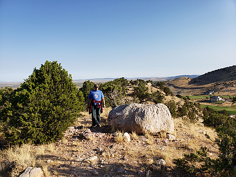
Photos
Awards
About peakery awards
Log successful summits on peakery to earn awards:
Peak Badges: Earn a special badge for each unique peak you summit. See all of your badges on your Badges page.

First Ascent Award: Only 1 available per peak. Goes to the first peakery member to log a successful summit of a peak. Snag this award and the peak will forever bear your name.

King of the Mountain Award: Only 1 available per peak. Summit a peak more times than any other member. Beware: this award can be lost!

Summit Steward: Summit a peak at least 5 times to become one of its Summit Stewards. As Steward of a peak, you’re encouraged to keep that peak’s info up-to-date on peakery and spread goodwill on your future climbs up the peak.