
Region
Highlights
Routes
2 climbs • 2.5 mi • 898 ft gain • 3 hr 38 min
Latest climbs
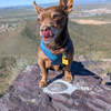
"Last mile or so is a use trail that's very loose soil/sand about 800 feet gain with some fallen trees and old granite mixed in. End is about a 50 -100 foot rock scramble. Depending on your approach to the peak, it's either a solid 2 scramble, or a 2 start into a 3 - I say this based on input from my hiking partner. Climbing wise, I think they are a V0-V1 bouldering grade : good hand holds, no unstable rocks, nothing overly technical. I didn't really need my hands on the side we went up until we were nearly at the top, and the chunks were big enough that my 9lb 12 yr old Chihuahua was able to ascend under his own power.
... And yes I did have fun climbing around a bit after we ascended. It was a lovely day and great views. Clear trail with mixed shade. " — MaxwellsDeamon • Oct 3, 2026

"The PCT crosses ACH just west of Sulpher Springs Rd. That's where the hike begins. The trail quickly intersects The Waterman Trail, where I left the PCT behind. I then stayed on The Waterman Trail for about 1.5 miles. A semi-obvious use trail leaves The Waterman Trail at a point below Peak 7097. The use trail goes all the way to the peak, while passing a few boulder pile false summits along the way. " — MikeTeeples • Aug 28, 2022

"I started my hike on the PCT at 3 Points and quickly joined the Waterman Trail almost immediately after crossing Angeles Crest Hwy. I took the Waterman Trail east for some time until I spotted a saddle between 7097 and Delight Peak, and thus I went cross-country in a roughly NW direction to join the ridge at the saddle, turned left, and joined the ridgetop use trail and followed it to the summit outcrop, where I did a very short basic class-3 climb to get to the top. After leaving the top, I found a slightly easier class-2 to get back down from the summit and rejoin the use trail where I followed it a bit and returned cross-country to the Waterman Trail and back to 3 Points. Overall, it was a typically awesome day in the San Gabriel Mountains. The cross-country was not even that difficult, despite some loose soil, because it was not a long stretch, and the steepness was mitigated by a climb of an oblique angle up to the ridgeline.. And since my hike was in December, the month with typically crystalline atmospheric clarity, I could make out Mt. Pinos, Frazier Mountain, the San Emigdio Mountains, Santa Monica Mountains, the Kern Plateau, Greenhorn Mountains, snowcapped high Sier..." — brianpowell • Dec 16, 2018
Photos
Awards


About peakery awards
Log climbs on peakery to earn awards:

Peak Badges: Earn a special badge for each unique peak you summit. See all of your badges on your Badges page.

First Ascent Award: Only 1 available per peak. Goes to the first peakery member to log a successful summit of a peak. Snag this award and the peak will forever bear your name.

King of the Mountain Award: Only 1 available per peak. Summit a peak more times than any other member. Beware: this award can be lost!

Summit Steward: Summit a peak at least 5 times to become one of its Summit Stewards. As Steward of a peak, you’re encouraged to keep that peak’s info up-to-date on peakery and spread goodwill on your future climbs up the peak.