Region
Highlights
Routes
/-121.969957,47.485483,11,0.00,0.00/320x240@2x?access_token=pk.eyJ1IjoicGVha2VyeSIsImEiOiJjampra3Z0bnAxeTVnM3FteHlybHY3b2p1In0.7a5dEa5-995VUv8ceHHNmw)
7 summits • 46.5 mi • 6,223 ft gain • 12 hr 46 min
1 summit • 11.0 mi • 1,763 ft gain • 3 hr 28 min
1 summit • 12.5 mi • 1,748 ft gain • 2 hr 33 min
1 summit • 12.6 mi • 2,074 ft gain • 4 hr 11 min
1 summit • 14.1 mi • 2,628 ft gain • 7 hr 20 min
1 summit • 14.2 mi • 2,899 ft gain • 6 hr 23 min
1 summit • 16.8 mi • 4,533 ft gain • 3 hr 48 min
1 summit • 16.9 mi • 2,121 ft gain • 3 hr 11 min
1 summit • 33.8 mi • 7,027 ft gain • 8 hr 17 min
1 summit • 9.1 mi • 2,152 ft gain • 2 hr 31 min
1 summit • 9.1 mi • 1,448 ft gain • 1 hr 57 min
Latest summits

"Thought I would hit 7 peaks, but only hit 3. Didn't realize I missed the 2 south peaks. Discovered that there is no hiker trail to Sally's summit or to Beaver Hill. (I did get these four peaks later.)" — danv • Jul 19, 2021

"Planned a loop route to summit the & peaks of East, Middle, and South Tiger Mountain, the remaining peaks on Tiger Mountain as part of the Issaquah Alps 24 list I needed to bag. This part of Tiger Mountain is designed for Mountain Bikes and has a wonderful network of graded trails like ski runs green, blue, black, etc. Beyond the first mile or so from the TH, most of the trails are a mix of gravel access and former logging roads. Much of South Tiger was logged recently and the land looks terrible, the route to Middle Tiger has areas slated for cutting. Honestly, I would not recommend hiking much of this area unless you want to bag the peaks. The route down East Tiger has some nice areas, but other than that is a mix of trails through the clear cut, restored forest, and gravel roads. I only saw people as I descended down East Tiger and the rest of the mountains and trails was deserted. Middle Tiger had a nice trail up - lots of interesting moss on the trees and some wood and rock structures that spooked me out as I was alone - a little Blair Witchesque for my preference. With the exception of a small stream a couple of miles into the route to South Tiger, there were no viabl..." — markhadland • Aug 29, 2020

"Yesterday was a big day; I'm still a bit tired. In 13.27 miles I picked up 7 of these Issaquah Alps lovelies. First up was Beaver Hill, then Sally’s Summit and East Tiger Mountain, then landing next at Middle Tiger Mountain.
After East Tiger Mountain, I went down Crossover Road #5500, then left on the East Tiger Re-Route Trail (aka Tiger Mountain Summit trail). After some beautiful forested hiking I then connected to the Main Tiger Mountain Rd (#4000) where I traversed the Northern edge of my 13 mile loop. At some point you run into a gated (and relatively unused) road. That’s the route to take over to the Middle Tiger trailhead which takes you right up to the top.
Specific to the summit, there are no views to speak of. The hike up and down are both a pretty steep grade, albeit doable. I guess I’d recommend you bring your cardio for the ascent… it’s snappy if you're coming in from the WNW like I did. At the top there is a Tee-Pee structure. I really should have snapped a pic, but alas I just passed it by and continued down the trail.
Next on the peak list was Wright’s Reach." — herdingcats • Apr 13, 2014
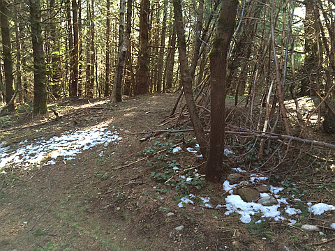
"Late afternoon exploratory jaunt up to Middle Tiger on this vey early spring day. Started out from the southernmost Tiger Mountain Trail TH. Topped out on South Tiger #2, South Tiger, and Wright's Reach en route. Still a tiny bit of snow left in patches on the summit. Running out of time/light so return trip turned into trail run. Ran until legs so sore couldn't anymore, then hobbled into the finish line." — scott • Mar 21, 2014

"A couple of friends and I were antsy to get the hiking season going early this year, and so we trekked through the snow to Middle Tiger Mountain Summit. Along the way, we somehow switched trails without noticing and arrived at the peak through a few very well built trails that are not on my Green Trails Map. I'm told that there was once a view to be had here, but trees have since obstructed it. On the way down the mapped trail we discovered where we veered off, an easy mistake as the wide un-mapped trail continues past the old turn off up a hard-to-see boot path just before a small bridge. Round trip: 7 miles, Elevation gain: about 1200 ft" — Jeb • Jan 1, 2011

"Missed a turn in the TMT and summited using an old trail that extends from the end of the Artifacts Trail making it surprising when we reached the top and ran into the actual Middle Tiger Trail running up one side of the peak and down the other." — Al-Rashid • Jan 1, 2011
Awards
Challenges
About peakery awards
Log successful summits on peakery to earn awards:
Peak Badges: Earn a special badge for each unique peak you summit. See all of your badges on your Badges page.

First Ascent Award: Only 1 available per peak. Goes to the first peakery member to log a successful summit of a peak. Snag this award and the peak will forever bear your name.

King of the Mountain Award: Only 1 available per peak. Summit a peak more times than any other member. Beware: this award can be lost!

Summit Steward: Summit a peak at least 5 times to become one of its Summit Stewards. As Steward of a peak, you’re encouraged to keep that peak’s info up-to-date on peakery and spread goodwill on your future climbs up the peak.