
Region
Highlights
Routes
1 climb • 10.7 km • 4,255 m gain • 4 hr 23 min
Latest climbs
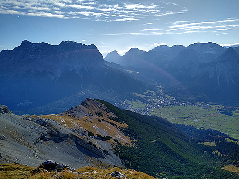
"Both my gpx files (OSMand and my Garmin watch) don't seem to work here, so you'll have to belive me. Started from Ehrwald, walked up to Daniel/Upsspitze and then crossed the ridge of the main chain of the Ammergau Alps until Pitzenegg. From there I had to descend and trek back up to Kohlbergspitze. Beautiful, sunny day, but very windy. Some scrambling along the ridge, but nothing too exposed. Paths until Hochschrutte are well marked, getting to Pitzenegg can be a bit tricky. If in doubt, retrace and look for footprints/traces/markings. 9h, 25km, 2800m elev. gain. PM me for the gpx." — TheTMan • Oct 15, 2019
Photos
Awards
About peakery awards
Log climbs on peakery to earn awards:
Peak Badges: Earn a special badge for each unique peak you summit. See all of your badges on your Badges page.

First Ascent Award: Only 1 available per peak. Goes to the first peakery member to log a successful summit of a peak. Snag this award and the peak will forever bear your name.

King of the Mountain Award: Only 1 available per peak. Summit a peak more times than any other member. Beware: this award can be lost!

Summit Steward: Summit a peak at least 5 times to become one of its Summit Stewards. As Steward of a peak, you’re encouraged to keep that peak’s info up-to-date on peakery and spread goodwill on your future climbs up the peak.