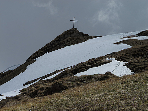
Highest peak
Vorder-Grauspitz
8,526 ft / 2,598 m
Most prominent peak
Vorder-Grauspitz
1,161 ft / 354 m prom
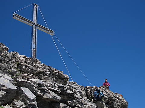
Most summited peak
Vorder-Grauspitz
9 summits
Most difficult peak
no info yet
Difficulty breakdown
no info yet
Highlights
Latest summits

"My consolation prize after not reaching the Grauspitz. Horrible weather this spring meant the class IV arete to the Grauspitz was covered in lingering ice with death exposure to the north, and muddy, loose rock everywhere else. Wasn't worth it for an 8,000' peak so I settled for the second highest in Liechtenstein instead.
Complete TR: http://themtsarecalling.com/hinter/" — Christopher • Jun 10, 2016
"Two friends and I had decided to go on a short hiking holiday during Pentecost (a.k.a. Whit Sun) which is a two day holiday in the Netherlands. We stayed at a lovely mountain lodge called Berggasthaus Sücka. We started the hike at 08:00 in the morning temp was about 3-5C, partly in the clouds. We marched towards Gapfahl where we crossed some snow fields and saw lovely little flowers. So far a T1 route. After Gapfal the path was somewhat unclear because there were more snow fields. A few red marked sticks however marked the route upwards until we reached the saddle between the Rappastein and Goldlochspitz. Now we turned left and crossed some rocks (T2) after which the path continued across some fields. Again part of those were covered with up to 50cm of snow. Close to the ridge it was clear and after about 20 minutes we reached the summit with poor visibility.
The weather that day was changing very rapidly. One moment you were in the clouds with visibility <100m, a minute or so later you could see 30-40km towards the Bodensee under blue skies... Magnificent views! At some point it also snowed... it never rained up there. That started on the way back after Gapfahl in the Valuna ..." — pc5a • May 20, 2013

"The climb to Vorder-Grauspitz started in Steg, at the parking near the ponds. The route brings you first via the Valüna Alp and further towards the Pfäelzer Hütte. At the junction "Valüna Obersäss" go off the road on the small dirt trail (direction Naafkopf/Pfäelzer Hütte). This trail soon makes a left turn, but keep going ahead. It then brings you on the slopes under the Naafkopf. Follow a trail towards a saddle between the Naafkop and Hinter-Grauspitz: Ijes. At Ijes simply turn right onto the ridge. The first few steps are a bit difficult but soon there after there is a clear trail. Simply follow it to almost at the Hinter-Grauspitz. Don't go all the way to the summit but go *around* it (to the left). After a short while you stand on the ridge of the valley at Vorder-Grauspitz. Here there is no path at all... you're on your own. Try to decent about 2/3 and from there walk towards the saddle between Hinter and Vorder-Grauspits. There follow the ridge. You will first pass the "fake-peak". It's just a little further to the real summit. Under a pile of rocks you can find the "Gipfelbuch". " — pc5a • Jul 5, 2011
"One alternative route to the Falknis starts in Stegs and brings you to the Rappenstein saddle. From there you walk around the Rappenstein on the Rhein valley side into the Lawena Tal. There you shoot for the Saddle under the Falknis Horn and walk around it towards the Falknis. " — pc5a • Jul 3, 2011