
Highlights
Latest climbs
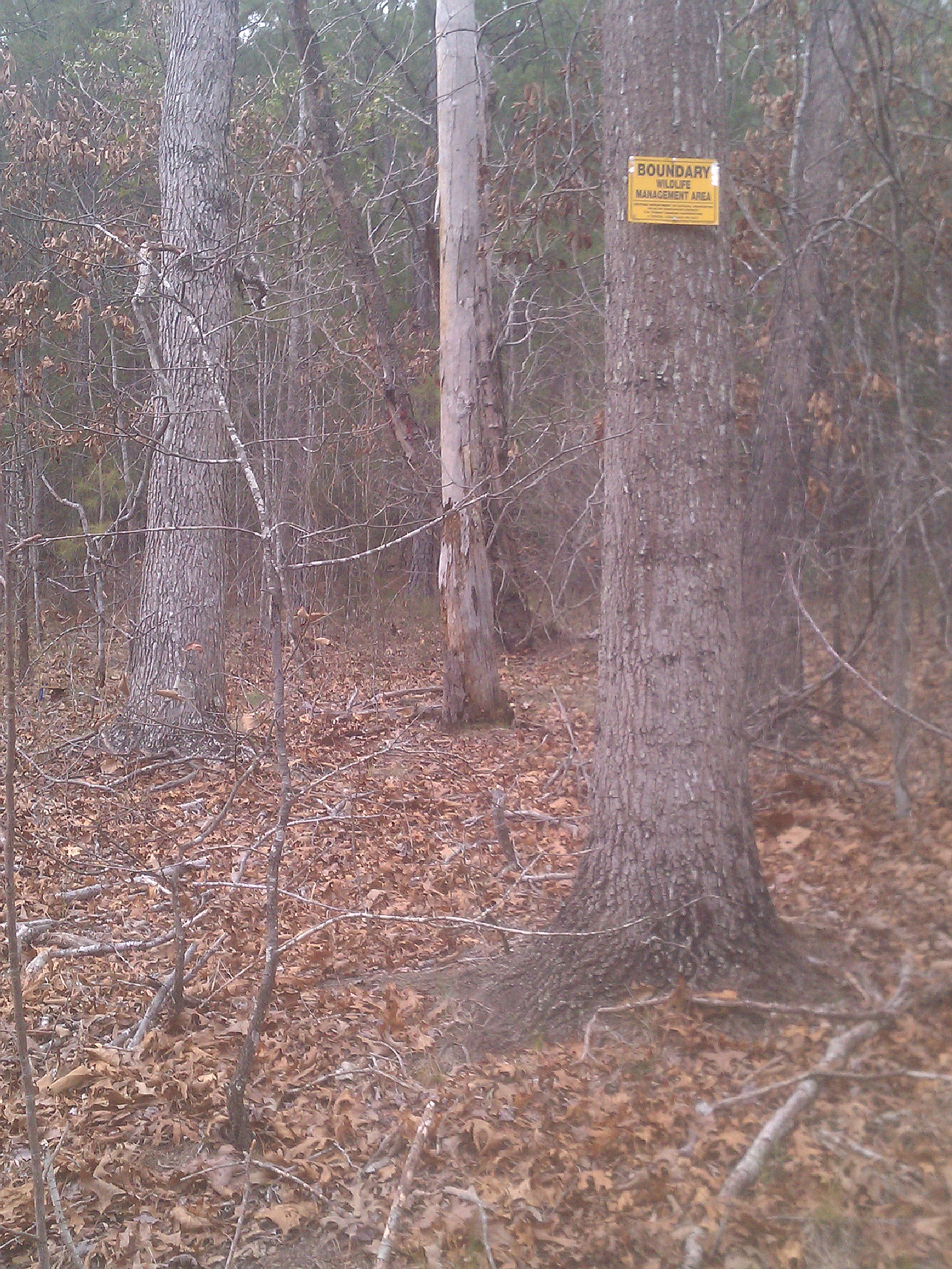
"After parking my car about .5 miles away from Middle Broad River and Cannon Rd. intersection, I've took a longer than I had to hike, but lucked out and found the highest point in dense brush/forest which corresponded to the gps coordinates. I could not find a geological marker, hard to get to the top because of dense brush/trees and there is no clear path. Most direct way to the summit..is by going back to the intersection and taking the dirt rd. next to a house for about 600 ft. pay attention to a boundary Wildlife Managment Area sign on left side nailed to a tree. Take a left up the hill and go as far as you can up hill. There is no clearing at the top, the vegetation is dense and after the ground leveled off you reached the top. There are higher peaks in the area, but I've doubled checked with my gps and I've reached Brady Hill. I was thrilled , this improved my today's summit success to 3 out of 4!" — ChristophVogt • Mar 22, 2013
Photos
Awards
About peakery awards
Log climbs on peakery to earn awards:
Peak Badges: Earn a special badge for each unique peak you summit. See all of your badges on your Badges page.

First Ascent Award: Only 1 available per peak. Goes to the first peakery member to log a successful summit of a peak. Snag this award and the peak will forever bear your name.

King of the Mountain Award: Only 1 available per peak. Summit a peak more times than any other member. Beware: this award can be lost!

Summit Steward: Summit a peak at least 5 times to become one of its Summit Stewards. As Steward of a peak, you’re encouraged to keep that peak’s info up-to-date on peakery and spread goodwill on your future climbs up the peak.