

Highlights
- Highpoint elevation varies depending on the map you use. Most don't even show an elevation for the highest part of the mountain. This elevation comes from the ArcGIS-World map.
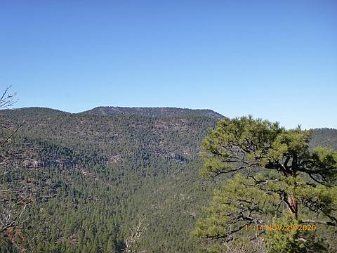
Latest climbs
"I accessed the mountain from forest road 870 which is east of the highpoint (the backside of the mountain). The advantage is a higher starting elevation. The negative is getting there as it involves using several forest roads, from NM-32: FR-93, FR-17 and FR-870. 870 is the worst, it requires a high-clearance vehicle at a minimum assuming dry conditions. Also, FR-870 is not signed. To avoid confusion, best to use the 2016 forest service map.
" — fredbrown585 • Nov 29, 2020
Photos
Awards
About peakery awards
Log climbs on peakery to earn awards:
Peak Badges: Earn a special badge for each unique peak you summit. See all of your badges on your Badges page.

First Ascent Award: Only 1 available per peak. Goes to the first peakery member to log a successful summit of a peak. Snag this award and the peak will forever bear your name.

King of the Mountain Award: Only 1 available per peak. Summit a peak more times than any other member. Beware: this award can be lost!

Summit Steward: Summit a peak at least 5 times to become one of its Summit Stewards. As Steward of a peak, you’re encouraged to keep that peak’s info up-to-date on peakery and spread goodwill on your future climbs up the peak.