Region
Highlights
Routes
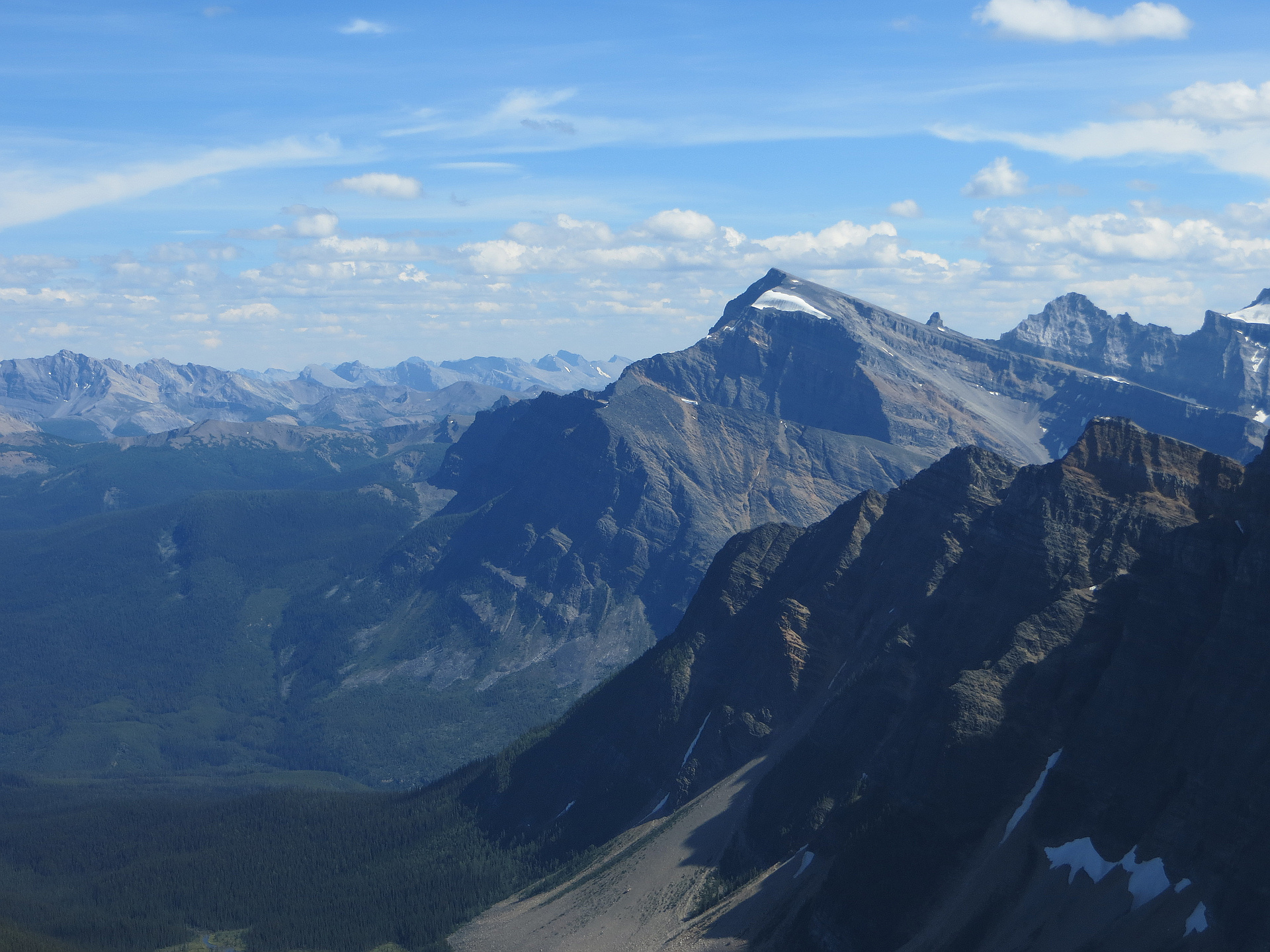
/-116.00450040741,51.2077891617802,11,0.00,0.00/320x240@2x?access_token=pk.eyJ1IjoicGVha2VyeSIsImEiOiJjampra3Z0bnAxeTVnM3FteHlybHY3b2p1In0.7a5dEa5-995VUv8ceHHNmw)
6 summits • 10.3 km • 1,506 m gain • 7 hr 37 min • Class 2
1 summit • 13.1 km • 1,509 m gain • 9 hr 0 min
1 summit • 10.7 km • 1,463 m gain • 6 hr 45 min
1 summit • 11.9 km • 1,535 m gain • 6 hr 12 min
1 summit • 12.7 km • 1,700 m gain • 8 hr 52 min
1 summit • 18.2 km • 1,651 m gain • 10 hr 18 min
Latest summits

"There was some light rain for the final 150m of climbing but luckily it stopped has I reached the summit. I enjoyed the views for at least an hour then made my way down. To have snow and the proper equipment on these rocky slopes would be beneficial. Another slog in the rockies." — Randy • Aug 10, 2022

"Tried to ski it last year but got stymied by snow. This year COVID prevented a March/April shot on skis. Ran out of time this year with skiable snow. Took the afternoon off work to get in a Kane in one of the fewer weather windows this year so far. Casual start had us at the trailhead at 3pm. Looked straight up but straight forward with questions about where the trail left the road and the bushwack. Following OpenTopo we entered the bush and immediately was wet crossing the creek. Then trended up in decent bushwacking for 40 min before realizing there is a great trail on the north side of the drainage. That hastened the pace and after numerous log walks we were in the valley and breaking out onto nice solid sand/gravel/rock walking up to the snow. Much better travel on the snow but really a huge kickstep straight up. Last bit exiting the gully was very loose and then a false summit showed the true beast another 30 min away!!! Some of the best views from any peak in the area. Incredible evening where we could see Sir Douglas, ski slope on Joffre, Assiniboine towering, Jumbo area, Hoswer Towers in Bugaboos, Goodsirs, Rogers Pass?, Hungabee, Deltaform, Temple, Hector, Ptarmigan (where..." — alexjoseph • Jun 25, 2020

"First day of warmer weather in a while. -18C at the start but quickly up to 0C and then windy up high as moody clouds hovered to the west. Took the high route and got cliffed out so went down and around to get in the valley. Was 130m from the summit at 3:45pm and decided to shut it down. Bootpacked 200m then skied some nice deep powder. Then powder thinned and sounded like complete trashing of skis on rocks (surprisingly not though). Then tricky faceted tight tree skiing direct line to road. Made the highway with some challenging skiing at 6pm with sun fading. Great day with the 3 Robs, Matt, Barry and Curtis. I'll be back.
Scramblers (Skiers 7): Barry, Matt, Curtis, Rob Maybury, Rob Herbst, Rob Maiman, Alex
https://www.meetup.com/canadian-scrambling-and-mountaineering-company/events/259522366/" — alexjoseph • Mar 9, 2019

"Right time to tag this mountain is late May-early June. I used snow for 550 vertical meters to make the ascent and especially descent easier. Would have been even better had I gone 2-3 weeks earlier. Crampons and ice-axe are essential for the early season ascents.
Other than this, it is important to find a faint trail on the east side of the creek that will make the initial 2km of Tarzan-style log hopping less painful." — Taras • Jun 24, 2017

"A great day. The creek was easily crossed. There was bushwhacking a plenty, in particular over deadfall. The scree bowl started out ok, but then the scree got nasty (exceptionally loose) for a few hundred meters. Once past the bad part the grade leveled out and it was an easy walk up to the summit. Great views!" — BertB • Jun 6, 2015
Photos
Awards
Challenges
About peakery awards
Log successful summits on peakery to earn awards:
Peak Badges: Earn a special badge for each unique peak you summit. See all of your badges on your Badges page.

First Ascent Award: Only 1 available per peak. Goes to the first peakery member to log a successful summit of a peak. Snag this award and the peak will forever bear your name.

King of the Mountain Award: Only 1 available per peak. Summit a peak more times than any other member. Beware: this award can be lost!

Summit Steward: Summit a peak at least 5 times to become one of its Summit Stewards. As Steward of a peak, you’re encouraged to keep that peak’s info up-to-date on peakery and spread goodwill on your future climbs up the peak.