Region
Most climbed route
Highlights
Routes
/-71.1520170211792,44.3620863929669,11,0.00,0.00/320x240@2x?access_token=pk.eyJ1IjoicGVha2VyeSIsImEiOiJjampra3Z0bnAxeTVnM3FteHlybHY3b2p1In0.7a5dEa5-995VUv8ceHHNmw)
2 summits • 8.7 mi • 3,150 ft gain • 7 hr 10 min
1 summit • 18.7 mi • 6,275 ft gain • 11 hr 18 min
1 summit • 9.1 mi • 3,186 ft gain • 6 hr 20 min
Latest summits

"Spring hiking in the Whites. Nice day, dry trail to Mt Surprise. Above there, snow to the summit. Very sturdy but narrow monorail. Perfect 360 views from a somewhat calm summit." — Alohabuffy • Apr 28, 2023
"Did the "Loop" trail. Started at 7 am on Bangor Street trail head, and came out to Stoney Brook Trail head at 2:30. MANY stops on the way to take pictures and see the beautiful views as well!!!!" — Bucky • Oct 10, 2020
"A rather cold trip to the top of Moriah today. 17 deg at the bottom, 7 at the top plus a cruel wind made it a little inhospitable on the summit. Too bad as the bright blue skies were stunning and views for miles in every direction. Good look out from Surprise's ledges. Trail was in excellent shape, snowshoes door to door. Except snowmobilers have ripped apart the trail from the 1 mile to 2 mile mark." — Alohabuffy • Jan 20, 2020

"Started off the day at the Carter-Moriah trailhead and made our way up the 4.1 moderate trail to Moriah and the AT. From there we crossed the ridge through the Carters and stayed at the Carter Notch hut (another great hut team!) The hike was hot and dry and incredibly beautiful - that last drop to the is a looong one and we just made the dinner bell!" — deb-and-rob • Jun 16, 2018

"Beautiful winter day to be out in the Whites! Didn't see anybody else until I reached the top of Moriah, where I bumped into a few others who came up the other side. And passed a few clusters of folks who were heading up Carter-Moriah as I descended. Carter-Moriah was perfectly packed, and microspikes made for a smooth hike. " — matt-beard • Jan 3, 2016

"This was Kirby's longest hike to date, 9 miles roundtrip! He was all tuckered out and the summit and even took a nap. We let Rob and Rachelle carry on while we returned to the car and enjoyed an ice cream. " — clabrecque430 • Aug 8, 2015

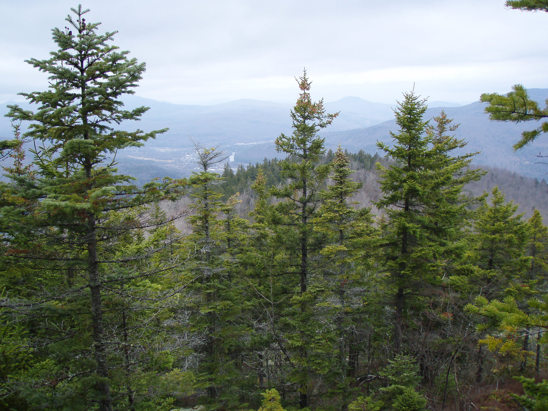
"The trailhead for the Northern end of the Carter-Moriah Trail is actually located in a residential neighborhood, and took us first over a more frequently visited Mt. Surprise (2194 ft). There are no signs indicating you've reached Mt Surprise, so we used GPS to determine when we'd reached the ~elevation. There was a blue marker on a tree very near that elevation. Also there is a granite slab, of which to take a rest, just before that Blue Marker. That slab provides the only viewpoint from Mt. Surprise. Unfortunately for us, it was cloudy so we had to squint just to make out the town of Gorham in the distance. " — CiccheMariti • Jun 23, 2013

"This hike wiped me out. Not sure whether I was tired from the previous weekend, or if we just cruised up at too fast of a pace. Our plan was to continue onto South Carter, but decided to turn back at the Imp Shelter as I had no gas. Next time." — markst-john • Aug 25, 2012

"Solo hiked the Carter-Moriah range, it was in the clouds the whole time but very mild weather in general. Bits of gusty wind on the bald tops and faces, and plenty of drizzle, with moisture that stuck the whole time. Despite that, it was beautiful and a great experience up there. Wish I could have caught some views of the Pressies, but oh well!" — chrisr00d • Jun 28, 2012
Photos
Awards
About peakery awards
Log successful summits on peakery to earn awards:
Peak Badges: Earn a special badge for each unique peak you summit. See all of your badges on your Badges page.

First Ascent Award: Only 1 available per peak. Goes to the first peakery member to log a successful summit of a peak. Snag this award and the peak will forever bear your name.

King of the Mountain Award: Only 1 available per peak. Summit a peak more times than any other member. Beware: this award can be lost!

Summit Steward: Summit a peak at least 5 times to become one of its Summit Stewards. As Steward of a peak, you’re encouraged to keep that peak’s info up-to-date on peakery and spread goodwill on your future climbs up the peak.