Region
Most climbed route
Highlights
Routes
/-121.611441693115,47.7901981724812,11,0.00,0.00/320x240@2x?access_token=pk.eyJ1IjoicGVha2VyeSIsImEiOiJjampra3Z0bnAxeTVnM3FteHlybHY3b2p1In0.7a5dEa5-995VUv8ceHHNmw)
1 summit • 4.5 mi • 3,026 ft gain • 4 hr 24 min
Latest summits
"I read a few trip reports about the trailhead, so I thought I had enough info to find it. After some searching though, I came up empty handed. Not wanting to tuck my tail between my legs and go back home, I decided to bushwhack to the top figuring I would follow the trail back down and find the beginning.
I figured if I headed straight for the ridge, I couldn't miss the trail. The hill side is quite overgrown at this time of year. I tried to limit the amount of underbrush I would have to plow through by staying in the creek bed as much as possible. This had only limited success as the creek eventually narrowed and became overgrown also.
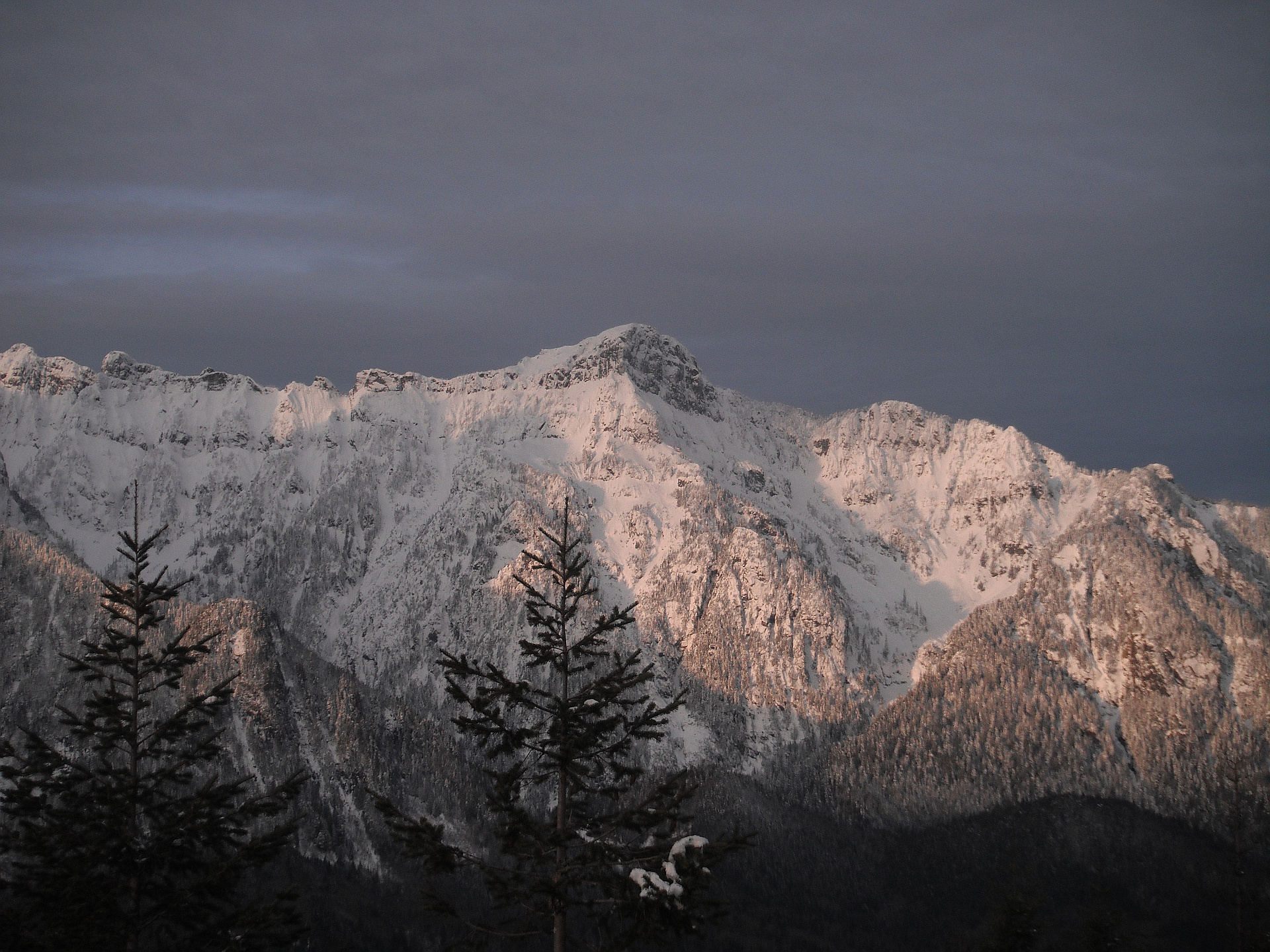
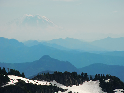
Eventually I made it to the ridge and followed it to the top. The view was nice, but the air was hazy today, so it wasn't as crisp as when the air is clear. It was still a cool view.
On the way down I attempted to follow the trail. It didn't take long to loose the trail. As I was running low on time, I didn't spend a lot of time searching. I just headed back down more or less the way I had come up." — MangyMarmot • Aug 12, 2012
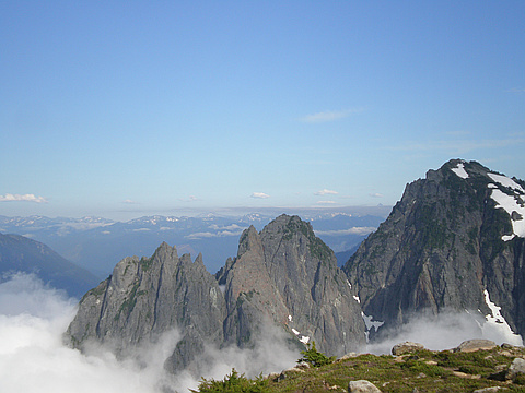
"Pretty awesome actually. Or not. I misread instructions to the trailhead, went way too far, and parked in the middle of nowhere. Bushwhacked my way all the way through thick underbrush, washed out drainages, rock walls, etc, to the summit, where I finally found the trail, about three hundred feet from the summit. It was absolutely spectacular - there were a lot of clouds, but they moved out of the way on and off to let me get a good view of Index, Glacier, Rainier, and tons of other peaks I couldn't place. The way back down was pretty bad too - left the trail as it seemed to be heading in the wrong direction... which it was, based on where I was parked... Slid down the mountain side in about an hour, following a little creek as much as I could, and still ended up overshooting where I parked and had to walk about a half mile up the road. But it was worth it, although I THINK I might try to find the actual trailhead next time... Still made it up and down in about six hours though, which I feel is pretty good for all the time I spent forcing my way through really thick brush and trying to figure out where I was...." — quietbe27 • Jul 29, 2012
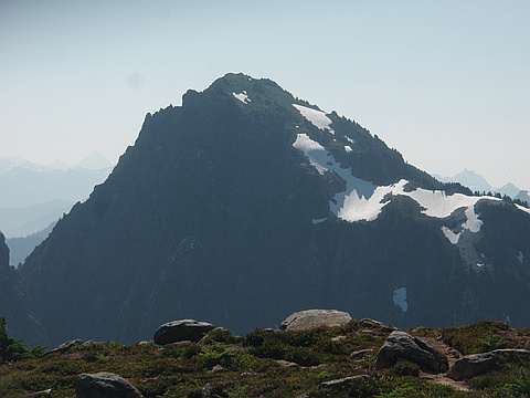
"The route to Mt Persis Summit is physically exhausting, yet simple to navigate. From the trailhead we climbed east in a near straight line for about a mile to the NW ridge and its near-vertical east face, which we followed just over a mile to the top. The trail is well beaten and easy to spot, but also steep, overgrown, and very muddy. Even with no chance of rain I would recommend rain gear if you plan on hitting the trail in the early morning, before the dew is gone.
Upon reaching the summit the gps app for my phone showed that we were still a few hundred feet west of our planned destination, but looking east we could see nothing beyond the mound of snow that peaked less than 40' away and Neither of us were interested in stepping through a cornice, so we opted to keep our distance. Unfortunately thick clouds hid any views, and the icy wind kept us from lingering to see if they would part.
The snowline started around 4000' today, and we were lucky to have a few inches of fresh powder where the canopy hadn't caught it, making for low impact and solid footing. It rained light but steady for our whole trip and visibility was extremely low once we climbed into the clouds that sa..." — Jeb • Jun 9, 2012

"To reach the trailhead for Mt. Persis you want to head east on HW-2 and take a right onto forest road 62 just before milepost 33 near the town of Index. Once on the forest road you will head a few miles up climbing around 2500' in elevation on a rocky potholed road. You will want a high clearance vehicle. There are a couple junctions in the road where you will want to stay to the left and eventually the road will come to a dead end just past a wide spot in the road. The trail begins on the right side of the road next to the wide spot.
Now that half the elevation is out of the way on the forest road there is only 2 miles of trail seperating you from the 5464' summit. The catch is you are going to climb around 2700' in those 2 miles. Not to mention you climb 2000' of that in the first mile. That's right, I said 2000' in one mile. The trail wastes no time as it heads up the west ridge through a patch of recently logged forest. This section is muddy to say the least. There was a drizzle today and the first mile of trail has quite a bit of brush encrouching on it, but thankfully we had a waterproof outer layer or else we would have been completely soaked. The brush is to the point wh..." — Al-Rashid • Jun 9, 2012
"I've been staring up at this cool mountain and it's neighbor, Mt. Index, and wondering what the Sky River Valley would look like from up there. Today was the day, and with the gate open near Hwy 2, we made our way up a winding logging road to the trailhead. After doing some research, I thought I was ready for the incline. What was in store for us was evident from the narrow, steep trail leading up from the parking area. It was truly a climb, and lasted for what seemed like more than a mile before finally leveling off. The views were amazing and I can't describe what it felt like upon reaching the summit. The view of Mt. Index was awesome! I can't wait to get back up here." — RetrieversRule • Aug 21, 2011

"Summited with Seattle Mountaineers alpine scrambling party. Saw a disturbing amount of logging activity on the lower slopes. Up higher, we saw some tree frogs. Had to fight through a lot of brush. Plenty of slide alder." — mmhansen • Aug 17, 1996
Photos
Awards
Challenges
About peakery awards
Log successful summits on peakery to earn awards:
Peak Badges: Earn a special badge for each unique peak you summit. See all of your badges on your Badges page.

First Ascent Award: Only 1 available per peak. Goes to the first peakery member to log a successful summit of a peak. Snag this award and the peak will forever bear your name.

King of the Mountain Award: Only 1 available per peak. Summit a peak more times than any other member. Beware: this award can be lost!

Summit Steward: Summit a peak at least 5 times to become one of its Summit Stewards. As Steward of a peak, you’re encouraged to keep that peak’s info up-to-date on peakery and spread goodwill on your future climbs up the peak.