Region
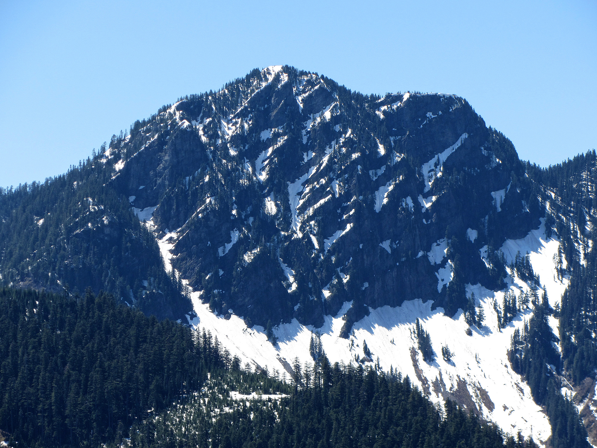
Most climbed route
Highlights
Latest summits
"Terrence's WTA Trip Report:
We are the Mountain Goats, Terrence (13) and Nathan (16) and today we headed up to the infrequently summited Mount Kent by way of the McClellan Butte Trail, which is the first 4 1/2 miles of the hike. At the point where you take the hard right turn to wrap around the backside of The Butte, there is a tree with 2 silver diamonds on it. This marks the "trail" towards Mount Kent. We headed southeast through a boulder field, hugging the trees, and dropped down to Forest Road 5020. From here we followed the road to a split where we headed left.
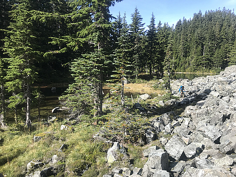
At the turn in the road, we headed straight up east towards Alice Lakes. We could find no trace of any trail whatsoever, so we just utilized GPS and pulled ourselves up through the steep, slippery slopes. In about 500 feet, we reached the first of Alice Lakes, which were partially frozen and very pretty. We made our way east past the second lake and headed up the boulders and through another another patch of woods. We had researched a couple of trip reports and tracks, which showed a route people had taken northeast, up to a ridge and then to the summit. We decided to head straight up the boulder field, st..." — BryHong8 • Oct 6, 2019
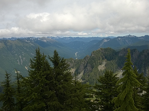
"I went with 3 other hikers who frequent these trails and roads on the south side of I-90 in the Snoqualmie Valley. We went up the main McClellan Butte trail to 4600 ft where the trail first hits the watershed boundary. Going down and SE, we found a forest service road, and followed that south around a large hill. We then cut east into the woods to find the two Alice Lakes. We skirted clockwise around the south lake, then straight up a steep slope to the ridgeline. The ridge is very narrow, but easy to follow SE up to the peak at 5087 ft. Coming down we went further on the ridge and descended a scree slope to the north lake, around it clockwise, and then south to the FS road again. At the second lake, there was a distinct trail heading west. It may be that that trail goes over the top of the hill, which is a more direct route, but Christopher said, based on past experience there that it's very difficult to get down on the west end. Going around involved 10 minutes of bushwhacking, but worked out fine.
3500 ft gain, 12 miles, 10:00 hours" — markgarrett • Jun 12, 2016
Photos
Awards
About peakery awards
Log successful summits on peakery to earn awards:
Peak Badges: Earn a special badge for each unique peak you summit. See all of your badges on your Badges page.

First Ascent Award: Only 1 available per peak. Goes to the first peakery member to log a successful summit of a peak. Snag this award and the peak will forever bear your name.

King of the Mountain Award: Only 1 available per peak. Summit a peak more times than any other member. Beware: this award can be lost!

Summit Steward: Summit a peak at least 5 times to become one of its Summit Stewards. As Steward of a peak, you’re encouraged to keep that peak’s info up-to-date on peakery and spread goodwill on your future climbs up the peak.