Region
Highlights
Routes
/-121.641912449635,47.5471890525781,11,0.00,0.00/320x240@2x?access_token=pk.eyJ1IjoicGVha2VyeSIsImEiOiJjampra3Z0bnAxeTVnM3FteHlybHY3b2p1In0.7a5dEa5-995VUv8ceHHNmw)
2 summits • 15.8 mi • 4,461 ft gain • 11 hr 1 min
1 summit • 11.0 mi • 4,036 ft gain • 8 hr 26 min
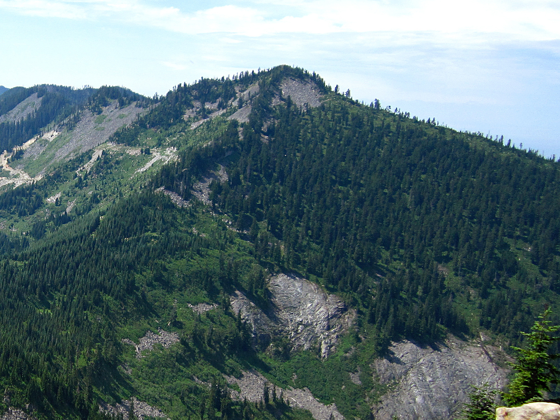
Latest summits

"Epic winter ascent of Moolock Mountain. Benson and I gained 5200 feet, 15.5 miles, in 11 hours C2C. Normally a tame jaunt up an old logging road, today's winter conditions presented a great snowshoe hike from 2500 - 4000 feet. After 4000 feet, the road becomes a trail, taking one through a winter wonderland of snow swept corridors, deep snow gated by towering trees, branches, and boughs heavy with a fresh dump of winter snow, which became increasing deep from a fresh dump this week, deepening the track to at least 24 inches. Travel became increasingly slow from 4000 feet to the summit which measured just shy of 5000. It felt like we were traversing in quicksand (like I would know what that's like). Per the mountain forecast, winds increased in the afternoon to 25+ mph blowing snow sidewise into our faces. It was snowing forcefully - not large flakes, but lots of small particles, sting any exposed body part. All of my gear froze up - straps, buckles, zippers - all became marginally functioning and made gear swap out cold and cumbersome. I went through 3 pairs of gloves. My hair even froze stiff! Visibility increasingly dropped to about 100 feet on the final push. The tra..." — markhadland • Mar 21, 2021

"Decided to try Moolock in the summer for a 14.15 training day. Long haul and some bushwhacking to get to the summit. Left the "trail" or road and hit the summit at a similar angle (northwest) as winter, which was difficult with brush and slippery ferns. Ended up coming down through boulders more south/southeast which was easier. Trail is getting very overgrown between Bessemer route and summit. No people" — BryHong8 • Oct 27, 2018

"Long haul up to Moolock in nasty weather. Took the Bessemer Road up to the last big switch back that heads east, and then went west/southwest towards Moolock on the old forest road - completely snow covered, but it was easy to follow the route even with zero visibility. There is no trail to the summit, so we cut off from the road as it started veering more southwest and headed up to the summit at a straight northwest bearing. Steep 35-40 degree slopes and luckily we chose a good route that got us right to the summit cornice. Sloppy wet snow is several feet deep and we caused a few small wet avalanches. Zero views and snowing up top, and good wet glissading back to the road. Will come back for the good summer summit views - rewarding, but LONG day. 14 miles round trip and no other people. " — BryHong8 • Apr 28, 2018
Photos
Awards
Challenges
About peakery awards
Log successful summits on peakery to earn awards:
Peak Badges: Earn a special badge for each unique peak you summit. See all of your badges on your Badges page.

First Ascent Award: Only 1 available per peak. Goes to the first peakery member to log a successful summit of a peak. Snag this award and the peak will forever bear your name.

King of the Mountain Award: Only 1 available per peak. Summit a peak more times than any other member. Beware: this award can be lost!

Summit Steward: Summit a peak at least 5 times to become one of its Summit Stewards. As Steward of a peak, you’re encouraged to keep that peak’s info up-to-date on peakery and spread goodwill on your future climbs up the peak.