Region
Most climbed route
Highlights
Routes
/-121.00089149703354,47.45011371152074,11,0.00,0.00/320x240@2x?access_token=pk.eyJ1IjoicGVha2VyeSIsImEiOiJjampra3Z0bnAxeTVnM3FteHlybHY3b2p1In0.7a5dEa5-995VUv8ceHHNmw)
1 summit • 7.0 mi • 3,635 ft gain • 5 hr 33 min
Latest summits

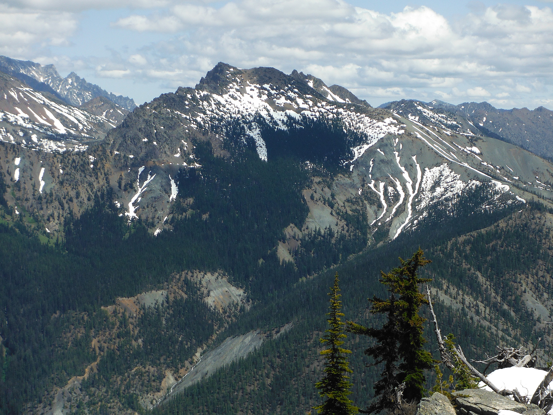
"I hiked solo to the summit of Hawkins Mountain, also hitting smaller peaks NW and S of the main peak. I went by the Camp Creek Road / Trail (305 on USGS map), where I found a lot of Serpentine rocks. These are dark green ocean-floor rocks with distinctive white serpentine lines. The trail becomes unreliable above 5600 ft, but bushwhacking and navigating by sight is reasonably easy. The view at the top of Mt Stuart and the surrounding landscape is fabulous.
3840 ft gain, 11 miles, 8:30 hours." — markgarrett • Aug 24, 2016

"Last year I failed to reach the summit of Hawkins Mountain during my annual family camping trip to the Cle Elum river. I took a non-traditional route in order to first visit Huckleberry Mountain. From the end of the old for road I ascended to the top of the ridge with 2 dogs in tow. We quickly got cliffed out, then ran out of water. This year I used Big Boulder Creek Trail #1392 from the trailhead at the end of Forest Road 128.
I started down the trail with Automahn at dawn. I fought the urge to leave the trail earlier than planned at a few overgrown jeep trails before the first junction at trail 1393 .7, knowing that we could climb another few hundred more feet on an actual trail before passing the base of Hawkins Mountain's South ridge. A half mile past the next junction the trail crosses back to the North of Big Boulder Creek.
From there I could see the length of the ridge up to the false summit as well as the Thimble to the east. We followed the occasional game trail and stayed to the west side of the ridge top, out of the wind. The wind picked up just below the false summit as the Sun danced between clouds. The rising Sun cast Mount Stuart, Ingalls Peak and the Navajo Ra..." — Jeb • Aug 11, 2013
Photos
Awards
Challenges
About peakery awards
Log successful summits on peakery to earn awards:
Peak Badges: Earn a special badge for each unique peak you summit. See all of your badges on your Badges page.

First Ascent Award: Only 1 available per peak. Goes to the first peakery member to log a successful summit of a peak. Snag this award and the peak will forever bear your name.

King of the Mountain Award: Only 1 available per peak. Summit a peak more times than any other member. Beware: this award can be lost!

Summit Steward: Summit a peak at least 5 times to become one of its Summit Stewards. As Steward of a peak, you’re encouraged to keep that peak’s info up-to-date on peakery and spread goodwill on your future climbs up the peak.