Region
Most climbed route
Highlights
Latest summits
"Visited after descending from Pallett, Peak 8180, and Peak 7560. I stayed longer on this summit because this was the only one with a peak register. After descending the other side, I made a few wrong turns looking for the use trail to Bobcat Knob. It only took me a few minutes to get back on track though. On the way I went to Bobcat Knob." — MikeTeeples • Oct 6, 2018
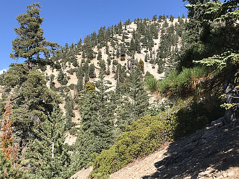
"My second attempt at Goodykoontz (previous 8 days earlier) yielded happy success. I started at about 5:45 am on the PCT at Islip Saddle and climbed the Pleasant View Ridge use path over Williamson (USGS, 8,214'), Sierra Club Williamson (8,244' with summit register), Peak 8248' (actual high point of Pleasant View Ridge), and down and up Peak 8160', all along the use trail, then descended cross-country starting west along a ridge dropping down from 8160's west face, gradually curving toward the south where occasional traces of a foot path show up down very steep and loose duff and scree make footholds very tough. There is an occasional rock duck or piece of tape on a tree branch to see the route, and then at the bottom of the very loose scree/duff, a more easily discernible foot path emerges that completes the descent from 8160 and then goes over a few bumps to Peak 7560, then down a small saddle and then up a little to Goodykoontz. I signed the register and took the required selfies and saw the article of the late Sierra Club member Frank Goodykoontz stuffed in the register can. It is a tough haul to the peak with ups and downs along the ridge accumulating to about 2,180' gain to..." — brianpowell • Jul 1, 2018

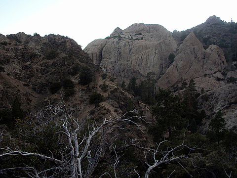
"From Bobcat Knob(6,709'), route was xcountry 1-mile w/900' gain and 50' loss via unmaintained but obvious trail. Hiked with group of 12 WTC/Sierra Club members led by Mat K and Dave S." — BradStemm • Jun 18, 2016

"Peak 5/5 on a grand tour of Pleasant View Ridge. From Pleasant View Ridge, this was a pain to get to. We climbed back over Will Thrall, down to Burkhart Saddle, back up and over Pallet, then back down to the saddle between Pallet and the bump from Williamson. We descended the drainage a bit too soon and had a steep climb over garbage screen and snow up to a minor saddle at 7320. The walk along the ridge to the summit became very cold as the storm front we had been watching all day swallowed the area. Descent down the southeast ridge was aided by pink flagging all the way down to the creek. As daylight faded, we wandered around the creek looking for a marked trail on the map to take us back to the TH. Never really found it, so had a long 200 foot climb at the end of 5500ft of climbing.
The drive back to LA was the hardest part of the whole day though! 5-10 foot visibility through the densest fog I've driven through combined with heavy rain and wind. I was very glad to make it back down the mountain after the end of a strenuous day." — edg • Dec 13, 2015
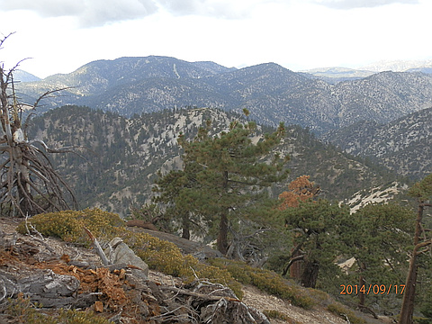
"Solo hike from Mt Williamson-Peak to Peak 8248-Peak 8160-Goodykoontz Peak. Rain, thunderclouds and thoughts of lightening strikes on return kept me moving on this 4-peak traverse. Didn't bother to stop and sign the register in the rain, I'll get it next time when I approach from Bobcat Knob." — BradStemm • Sep 17, 2014
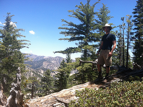
"Sub-list 13 finish on the HPS. A nice steep climb with a lot of variety on route for my brother Brian's first hike in the San Gabriels. Aside from the rattlesnake, Rock Creek was a pleasant approach to a steep and loose ascent to the summit." — Christopher • Jun 26, 2013
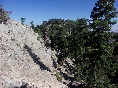
"Took ridge trail from 8160' bump between Mt Williamson and Pallett Mtn. Trail is hard to find early but follows the ridge until you get to Goodykoontz. The way down is ridiculous. The southeast trail is non-existent and you should not go down this way due to the Southern mountain yellow-legged frog restriction. Going straight down the mountain on the east side drops you north of the frog restricted area, but involves sliding down the mountain. From there you must climb up the east wall of the canyon to get to the ridge where you can catch the overgrown remnants of the PCT. This requires going cross-country with difficult terrain. I don't recommend doing any of this at all, as it was really tough. Fifth peak of the day." — srphilip • Aug 20, 2011
Photos
Awards
Challenges
About peakery awards
Log successful summits on peakery to earn awards:
Peak Badges: Earn a special badge for each unique peak you summit. See all of your badges on your Badges page.

First Ascent Award: Only 1 available per peak. Goes to the first peakery member to log a successful summit of a peak. Snag this award and the peak will forever bear your name.

King of the Mountain Award: Only 1 available per peak. Summit a peak more times than any other member. Beware: this award can be lost!

Summit Steward: Summit a peak at least 5 times to become one of its Summit Stewards. As Steward of a peak, you’re encouraged to keep that peak’s info up-to-date on peakery and spread goodwill on your future climbs up the peak.