Region
Highlights
Routes
/-106.351859522141,35.052763491394,11,0.00,0.00/320x240@2x?access_token=pk.eyJ1IjoicGVha2VyeSIsImEiOiJjampra3Z0bnAxeTVnM3FteHlybHY3b2p1In0.7a5dEa5-995VUv8ceHHNmw)
3 summits • 4.8 mi • 741 ft gain • 1 hr 25 min
2 summits • 5.9 mi • 947 ft gain • 2 hr 36 min
1 summit • 12.2 mi • 1,748 ft gain • 5 hr 22 min
1 summit • 27.1 mi • 2,340 ft gain • 7 hr 48 min
1 summit • 6.6 mi • 750 ft gain • 1 hr 7 min
Latest summits
"April 29, 2023 – Hiking to Cedro Peak from South 337 along the Jackalope Trail
Hiking Notes:
We left shortly after 10:00 AM on a beautiful spring morning. There were 5 of us on the hike. The plan was to blast as fast as we can until the trail is washed away in some forestry work, then follow the red flags at the edge of the work, to the powerlines, reconnecting with the trail near the peak. We blasted to the end of the regular trail and one in our group was not with us. We headed back and located him. He had some daypack problems, returned then hiked up again. We continued on to the top, enjoyed the views, then headed back. The total hike was 6.3 miles but would have only been 6 if we had not returned.
Departure Time: Saturday April 29, 2023, 10:00 AM to 12:30 PM – Please be prompt we will leave by 10:05
Who Should Attend: Fast pasted Cardio Hike, hiking all together. You should be able to do 6 miles in about 2 hours and 15 minutes and be prepared for an up-down elevation gain of 1400 feet. We will mostly be hiking on a trail, but be prepared to do a little mild bushwhacking.
Hike Description: This hike is to hopefully inspire further peakbagging in the area by hikin..." — Phil-Robinson • Apr 29, 2023
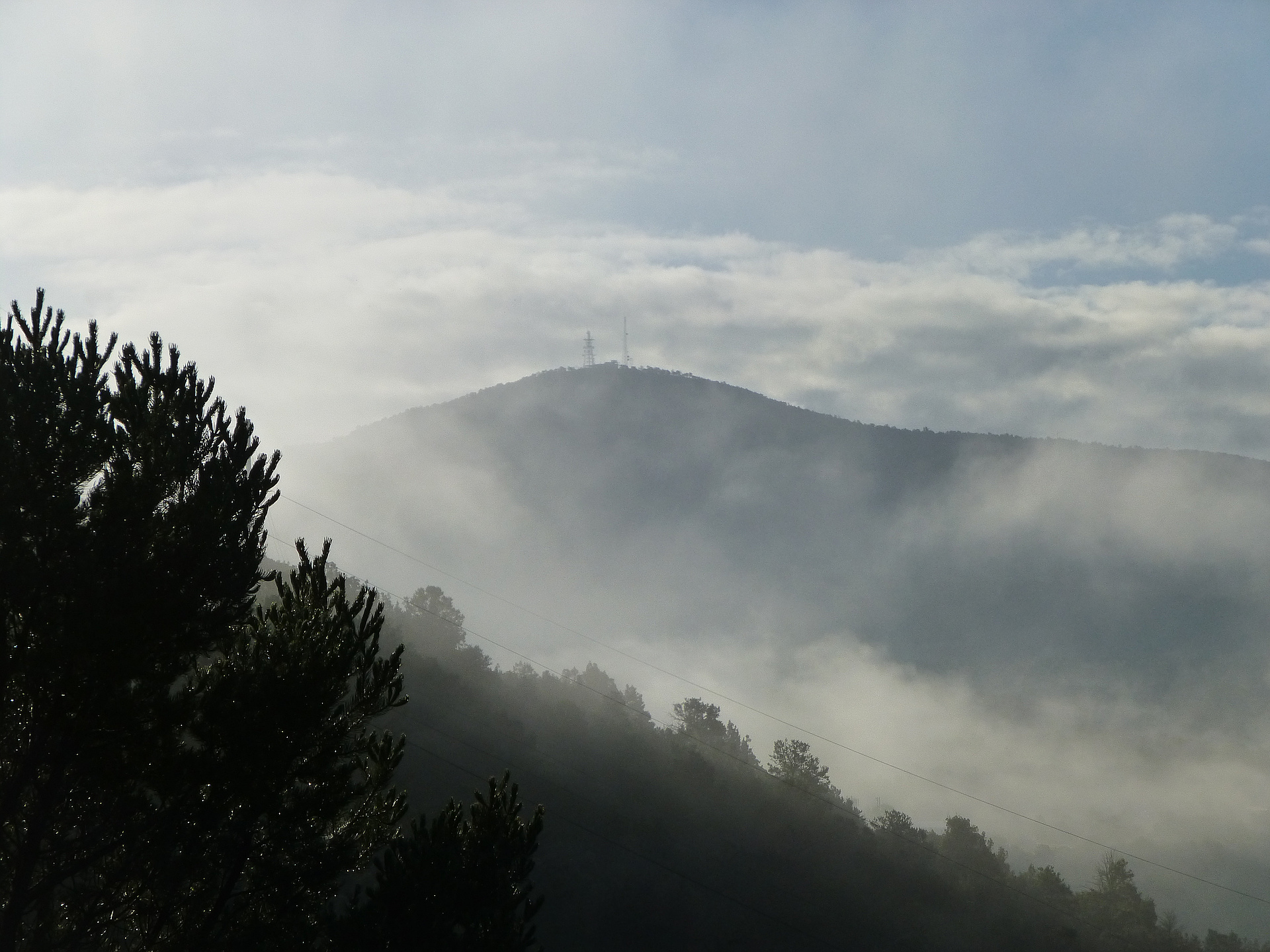
"April 2, 2023 – Since I am now leading Cardio Hikes through “The Albuquerque Hiking and Outdoor Meetup,” I was looking for another to share and to be able to bag a small peak in the process. This is my 14th Cardio Hike and the others do not bag a peak. (See below for full description of Cardio Hike) I started this hike 3.5 miles south of Tijeras at the east edge of Highway 337. There is a locked gate at this location and the trail starts there. This is about a mile south of popular Tunnel Canyon Trailhead. This is a very obscure trail, called Jackalope Tail. I started Sunday at 12:35 PM at an elevation of approximately 6740 feet. I blasted quickly up the trail. I have done this trail once before in reverse from the peak to the highway. There became some difficulty finding the trail because of an area the forest service was clearing trees and brush for fire safety. I regrouped, followed a cleared area under electric lines, then followed a road to the top. It took me about an hour and 10 minutes, and 3.2 miles to reach Cedro Peak, elevation 7767. There was about a 1200-foot elevation gain. I can tell I got a good workout. There is a fire lookout station on the top of the peak. I st..." — Phil-Robinson • Apr 2, 2023
"At the moment I am not interested in hiking any New Mexico peaks unless they are 10,800 feet in elevation and above. Although, I am somewhat interested in hiking peaks that are close to home, that do not take a drive to get to the starting point. I started hiking at 7:30 in the morning, October 25, 2014, from the Canyon Estates trailhead. It was a cool morning in the mid 40’s. The starting elevation was 6575 feet. I hiked a little bit up the trail then bushwhacked immediately to the south to catch a new open space trail. It was a beautiful forested hike. I continued south to the open space parking area then followed a dirt road into Tijeras, New Mexico. This was the lowest point in elevation on the hike, 6200 feet. Very rarely do I hike on roads, much less paved roads, but from my starting point I did not have much choice. I hiked through Tijeras, then south on highway 337 to the National Forest Service Ranger Station. Just south of the ranger station I hiked southeast into the forest making a beeline for the peak. There were lots of ups and downs. I followed a trail here and there, then came to the firebreak and followed it directly to the peak. I thought this peak was going t..." — Phil-Robinson • Oct 25, 2014
Photos
Awards
Challenges
About peakery awards
Log successful summits on peakery to earn awards:
Peak Badges: Earn a special badge for each unique peak you summit. See all of your badges on your Badges page.

First Ascent Award: Only 1 available per peak. Goes to the first peakery member to log a successful summit of a peak. Snag this award and the peak will forever bear your name.

King of the Mountain Award: Only 1 available per peak. Summit a peak more times than any other member. Beware: this award can be lost!

Summit Steward: Summit a peak at least 5 times to become one of its Summit Stewards. As Steward of a peak, you’re encouraged to keep that peak’s info up-to-date on peakery and spread goodwill on your future climbs up the peak.