no info yet
no info yet
no info yet
no info yet
I drove in to the location where I started my climb. I drove South from Pactola Lake until I reached Victoria Lake Rd. After driving a ways on Victoria Lake Rd. I drove on a couple of Forest Service Roads until the road wasn't fit for driving on. From there I followed along the edge of 2 power-line clearings as far as I could. Then I made my own trail up to the summit; there was some challenge to it. Near the summit I ran into loose break-away rock, so I followed a line of trees through the rocks until I reached grass again. I figured if the rocks gave way I could hang onto the trees.
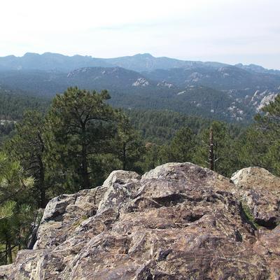
Someone had arranged a stack of stones at the top as some sort of small monument with a sign on it. Near the top were a few excellent viewing locations allowing me to see for a long ways, especially to the West. However, I was also able to catch some views to the East, Northwest, and South. For me this hike was definitely worth it! If you do hike it, I suggest hiking it with someone else as I should've done. I didn't see any trace of another person until I made it to the top and was able to look down on the town of Johnson Siding.
Victoria Lake Road - National Forest Roads - Power Line Clearings
out-and-backroutefinding, no water source, rockfall/loose rock, avalanche danger
mountaineering boots
