Region
Most climbed route
Highlights
- Highest point on and eastern terminus of the 36-mile Cross Rivendell Trail (CRT) that runs to Flagpole Hill in Vershire VT
Routes
/-72.0232186508179,43.8858555182577,11,0.00,0.00/320x240@2x?access_token=pk.eyJ1IjoicGVha2VyeSIsImEiOiJjampra3Z0bnAxeTVnM3FteHlybHY3b2p1In0.7a5dEa5-995VUv8ceHHNmw)
2 summits • 6.8 mi • 1,562 ft gain • 5 hr 36 min • Class 1
1 summit • 12.2 mi • 2,734 ft gain • 6 hr 52 min
1 summit • 7.7 mi • 1,879 ft gain • 5 hr 6 min
1 summit • 4.4 mi • 1,469 ft gain • 1 hr 42 min
Latest summits

"This trail is meant to be an out and back and you should do it as an out and back, I was using all trails and it showed the construction road as a trail. Some of it is a gravel road the rest of it is tall grass. I had taken about 10 ticks off of me after walking through the tall grass. I do not recommend making this mountain a loop." — MadHobbyist • Jun 30, 2022

"Hiked Cross Rivendell Trail (CRT) from Baker Road to Mount Cube (South Peak), then Appalachian Trail (AT) North Bound (NoBo) to North Peak Side Trail to North Peak and back over South Peak a second time. Blue blazes on the rock face on South Peak and rock cairns on the North Peak helped me find the easiest ways up and down the rock faces so I was able to remain upright with trekking poles and did not need to get down to scramble. Blue blazes point to the next blaze going up, and just have to remember going down. CRT is a soft trail that sounds like walking on a bass drum. CRT looks well traveled, but I was alone going up and saw only one other hiker ascending as I descended. AT and South Peak had many hikers including both through hikers and section hikers. I was alone on North Peak, but first time on South Peak I talked with a hiker who had just come from North Peak." — davidensley • Aug 17, 2021

"Hiked Cross Rivendell Trail (CRT) from Baker Road to Mount Cube (South Peak), then Appalachian Trail (AT) North Bound (NoBo) to North Peak Side Trail to North Peak and back over South Peak a second time. Blue blazes on the rock face on South Peak and rock cairns on the North Peak helped me find the easiest ways up and down the rock faces so I was able to remain upright with trekking poles and did not need to get down to scramble. Blue blazes point to the next blaze going up, and just have to remember going down. CRT is a soft trail that sounds like walking on a bass drum. CRT looks well traveled, but I was alone going up and saw only one other hiker ascending as I descended. AT and South Peak had many hikers including both through hikers and section hikers. I was alone on North Peak, but first time on South Peak I talked with a hiker who had just come from North Peak." — davidensley • Aug 17, 2021
"Busy trail today, on way up passed 9 hikers and on way down another 6. The humidity and hot weather broke during the night so views and relaxing on the summit were both exceptional" — hiking4000 • Aug 10, 2018
"Headed out early to grab a 52wav peak....Met 4 thru hikers on the AT...gifted muffins and chocolate. I saw a large white tail deer in the path....we had a staring match for a few seconds before it ran away. Blue skies....headed to both North & South Peak for the views. " — shay-shay • Jun 14, 2017
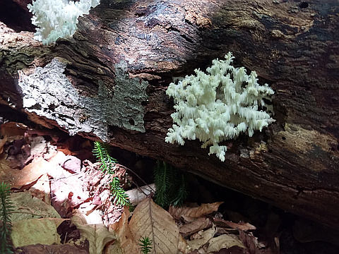
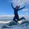
Photos
Awards
Challenges
About peakery awards
Log successful summits on peakery to earn awards:
Peak Badges: Earn a special badge for each unique peak you summit. See all of your badges on your Badges page.

First Ascent Award: Only 1 available per peak. Goes to the first peakery member to log a successful summit of a peak. Snag this award and the peak will forever bear your name.

King of the Mountain Award: Only 1 available per peak. Summit a peak more times than any other member. Beware: this award can be lost!

Summit Steward: Summit a peak at least 5 times to become one of its Summit Stewards. As Steward of a peak, you’re encouraged to keep that peak’s info up-to-date on peakery and spread goodwill on your future climbs up the peak.