Region
Most climbed route
Highlights
Routes
/-117.302725423022,34.2101698329982,11,0.00,0.00/320x240@2x?access_token=pk.eyJ1IjoicGVha2VyeSIsImEiOiJjampra3Z0bnAxeTVnM3FteHlybHY3b2p1In0.7a5dEa5-995VUv8ceHHNmw)
10 summits
2 summits • 10.2 mi • 2,119 ft gain • 4 hr 43 min
1 summit • 5.3 mi • 1,021 ft gain • 2 hr 19 min
Latest summits

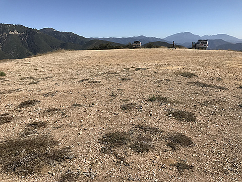
"Where Highway 18 meets FR 2N40, the hike begins. The road is rough but driveable, but as far as I’m concerned, I’m there to hike, so I went on foot. The first stop was Peak 4120. It is the highest point on the hike. It also has a running power station on top, which kind of negates its natural side. Good views over Marshall Peak, though.
Marshall Peak was next, and just across the road. On the short visit, I saw no paraglider activity up there. I returned to the road and walked out to the neighboring peak, Cloud Peak. With suddenly 3 peaks in n the bag, I made a point to add two new ones. First was Peak 3215. I had to take Cloudland Truck Trail SE for about 1.5 miles and drop 700 feet to reach it. This too has a power station, but the high point is above the building. The last peak was on the way back. About a half mile from the parking area, I veered off FR2N40, and bushwhacked about 0.15 miles to the top. Not much of a summit really, so I didn’t really save the best for last. That wrapped up a five peak day." — MikeTeeples • Aug 6, 2022
"I picked up Cloudland Truck Trail from Highway 18 (which is an unmarked dirt road at a lower ridge of the mountain range). The dirt road sometimes has vehicles, most notably couriers for paraglider services heading for the top of Marshall Peak. The rocky dirt road is probably a 4wd road, but I wouldn't know for sure, I was just glad to be walking on it rather than driving it. At about 1.5 miles in, there are a cluster of peaks that I visited. The first was Marshall Peak. Surprisingly, I found nobody on top, which is a first for me, since there are usually paragliders up there. I looked to the west where Cloud Peak is, and decided to add it to my hiking day. It is only another mile along the dirt road. Cloud Peak was my turnaround point where I returned to the turnoff for Marshall Peak to assess my next move.
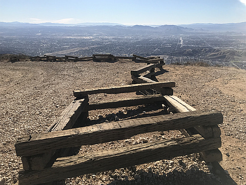
There are two more peaks across from Marshall Peak, I climbed the one to the east first. The short climb also follows a dirt road to a point near the top. I took a use trail the rest of the way. The top of this peak is actually red in color, since it looks like fire retardant was dumped on it at one point, probably as a strategic move when fighting a recent fire..." — MikeTeeples • Dec 6, 2020
"Parked at a small parking area shortly before the pavement ends on Cloudland Truck Trail off of Devils Canyon Rd north of Cal State San Bernardino. From there, it is a climb along the dirt road to Cloud Peak. Before reaching Cloud Peak, there are two places where Jeep trails leave the road and provides a short cuts to Cloud Peak. I opted to take the shortcuts, which cut out a lot of unnecessary winding in the dirt road. I didn’t see any sort of register on top, but then again if it isn’t out In the open with neon lights flashing to get my attention, then I usually don’t look for it.
From the summit, Marshall Peak is clearly visible to the east. I continued on the road for about a mile and up a Jeep trail to its summit. Paragliders were using the mountain top as their launch point. I was the only hiker there, so I felt a little out of place before returning the way I came." — MikeTeeples • Oct 13, 2019

"Awesome views of San Bernardino Peak, San Jacinto Peak, and Cucamonga, Telegraph and Mt. Baldy. Easy road hike (or you can drive to the top, as I discovered when I found cars at the summit)." — jimduvall • Feb 16, 2013
Photos
Awards
About peakery awards
Log successful summits on peakery to earn awards:
Peak Badges: Earn a special badge for each unique peak you summit. See all of your badges on your Badges page.

First Ascent Award: Only 1 available per peak. Goes to the first peakery member to log a successful summit of a peak. Snag this award and the peak will forever bear your name.

King of the Mountain Award: Only 1 available per peak. Summit a peak more times than any other member. Beware: this award can be lost!

Summit Steward: Summit a peak at least 5 times to become one of its Summit Stewards. As Steward of a peak, you’re encouraged to keep that peak’s info up-to-date on peakery and spread goodwill on your future climbs up the peak.