Distance
1.7 km to summit
3.4 km total
Elevation
858 m start
Vertical
479 m gain
Time
1 hr 23 min to summit
2 hr 27 min total
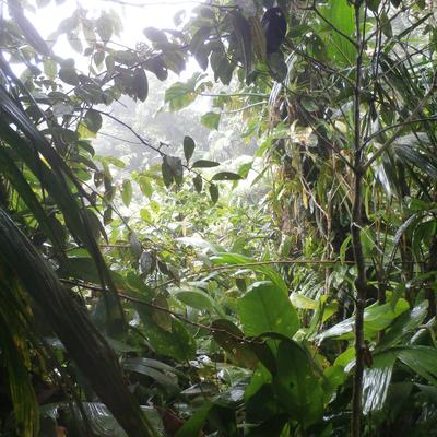
Ascended from Aripo village. Route started in the heights of Aripo near the Humming Bird Sancturary. A series of trails tha link together passing the trails to Big Cave and little Cave took ascended a series of steps through a cliff system ( barely seen in the thick forest ) to the main dividing ridge between Gunapo and Aripo (North South). The vegetation changed to upper montanne and the clouds rolled through as we came to the summit. A Trinidad and Tobago flag and a Surveyors stone were at the top.
Route name
out-and-back
Obstacles
routefinding, no water source
Key gear
GPS device
brandonpeters
Hey, do you GPS track these hikes?
chriskelshall
Hi Brandon, no, I went with Island Hikers Trinidad on a field trip and got a jpeg of the route.