Another New England classic. Includes the 50 peaks with the highest prominence in New England. Far different than the NH 4000 footers challenge, it includes 20 peaks in Maine, 15 in Vermont, 14 in New Hampshire, and 1 in Massachusetts. A stepping stone to the New England Hundred Highest challenge.
Highest peak
Mount Washington
6,288 ft / 1,916 m
Most prominent peak
Mount Washington
6,148 ft / 1,873 m prom
Most summited peak
Mount Washington
1,131 summits
Most difficult peak
Mount Washington
Class 1
Difficulty breakdown
Class 1/2 6 peaks
Highlights
Latest summits

"A hike for some Ossipee peaks. I hiked up Sentinel Mtn, which was quite a prominent bump. I then hiked over to Flagg. There were a lot of rocks along the trail that slowed down my momentum. I then took the Guerilla Tr to Mt Shaw. The Guerilla Tr had most of their paint blazes down on rocks on the ground. This would be difficult to follow in the winter with there being a lot of open woods. I reached Shaw and had a swarm of blackflies. Nice views though despite the cloudy weather. I headed back to Flagg. I then decided to bushwack to Canaan to save elevation gain/loss if I kept on the trail. I tried to sign into the canister on Canaan but the journal was soaked. I hooked back up to the trail, went over Sentinel and back down to my car. " — newenglandwarrior • May 23, 2024
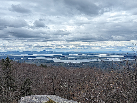
"Slightly overcast day that got cloudier later on. High 50s and not a lot of wind, so the temperate was fairly pleasant. Not as muddy as expected but still plenty buggy. Left the trailhead at 10am. After about 0.8 miles we reached an infamous stream crossing which has a sign commemorating a person named John who died there in 2006. The trail is easy after that until about 2 miles in, where it climbs 800 feet in less than half a mile. The trail levels out right before the intersection with Black Snout Trail and is easy-going all the way to the summit. A clearing on the north side of the Mt. Shaw summit offers spectacular views of the White Mountains and portions of Maine. On the way down to Big Ball Mountain we also visited Black Snout which has views to the south of Lake Winnipesaukee and the Belknap Mountains. The trail down from Black Snout is steep and in a thick coniferous forest. After about half a mile the trail levels off and suddenly enters a deciduous forest. Because we climbed Mt. Shaw in early spring, the leaves had not come in yet and we had a stark contrast between the dark and thick coniferous forest to the sparse and well-lit deciduous forest. After about another half..." — JCalautti • May 11, 2024
"Molly wanted to hike Carrigain for her Grid. I needed something for my Grid gains. We had to do the road walk for 2 miles. There was washout damage along Sawyer River Rd. There were signs of former flooding near the river crossing along Signal Ridge Tr. There was water in several places along the trail below the junction with Carrigain Notch Tr. We headed up Signal Ridge Tr and located the snow. Partway up, we used microspikes. We reached the summit and had some views. But the cloud cover was coming in and out so the views changed. We headed back down. We saw an owl early in the hike!!!" — newenglandwarrior • May 4, 2024
"A Monroe, Washington, Jefferson hike for my Grid and calendar day. Hiked up Ammonoosuc Ravine Tr. From Gem Pond, I used my microspikes on the ascent. I ascended into a cloud and had no views on Monroe and on Washington. On the way over to Jefferson, the cloud cover was breaking up. I dropped my snowshoes just past Jewell Tr. On Jefferson, I had views, but Washington was still in the clouds. I headed back to Jewell Tr and down that, making good time coming down. I was beat after today's hike. Saw a short tailed weasel below the summit of Jeff!!!" — newenglandwarrior • May 3, 2024

"Began at 10:45am. The base of the mountain was a little muddy, and fairly buggy, but nothing copious amounts of bugspray couldn't handle. White Dot starts off at a moderate include until you pass Cascade Link, then the steep uphill and rock-scrambling begins. Luckily the trail was completely dry and devoid of any ice or snow, although it was very packed with people, especially as we neared the summit. From one of the outlooks on White Dot we were able to just barely see the Boston skyline above the southern Wapack Range. We reached the summit at 12:45 and made our way to Dublin Peak to cross off a Monadnock Subpeak. The trail to Dublin Peak was much quieter than the summit and was a great place to have lunch before continuing on to Town Line Peak via the Pumpelly Trail to cross off another Subpeak. We returned to the Monadnock State Park HQ via the Cascade Link which criss-crosses a stream. After rain I'm sure the water level is much higher, but on our hike it was fairly low and easily crossable. Returned to the car around 3:45pm." — JCalautti • Apr 27, 2024