The ultimate peak challenge on the isle of Ireland. The Arderins (Irish for "Ireland's height") includes all Irish mountains at least 500 m high with at least 30 m prominence. Designed to "encourage hillwalkers to explore upland areas throughout the island, without compromising the wildness, uniqueness and environment which give Ireland its character." A lifetime achievement. See more at https://mountainviews.ie/lists/arderin/
Highest peak
Carrauntoohil
3,407 ft / 1,038 m
Most prominent peak
Carrauntoohil
3,407 ft / 1,038 m prom
Most summited peak
Carrauntoohil
72 summits
Most difficult peak
Tomaneena
Class 1
Difficulty breakdown
Class 1/2 13 peaks
Class 3/4 1 peak
Highlights
Latest summits
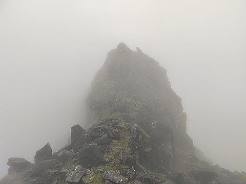
"This was a linear walk that we did with my hiking club. We started in Cloghane and climbed to Benagh and over the Faha ridge to Brandon North Top from which we continued to Brandon and Gearhane from which we descended. The visibility was poor but the weather was dry and there was no wind, which made it possible for us to cross the ridge." — hannahaapio • Jun 6, 2023

"We started from Ballycurrane and walked along the Dingle Way to the first saddle between Masatiompan and Pierasmore. We first climbed Masatiompan, came down the same way and then continued towards Brandon. The route took us over Pierasmore, Brandon Far North Top and Brandon North Top until we finally reached Brandon. We descended along the Saint's Road and from the carpark walked back to Ballycurrane along the country roads.
We did all the climbing in a cloud but once we started descending from Brandon the clouds disappeared and the sun was shining from a bright blue sky. It was also the first warm day of the year so had we started a few hours later we would have done our hike in the most beautiful weather." — hannahaapio • Mar 26, 2023

"We started from Ballycurrane and walked along the Dingle Way to the first saddle between Masatiompan and Pierasmore. We first climbed Masatiompan, came down the same way and then continued towards Brandon. The route took us over Pierasmore, Brandon Far North Top and Brandon North Top until we finally reached Brandon. We descended along the Saint's Road and from the carpark walked back to Ballycurrane along the country roads.
We did all the climbing in a cloud but once we started descending from Brandon the clouds disappeared and the sun was shining from a bright blue sky. It was also the first warm day of the year so had we started a few hours later we would have done our hike in the most beautiful weather.
16 km, 1100 metres of ascent." — hannahaapio • Mar 26, 2023

"Extremely Boggy , Fairly Strenuous & Rocky . Route is easy to follow as you just follow the county border wall all the way to the top . Low visibilty & poor weather obstructed view throughout . Nice active hike enjoyed the physical aspect." — Mark-Mountain-Sheehan • Dec 31, 2022

"High Winds , low visibility , Straight vertical hiking . There was not much of walk / build up to the base , Fairly Rocky & Slippery . Views obstructed near the top by poor weather & fog enjoyed the physical & navigational side of the hike though." — Mark-Mountain-Sheehan • Dec 31, 2022